ISS001-702-110

| NASA Photo ID | ISS001-702-110 |
| Focal Length | 250mm |
| Date taken | 2001.03.05 |
| Time taken | 12:44:26 GMT |
Resolutions offered for this image:
540 x 540 pixels 1031 x 1024 pixels 2063 x 2048 pixels 4127 x 4096 pixels 515 x 512 pixels 400 x 398 pixels
540 x 540 pixels 1031 x 1024 pixels 2063 x 2048 pixels 4127 x 4096 pixels 515 x 512 pixels 400 x 398 pixels


Cloud masks available for this image:
Spacecraft nadir point: 50.9° N, 0.7° E
Photo center point: 31.5° N, 47.5° E
Photo center point by machine learning:
Photo center point: 31.5° N, 47.5° E
Photo center point by machine learning:
Nadir to Photo Center: East
Spacecraft Altitude: 201 nautical miles (372km)
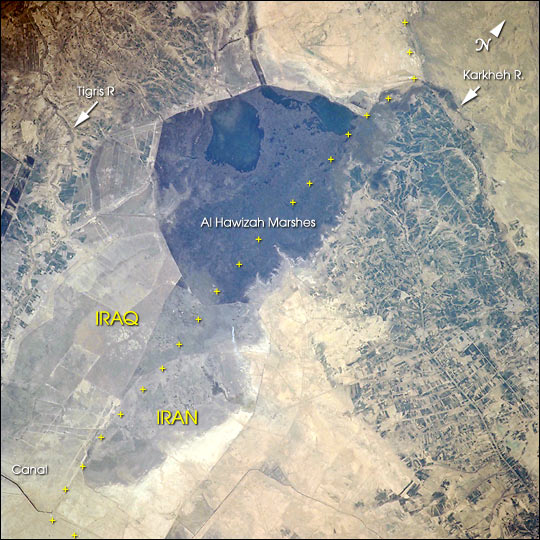
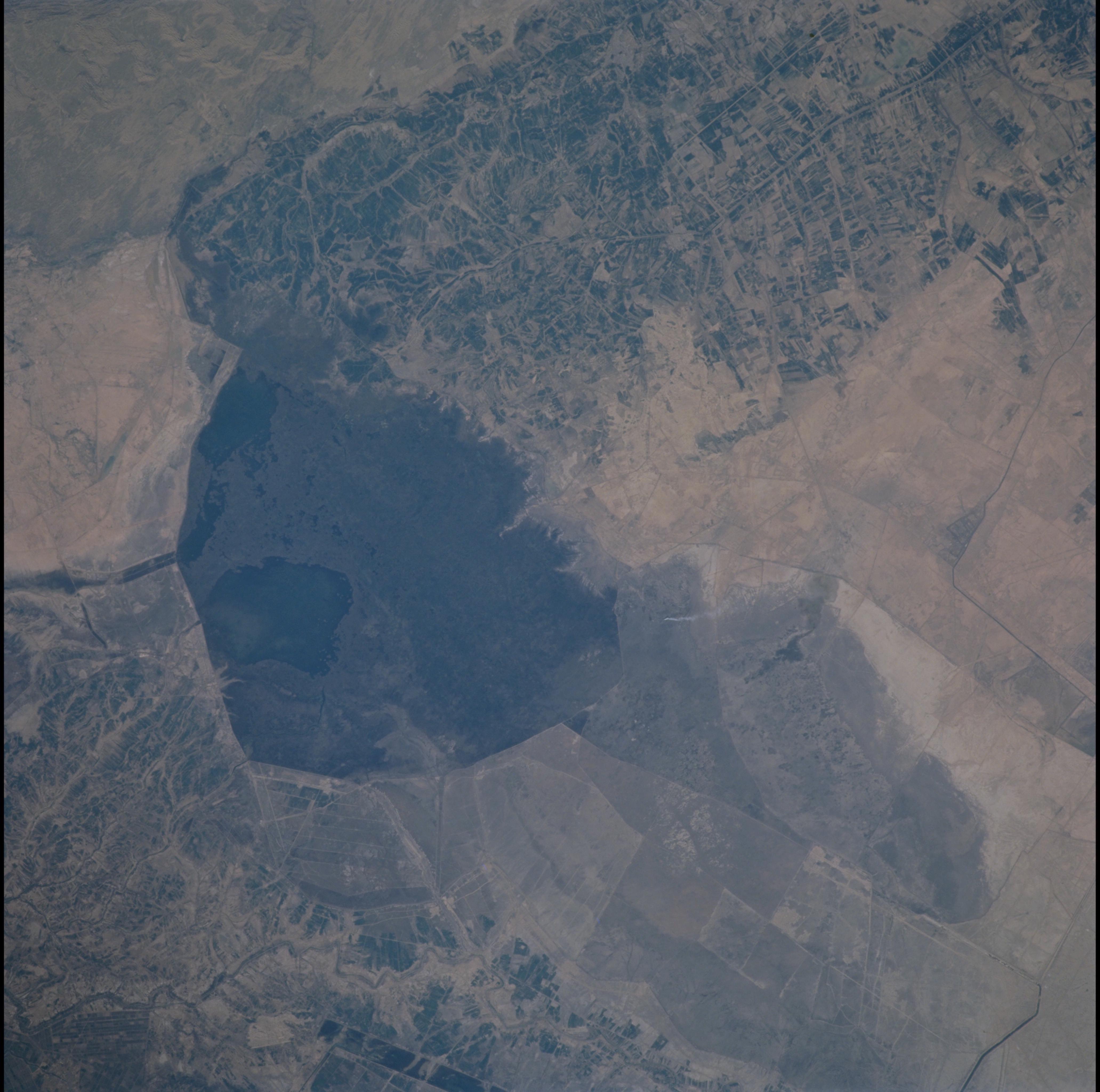
Country or Geographic Name: | IRAQ |
Features: | TIGRIS, AL HAWIZAH MARSH |
| Features Found Using Machine Learning: | |
Cloud Cover Percentage: | 10 (1-10)% |
Sun Elevation Angle: | 33° |
Sun Azimuth: | 191° |
Camera: | Hasselblad |
Focal Length: | 250mm |
Camera Tilt: | High Oblique |
Format: | 5069: Kodak Elite 100S, E6 Reversal, Replaces Lumiere, Warmer in tone vs. Lumiere |
Film Exposure: | |
| Additional Information | |
| Width | Height | Annotated | Cropped | Purpose | Links |
|---|---|---|---|---|---|
| 540 pixels | 540 pixels | Yes | No | Earth From Space collection | Download Image |
| 1031 pixels | 1024 pixels | No | No | Download Image | |
| 2063 pixels | 2048 pixels | No | No | Download Image | |
| 4127 pixels | 4096 pixels | No | No | Download Image | |
| 515 pixels | 512 pixels | No | No | Download Image | |
| 400 pixels | 398 pixels | No | No | Photographic Highlights | Download Image |
Download Packaged File
Download a Google Earth KML for this Image
View photo footprint information
Download a GeoTIFF for this photo
Image Caption: The Al Hawizah Marshes comprise the largest remaining tract of wetlands in the Mesopotamian Marshlands of Iran and Iraq. In the last 10 years, damming and diversion of waters from the Tigris and Euphrates Rivers, and draining of wetlands has led to a loss of 85% of wetlands that once covered about 20,000 square km (7,725 square miles).
This ecological disaster has been studied using Landsat data and summarized in a report by the United Nation Environment Programme's Division of Early Warning and Assessment, entitled The Mesopotamian Marshlands: Demise of an Ecosystem. [Print Resolution (13.3 MB)].
This ecological disaster has been studied using Landsat data and summarized in a report by the United Nation Environment Programme's Division of Early Warning and Assessment, entitled The Mesopotamian Marshlands: Demise of an Ecosystem. [Print Resolution (13.3 MB)].
