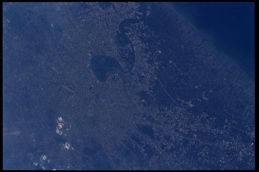
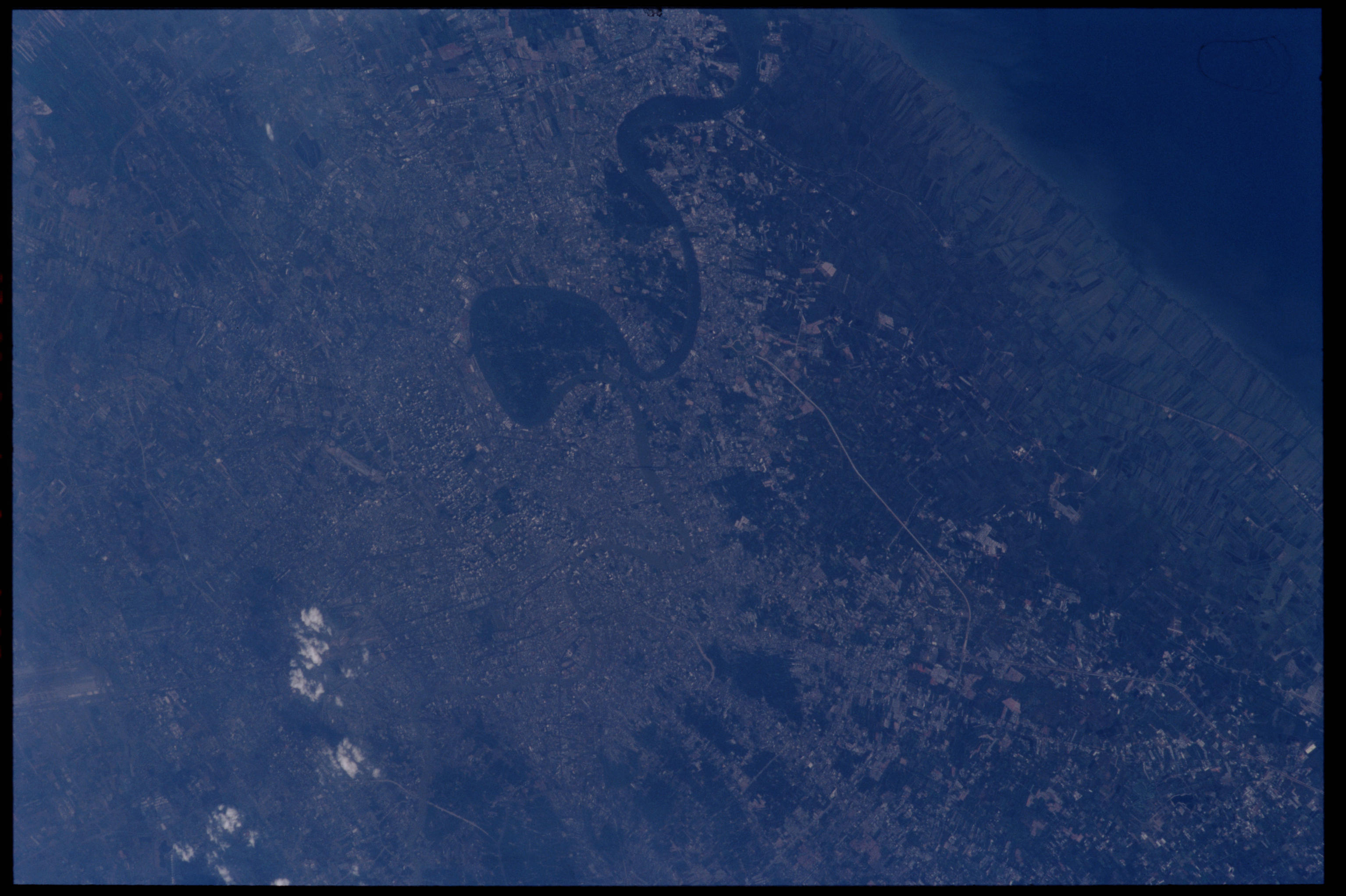
ISS001-338-4
| NASA Photo ID | ISS001-338-4 |
| Focal Length | 400mm |
| Date taken | 2001.01.09 |
| Time taken | 08:56:28 GMT |
Cloud masks available for this image:
Spacecraft nadir point: 10.6° N, 100.7° E
Photo center point: 13.5° N, 100.5° E
Photo center point by machine learning:
Photo center point: 13.5° N, 100.5° E
Photo center point by machine learning:
Nadir to Photo Center: North
Spacecraft Altitude: 199 nautical miles (369km)
Country or Geographic Name: | THAILAND |
Features: | BANGKOK |
| Features Found Using Machine Learning: | |
Cloud Cover Percentage: | 10 (1-10)% |
Sun Elevation Angle: | 30° |
Sun Azimuth: | 228° |
Camera: | Nikon 35mm film camera |
Focal Length: | 400mm |
Camera Tilt: | 41 degrees |
Format: | 5069: Kodak Elite 100S, E6 Reversal, Replaces Lumiere, Warmer in tone vs. Lumiere |
Film Exposure: | |
| Additional Information | |
| Width | Height | Annotated | Cropped | Purpose | Links |
|---|---|---|---|---|---|
| 3070 pixels | 2044 pixels | No | No | Download Image | |
| 515 pixels | 342 pixels | No | No | Download Image |
Download Packaged File
Download a Google Earth KML for this Image
View photo footprint information
Download a GeoTIFF for this photo
Georeferenced automatically using the human-determined center point - exported 2019-06-20-013615-UTCGeoreferenced automatically using the human-determined center point - exported 2019-06-20-013741-UTC
Georeferenced automatically using the human-determined center point - exported 2019-06-20-013942-UTC
An explanation of the georeference file(s) above
Image Caption: none
