AST-9-566
| NASA Photo ID | AST-9-566 |
| Focal Length | 50mm |
| Date taken | 1975.07.__ |
| Time taken | GMT |
Cloud masks available for this image:
Spacecraft nadir point:
Photo center point: 45.0° N, 51.0° E
Photo center point by machine learning:
Photo center point: 45.0° N, 51.0° E
Photo center point by machine learning:
Nadir to Photo Center:
Spacecraft Altitude: nautical miles (0km)
Country or Geographic Name: | KAZAKHSTAN |
Features: | CASPIAN SEA |
| Features Found Using Machine Learning: | |
Cloud Cover Percentage: | 10 (1-10)% |
Sun Elevation Angle: | ° |
Sun Azimuth: | ° |
Camera: | Hasselblad |
Focal Length: | 50mm |
Camera Tilt: | Low Oblique |
Format: | QX807: SO368 film (fine-grain Ektachrome) with yellow dye layer equivalent to Wratten 2A |
Film Exposure: | Normal |
| Additional Information | |
| Width | Height | Annotated | Cropped | Purpose | Links |
|---|---|---|---|---|---|
| 5700 pixels | 5800 pixels | No | No | Download Image | |
| 500 pixels | 509 pixels | No | No | Download Image |
Download Packaged File
Download a Google Earth KML for this Image
View photo footprint information
Download a GeoTIFF for this photo
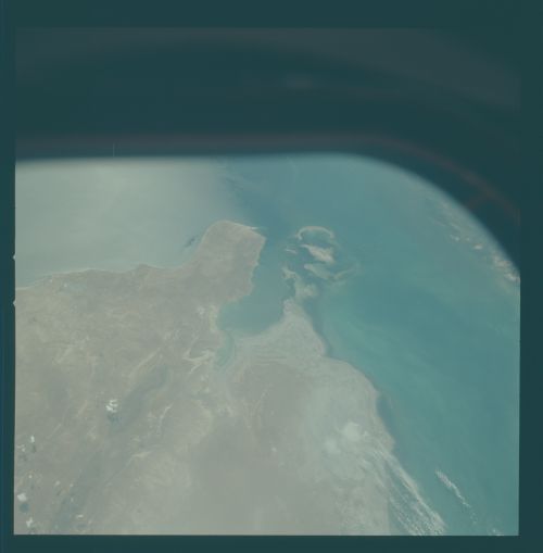
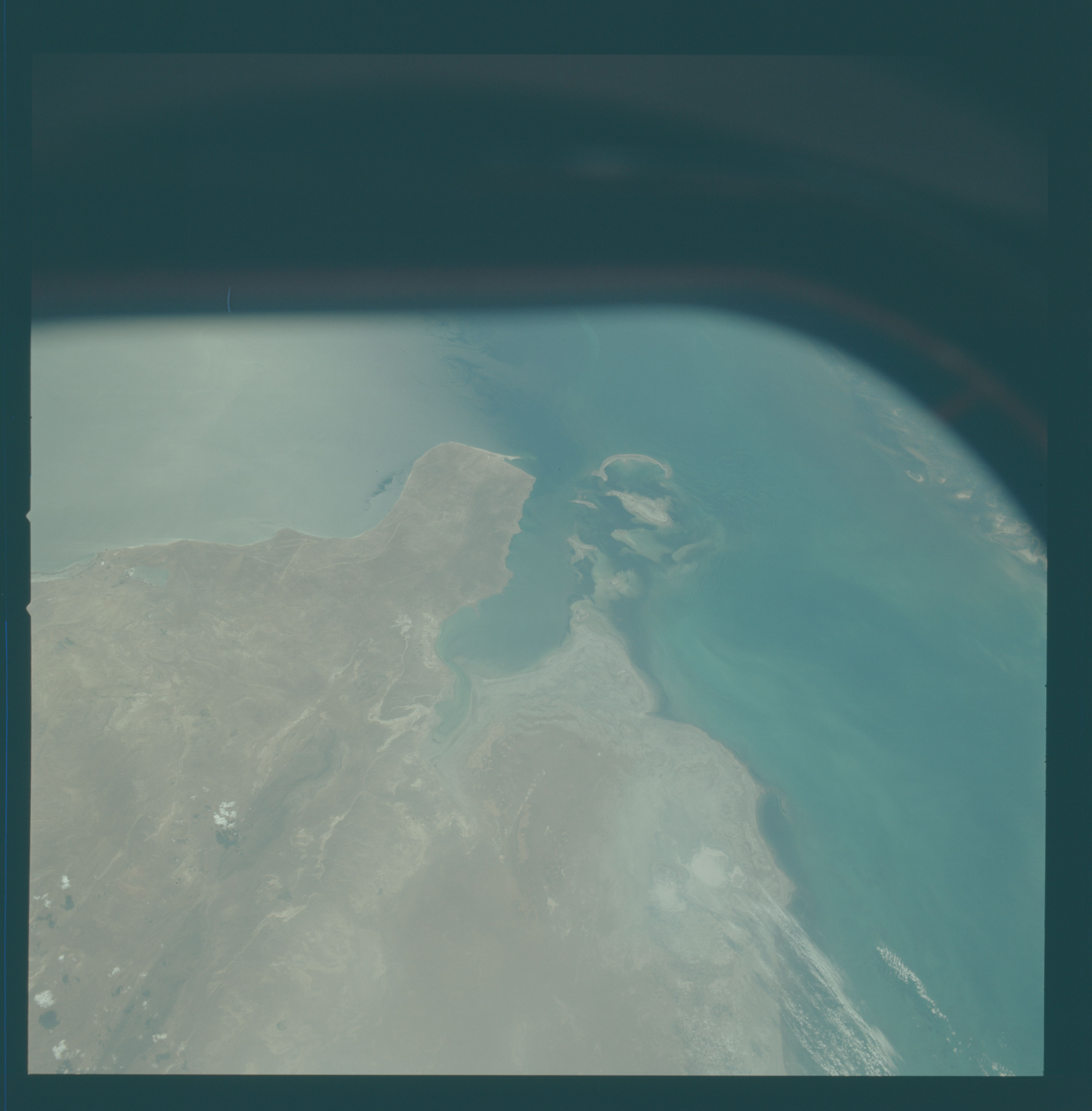
Image Caption: AST9-566 AST9-565 Kara Kum Desert, Tyub- Karagan Peninsula (1),
Shoreline South of Tyub-Karagan Peninsula
Sunglint outlines eddies (2) and waves (3) hitting the eastern Caspian
coast. Due to the arid climate, there is little sediment influx into
the sea. White areas (4) are salt-filled depressions which were once
flooded with seawater, but subsequently evaporated. This area is a
major oil, gas and coal producer; roads and settlements in this
otherwise desolate landscape (5) support this industry.
