AS09-23-3564
| NASA Photo ID | AS09-23-3564 |
| Focal Length | 80mm |
| Date taken | 1969.03.11 |
| Time taken | 16:20:00 GMT |
Cloud masks available for this image:
Spacecraft nadir point:
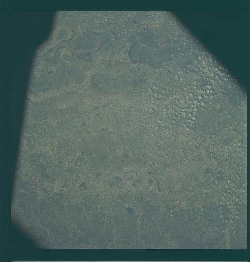
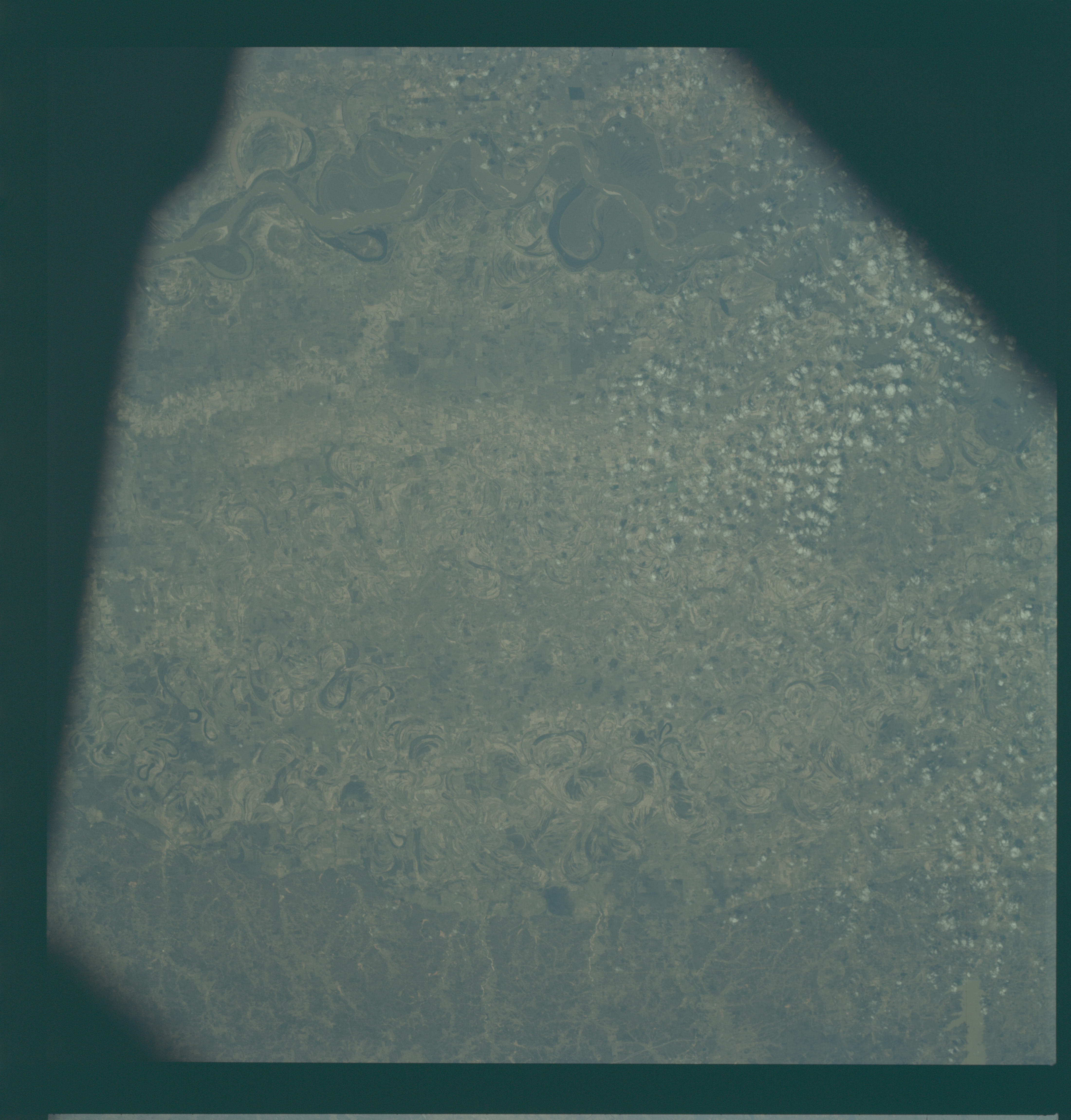
Photo center point: 33.7° N, 90.7° W
Photo center point by machine learning:
Photo center point: 33.7° N, 90.7° W
Photo center point by machine learning:
Nadir to Photo Center:
Spacecraft Altitude: 109 nautical miles (202km)
Country or Geographic Name: | USA-MISSISSIPPI |
Features: | MISS. RIVER, GREENVILLE |
| Features Found Using Machine Learning: | |
Cloud Cover Percentage: | 0 (no clouds present) |
Sun Elevation Angle: | 44° |
Sun Azimuth: | ° |
Camera: | Hasselblad |
Focal Length: | 80mm |
Camera Tilt: | Near Vertical |
Format: | SO368: Kodak Ektachrome MS, equivalent to 2448 Kodak Aerochrome, ASA64, thin base, fine grain |
Film Exposure: | Normal |
| Additional Information | |
| Width | Height | Annotated | Cropped | Purpose | Links |
|---|---|---|---|---|---|
| 4400 pixels | 4600 pixels | No | No | Download Image | |
| 492 pixels | 515 pixels | No | No | Download Image |
Download Packaged File
Download a Google Earth KML for this Image
View photo footprint information
Download a GeoTIFF for this photo
Image Caption: GEOGRAPHY/CARTOGRAPHY: ARKANSAS, MISSISSIPPI, CLEVELAND, GREENVILLE AND MISSISSIPPI RIVER.
GEOLOGY/HYDROLOGY: ALLUVIAL FLOOD PLAIN, MEANDER BELTS.
AGRICULTURE: EXTENSIVE CULTIVATED AREAS.
FORESTRY: MIXED FOREST STANDS.
METEOROLOGY: SMALL CUMULUS.
OCEANOGRAPHY:.
GEOLOGY/HYDROLOGY: ALLUVIAL FLOOD PLAIN, MEANDER BELTS.
AGRICULTURE: EXTENSIVE CULTIVATED AREAS.
FORESTRY: MIXED FOREST STANDS.
METEOROLOGY: SMALL CUMULUS.
OCEANOGRAPHY:.
