AS09-22-3473
| NASA Photo ID | AS09-22-3473 |
| Focal Length | 80mm |
| Date taken | 1969.03.09 |
| Time taken | 19:44:00 GMT |
Cloud masks available for this image:
Spacecraft nadir point:
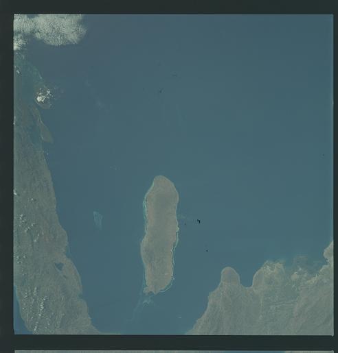
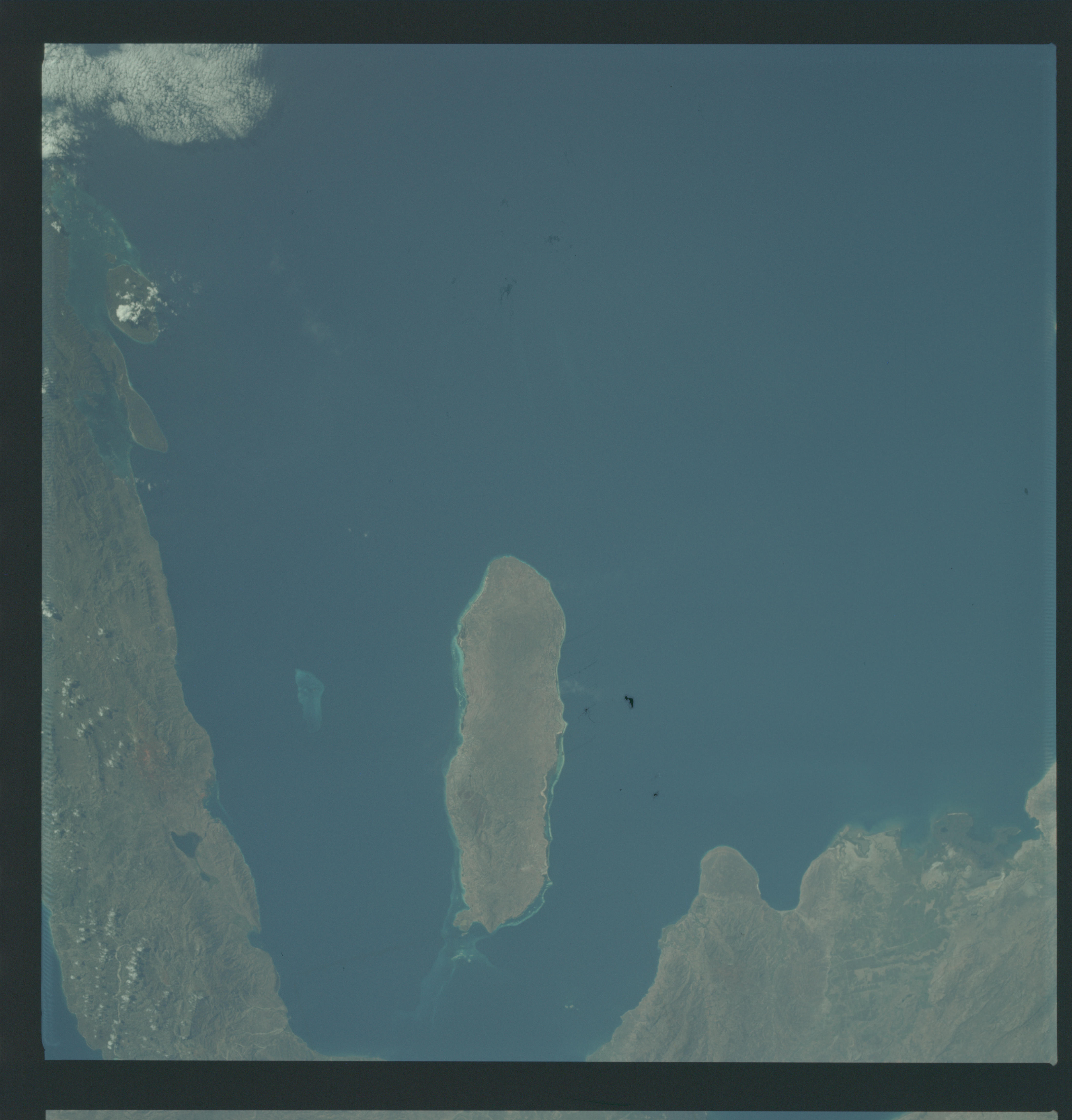
Photo center point: 18.9° N, 73.3° W
Photo center point by machine learning:
Photo center point: 18.9° N, 73.3° W
Photo center point by machine learning:
Nadir to Photo Center:
Spacecraft Altitude: 101 nautical miles (187km)
Country or Geographic Name: | HAITI |
Features: | GONAVE ISLAND |
| Features Found Using Machine Learning: | |
Cloud Cover Percentage: | 2 (1-10)% |
Sun Elevation Angle: | 45° |
Sun Azimuth: | ° |
Camera: | Hasselblad |
Focal Length: | 80mm |
Camera Tilt: | Near Vertical |
Format: | SO368: Kodak Ektachrome MS, equivalent to 2448 Kodak Aerochrome, ASA64, thin base, fine grain |
Film Exposure: | Normal |
| Additional Information | |
| Width | Height | Annotated | Cropped | Purpose | Links |
|---|---|---|---|---|---|
| 4400 pixels | 4600 pixels | No | No | Download Image | |
| 492 pixels | 515 pixels | No | No | Download Image |
Download Packaged File
Download a Google Earth KML for this Image
View photo footprint information
Download a GeoTIFF for this photo
Image Caption: GEOGRAPHY/CARTOGRAPHY: HAITI,GONAIVE ISLAND, ST MARK AND SUD CANALS, TOWN OF ST. MARK.
GEOLOGY/HYDROLOGY: COMPLEX MOUNTAINS AND COASTAL PLAIN.
FORESTRY: MIXED BROADLEAF, DECIDUOUS AND EVERGREEN.
AGRICULTURE: FIELD PATTERNS VISIBLE NEAR GONAIVES.
METEOROLOGY: CIRRO CUMULUS.
OCEANOGRAPHY: CARIBBEAN SEA, CORAL REEFS AND HEADS.
GEOLOGY/HYDROLOGY: COMPLEX MOUNTAINS AND COASTAL PLAIN.
FORESTRY: MIXED BROADLEAF, DECIDUOUS AND EVERGREEN.
AGRICULTURE: FIELD PATTERNS VISIBLE NEAR GONAIVES.
METEOROLOGY: CIRRO CUMULUS.
OCEANOGRAPHY: CARIBBEAN SEA, CORAL REEFS AND HEADS.
