AS09-21-3313
| NASA Photo ID | AS09-21-3313 |
| Focal Length | 80mm |
| Date taken | 1969.03.09 |
| Time taken | 19:44:00 GMT |
Cloud masks available for this image:
Spacecraft nadir point:
Photo center point: 19.3° N, 75.2° W
Photo center point by machine learning:
Photo center point: 19.3° N, 75.2° W
Photo center point by machine learning:
Nadir to Photo Center:
Spacecraft Altitude: 102 nautical miles (189km)
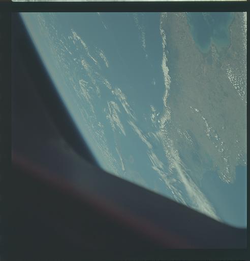
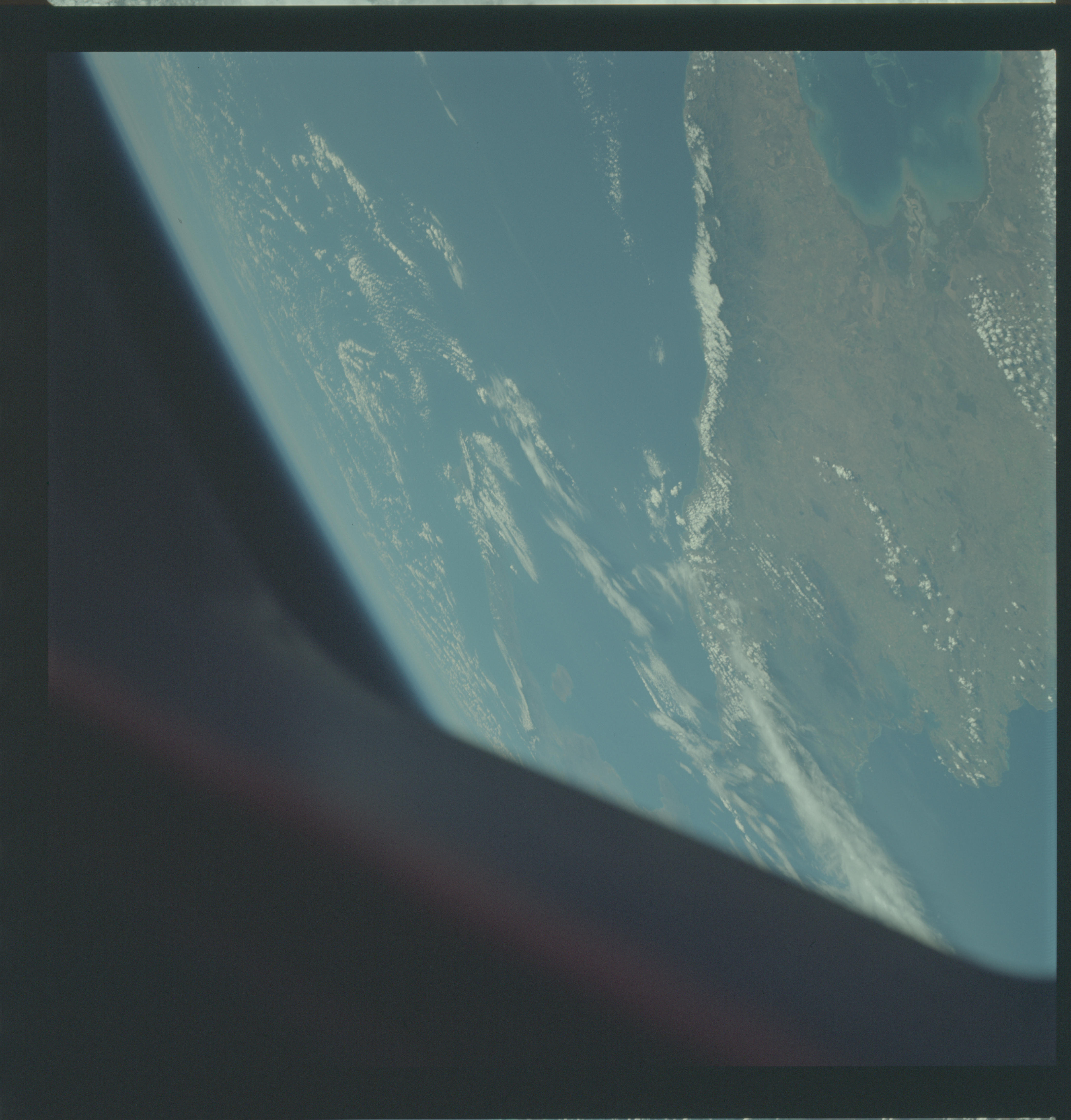
Country or Geographic Name: | CUBA |
Features: | EASTERN THIRD OF ISLAND |
| Features Found Using Machine Learning: | |
Cloud Cover Percentage: | 20 (11-25)% |
Sun Elevation Angle: | 47° |
Sun Azimuth: | ° |
Camera: | Hasselblad |
Focal Length: | 80mm |
Camera Tilt: | High Oblique |
Format: | SO368: Kodak Ektachrome MS, equivalent to 2448 Kodak Aerochrome, ASA64, thin base, fine grain |
Film Exposure: | Normal |
| Additional Information | |
| Width | Height | Annotated | Cropped | Purpose | Links |
|---|---|---|---|---|---|
| 4400 pixels | 4600 pixels | No | No | Download Image | |
| 492 pixels | 515 pixels | No | No | Download Image |
Download Packaged File
Download a Google Earth KML for this Image
View photo footprint information
Download a GeoTIFF for this photo
Image Caption: GEOGRAPHY/CARTOGRAPHY: CUBA, ORIENTE PROVINCE, GULF OF GUALANAYABO, WINDWARD PASSAGE, CAPE LUCRECIA, NIPE BAY, TOWNS OF MANZANILLO, BAYAMO AND BANES.
GEOLOGY/HYDROLOGY: LOW PLAINS REGION.
AGRICULTURE: MODERATE TO HEAVY CULTIVATION, IN GUALANAYABO GULF AREA.
FORESTRY: BROADLEAF EVERGREEN FORESTS.
METEOROLOGY: CUMULUS HUMILIS, ALTO-CUMULUS, CIRRUS FIBRATUS.
OCEANOGRAPHY: CARIBBEAN SEA, SUBMARINE CORAL REEFS VISIBLE, DEPTH VARIATIONS.
GEOLOGY/HYDROLOGY: LOW PLAINS REGION.
AGRICULTURE: MODERATE TO HEAVY CULTIVATION, IN GUALANAYABO GULF AREA.
FORESTRY: BROADLEAF EVERGREEN FORESTS.
METEOROLOGY: CUMULUS HUMILIS, ALTO-CUMULUS, CIRRUS FIBRATUS.
OCEANOGRAPHY: CARIBBEAN SEA, SUBMARINE CORAL REEFS VISIBLE, DEPTH VARIATIONS.
