AS09-19-3047
| NASA Photo ID | AS09-19-3047 |
| Focal Length | 80mm |
| Date taken | 1969.03.10 |
| Time taken | 17:42:00 GMT |
Cloud masks available for this image:
Spacecraft nadir point:
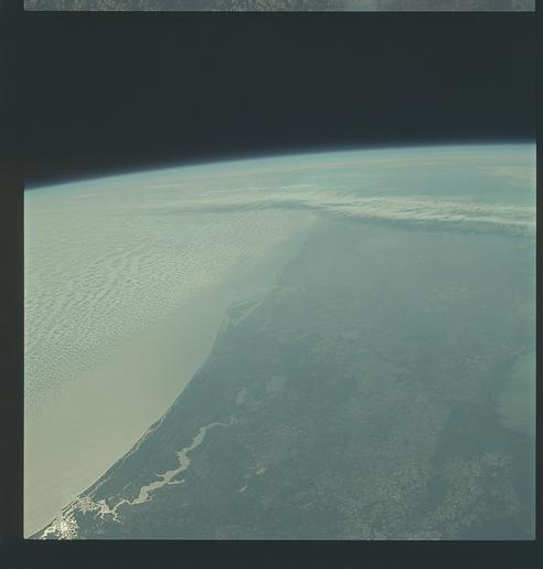
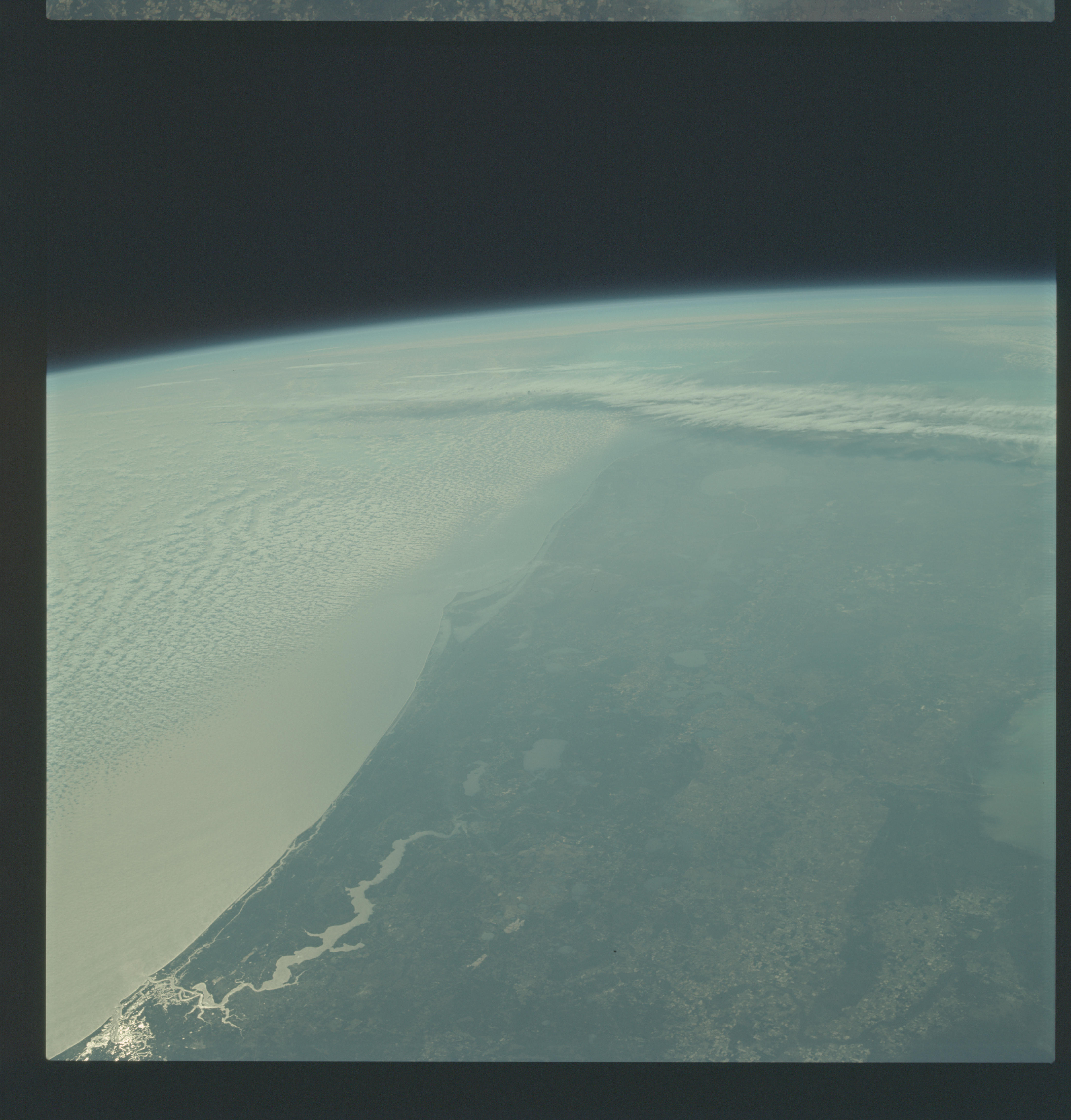
Photo center point: 27.8° N, 80.4° W
Photo center point by machine learning:
Photo center point: 27.8° N, 80.4° W
Photo center point by machine learning:
Nadir to Photo Center:
Spacecraft Altitude: 101 nautical miles (187km)
Country or Geographic Name: | USA-FLORIDA |
Features: | CENTRAL FLORIDA, HAZY |
| Features Found Using Machine Learning: | |
Cloud Cover Percentage: | 10 (1-10)% |
Sun Elevation Angle: | 57° |
Sun Azimuth: | ° |
Camera: | Hasselblad |
Focal Length: | 80mm |
Camera Tilt: | High Oblique |
Format: | SO368: Kodak Ektachrome MS, equivalent to 2448 Kodak Aerochrome, ASA64, thin base, fine grain |
Film Exposure: | Under Exposed |
| Additional Information | |
| Width | Height | Annotated | Cropped | Purpose | Links |
|---|---|---|---|---|---|
| 4400 pixels | 4600 pixels | No | No | Download Image | |
| 492 pixels | 515 pixels | No | No | Download Image |
Download Packaged File
Download a Google Earth KML for this Image
View photo footprint information
Download a GeoTIFF for this photo
Image Caption: GEOGRAPHY/CARTOGRAPHY: UNITED STATES, FLORIDA, CAPE KENNEDY, LAKE GEORGE, ST. JOHNS RIVER, CITIES OF JACKSONVILLE, DAYTONA BEACH, ORLANDO, SANFORD, COCOA, AND MELBOURNE.
GEOLOGY/HYDROLOGY: COASTAL PLAIN REGION.
AGRICULTURE: EXTENSIVE CULTIVATION, CONJESTED FIELD PATTERNS.
FORESTRY: MIXED PINE/HARDWOOD WITH PURE CONIFER STANDS.
METEOROLOGY: ALTO-CUMULUS, CIRRUS.
OCEANOGRAPHY: ATLANTIC OCEAN, SUNGLINT.
GEOLOGY/HYDROLOGY: COASTAL PLAIN REGION.
AGRICULTURE: EXTENSIVE CULTIVATION, CONJESTED FIELD PATTERNS.
FORESTRY: MIXED PINE/HARDWOOD WITH PURE CONIFER STANDS.
METEOROLOGY: ALTO-CUMULUS, CIRRUS.
OCEANOGRAPHY: ATLANTIC OCEAN, SUNGLINT.
