AS09-19-3031
| NASA Photo ID | AS09-19-3031 |
| Focal Length | 80mm |
| Date taken | 1969.03.09 |
| Time taken | 22:51:00 GMT |
Cloud masks available for this image:
Spacecraft nadir point:
Photo center point: 0.4° S, 91.0° W
Photo center point by machine learning:
Photo center point: 0.4° S, 91.0° W
Photo center point by machine learning:
Nadir to Photo Center:
Spacecraft Altitude: 102 nautical miles (189km)
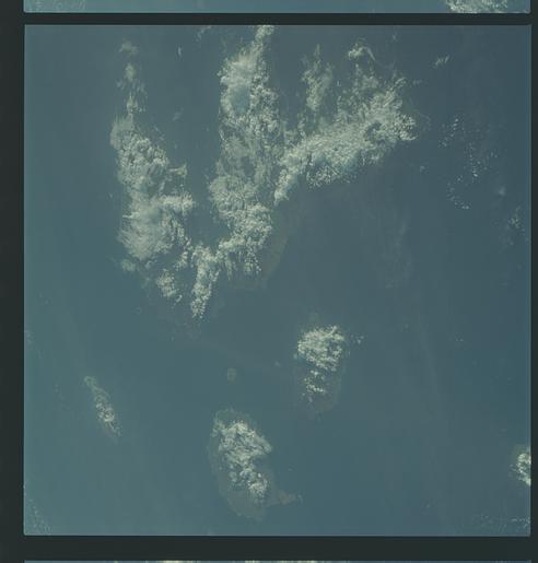
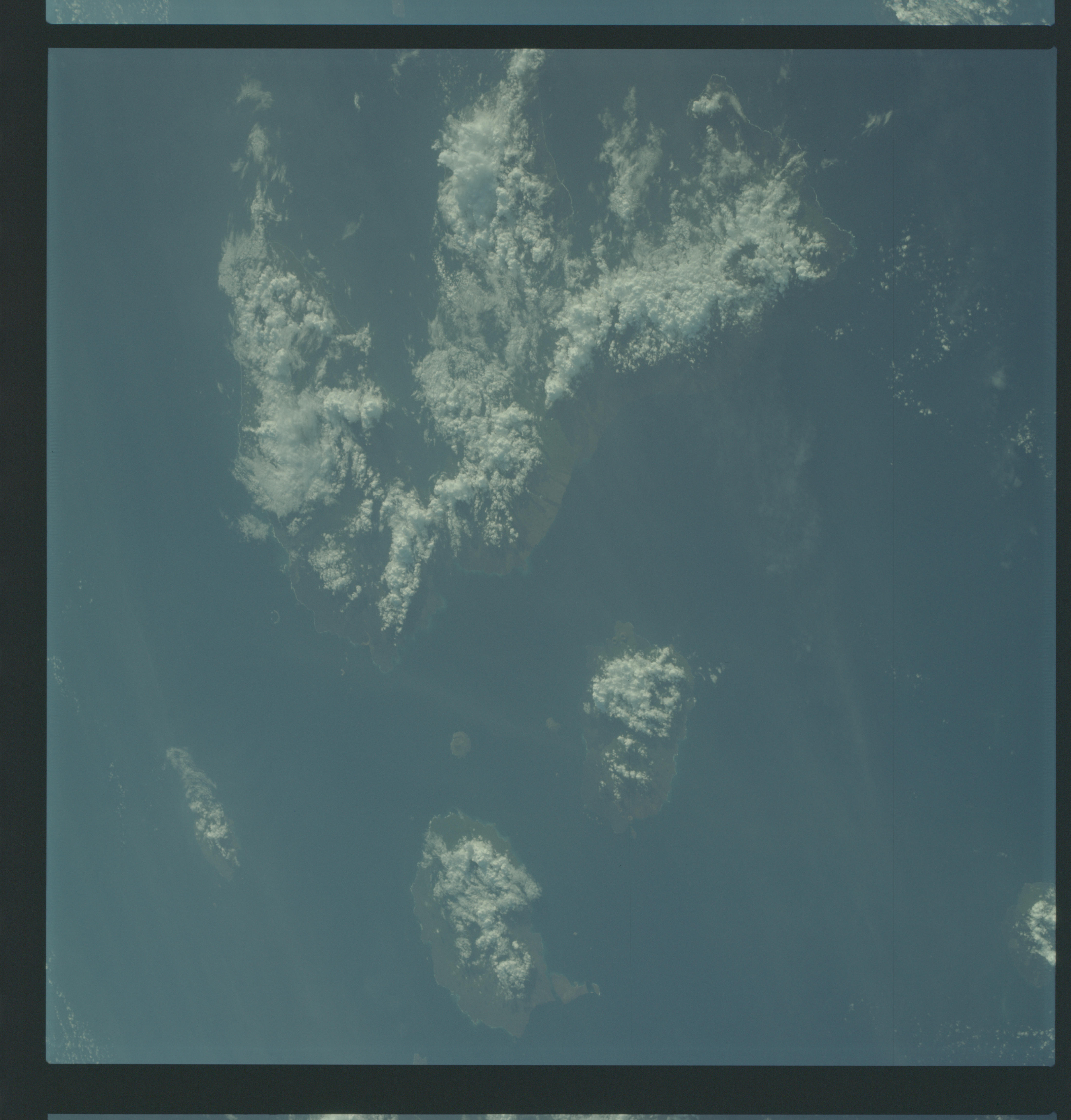
Country or Geographic Name: | GALAPAGOS ISLANDS |
Features: | CLOUD COVERED, DARK |
| Features Found Using Machine Learning: | |
Cloud Cover Percentage: | 13 (11-25)% |
Sun Elevation Angle: | 21° |
Sun Azimuth: | ° |
Camera: | Hasselblad |
Focal Length: | 80mm |
Camera Tilt: | High Oblique |
Format: | SO368: Kodak Ektachrome MS, equivalent to 2448 Kodak Aerochrome, ASA64, thin base, fine grain |
Film Exposure: | Under Exposed |
| Additional Information | |
| Width | Height | Annotated | Cropped | Purpose | Links |
|---|---|---|---|---|---|
| 4400 pixels | 4600 pixels | No | No | Download Image | |
| 492 pixels | 515 pixels | No | No | Download Image |
Download Packaged File
Download a Google Earth KML for this Image
View photo footprint information
Download a GeoTIFF for this photo
Image Caption: GEOGRAPHY/CARTOGRAPHY: GALAPOGOS ISLAND, FERNANDINA, ISABELA, SAN SALVADOR, SANTA CRUZ, AND SANTA MARIA ISLANDS.
GEOLOGY/HYDROLOGY: VOLCANIC ISLAND CHAIN.
FORESTRY: DENSE BROADLEAF EVERGREEN FORESTS INLAND.
METEOROLOGY: CUMULO-NIMBUS, CUMULUS CONGESTUS, STRATUS.
OCEANOGRAPHY:PACIFIC OCEAN, SOME COLOR CHANGES DENOTING POSSIBLE SALINITY, CURRENT OR DEPTH CHANGE.
GEOLOGY/HYDROLOGY: VOLCANIC ISLAND CHAIN.
FORESTRY: DENSE BROADLEAF EVERGREEN FORESTS INLAND.
METEOROLOGY: CUMULO-NIMBUS, CUMULUS CONGESTUS, STRATUS.
OCEANOGRAPHY:PACIFIC OCEAN, SOME COLOR CHANGES DENOTING POSSIBLE SALINITY, CURRENT OR DEPTH CHANGE.
