AS07-8-1943
| NASA Photo ID | AS07-8-1943 |
| Focal Length | 80mm |
| Date taken | 1968.10.__ |
| Time taken | GMT |
Cloud masks available for this image:
Spacecraft nadir point:
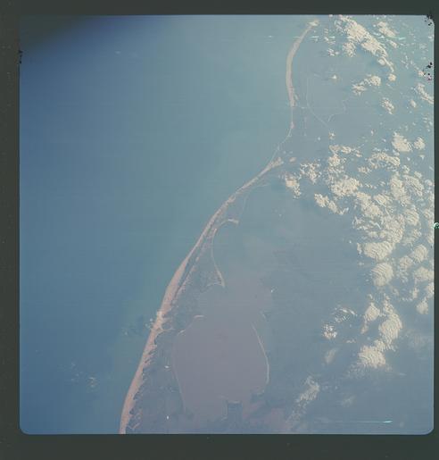
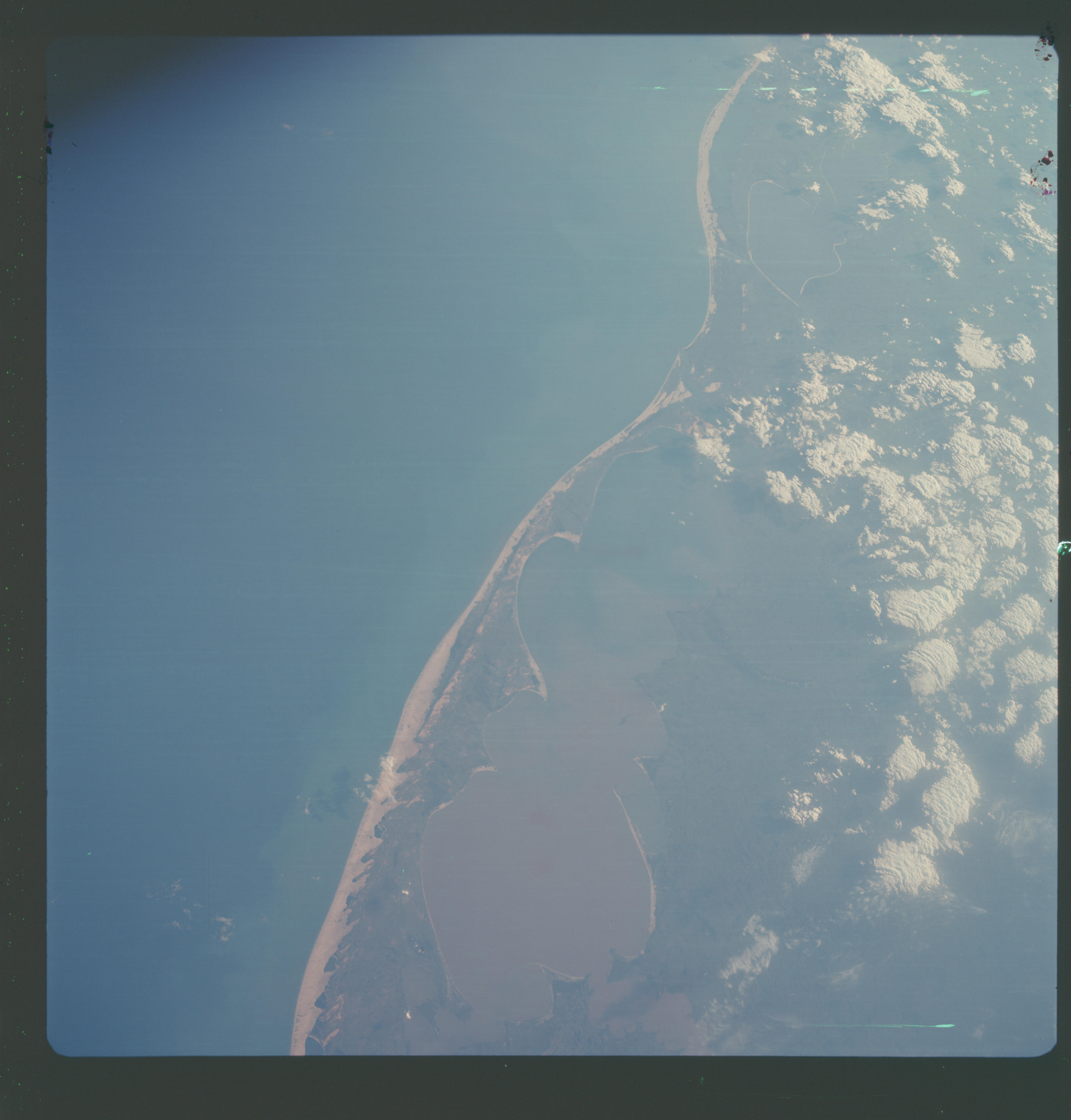
Photo center point: 32.0° S, 52.0° W
Photo center point by machine learning:
Photo center point: 32.0° S, 52.0° W
Photo center point by machine learning:
Nadir to Photo Center:
Spacecraft Altitude: nautical miles (0km)
Country or Geographic Name: | BRAZIL |
Features: | PORTO ALEGRE |
| Features Found Using Machine Learning: | |
Cloud Cover Percentage: | 15 (11-25)% |
Sun Elevation Angle: | ° |
Sun Azimuth: | ° |
Camera: | Hasselblad |
Focal Length: | 80mm |
Camera Tilt: | Low Oblique |
Format: | SO121: Kodak Ektachrome 64 |
Film Exposure: | Normal |
| Additional Information | |
| Width | Height | Annotated | Cropped | Purpose | Links |
|---|---|---|---|---|---|
| 4400 pixels | 4600 pixels | No | No | Download Image | |
| 492 pixels | 515 pixels | No | No | Download Image |
Download Packaged File
Download a Google Earth KML for this Image
View photo footprint information
Download a GeoTIFF for this photo
Image Caption: Atlantic coastal area of northeastern Uruguay and southern Brazil, showing Lagoa Mirim and Lagoa dos Patos, as seen from the Apollo 7 spacecraft during its 139th revolution of the earth. Photographed from an altitude of 185 nautical miles, at ground elapsed time of 221 hours and 30 minutes.
