< STS073-707-R >

| NASA Photo ID | STS073-707-R |
| Focal Length | 100mm |
| Date taken | 1995.__.__ |
| Time taken | GMT |
Resolutions offered for this image:
3872 x 3872 pixels 639 x 639 pixels 5700 x 5900 pixels 500 x 518 pixels
3872 x 3872 pixels 639 x 639 pixels 5700 x 5900 pixels 500 x 518 pixels


Cloud masks available for this image:
Spacecraft nadir point:
Photo center point: 39.5° N, 84.0° W
Photo center point by machine learning:
Photo center point: 39.5° N, 84.0° W
Photo center point by machine learning:
Nadir to Photo Center:
Spacecraft Altitude: nautical miles (0km)
Camera: | Hasselblad |
Focal Length: | 100mm |
Camera Tilt: | Low Oblique |
Format: | 5046: Kodak, natural color positive, Lumiere 100/5046, ASA 100, standard base |
Film Exposure: | Normal |
| Additional Information | |
| Width | Height | Annotated | Cropped | Purpose | Links |
|---|---|---|---|---|---|
| 3872 pixels | 3872 pixels | No | No | Earth From Space collection | Download Image |
| 639 pixels | 639 pixels | No | No | Earth From Space collection | Download Image |
| 5700 pixels | 5900 pixels | No | No | Download Image Download Color Calibration Image for this Image |
|
| 500 pixels | 518 pixels | No | No | Download Image Download Color Calibration Image for this Image |
Download Packaged File
Download a Google Earth KML for this Image
View photo footprint information
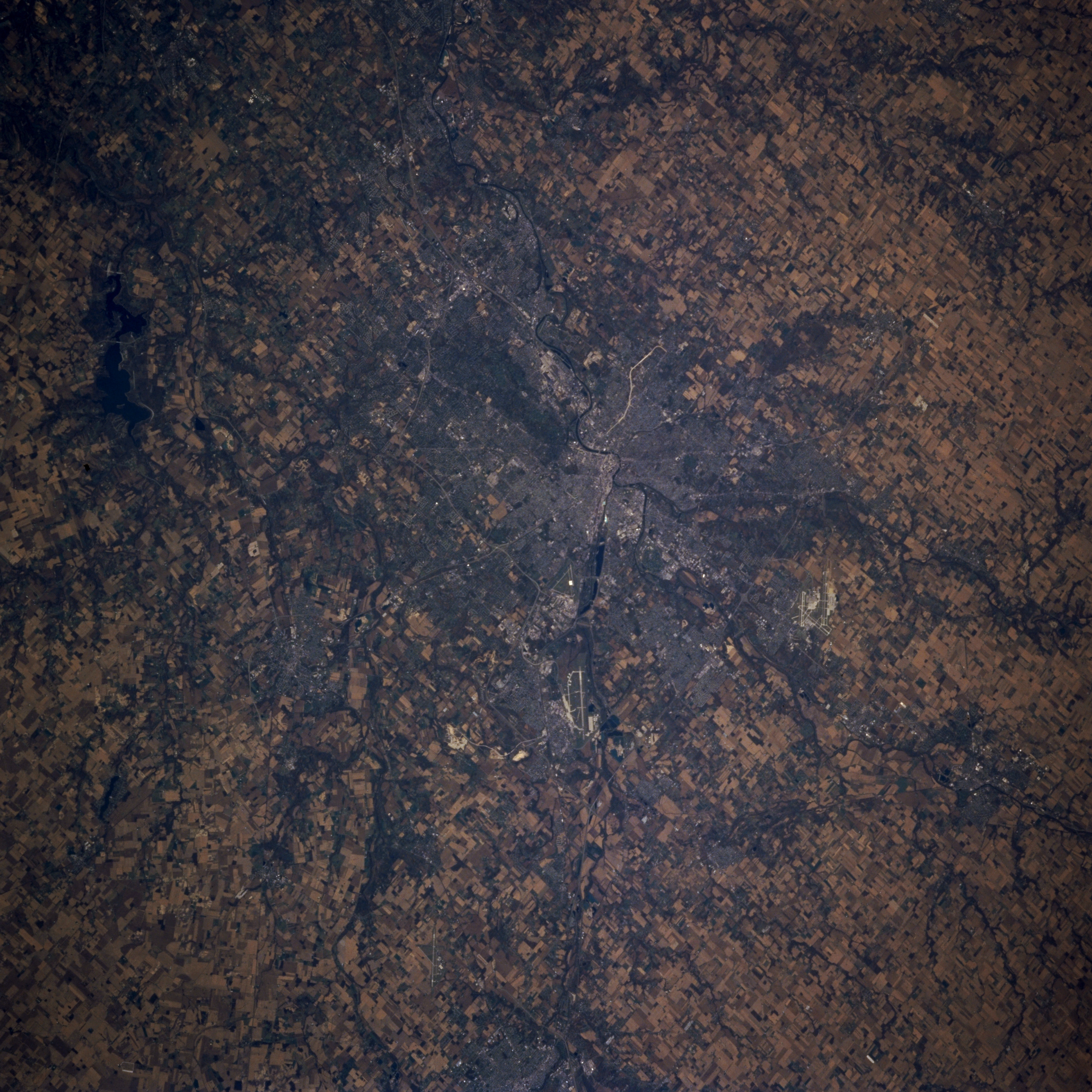
No GeoTIFF is available for this photo.Image Caption: STS073-707-R Dayton, Ohio October 1995
Dayton, Ohio, seen in this southwest-looking view, is the home of the inventors of the airplane, the Wright brothers. Situated on the Great Miami River where the Stillwater River joins the Great Miami, Dayton is the industrial, trade, and distribution center in a rich farming area of east central Ohio. With the location of Wright-Patterson Air Force Base northeast of the central city (airport runways are visible), Dayton is also an aviation and research center. Wright-Patterson Air Force Base was also the site of the Bosnian Peace Accords in October and November of 1995. The runways of the James M. Cox-Dayton Municipal Airport are discernible to the north (right) of the central city. To the top of the left center of the image is Caesar Creek Lake, a recreational lake on the Little Miami River. A small portion of southwest Springfield, Ohio is visible at the bottom center of the view.
Dayton, Ohio, seen in this southwest-looking view, is the home of the inventors of the airplane, the Wright brothers. Situated on the Great Miami River where the Stillwater River joins the Great Miami, Dayton is the industrial, trade, and distribution center in a rich farming area of east central Ohio. With the location of Wright-Patterson Air Force Base northeast of the central city (airport runways are visible), Dayton is also an aviation and research center. Wright-Patterson Air Force Base was also the site of the Bosnian Peace Accords in October and November of 1995. The runways of the James M. Cox-Dayton Municipal Airport are discernible to the north (right) of the central city. To the top of the left center of the image is Caesar Creek Lake, a recreational lake on the Little Miami River. A small portion of southwest Springfield, Ohio is visible at the bottom center of the view.
