< STS087-707-92 >
| NASA Photo ID | STS087-707-92 |
| Focal Length | 250mm |
| Date taken | 1997.11.22 |
| Time taken | 04:41:42 GMT |
Resolutions offered for this image:
5700 x 5900 pixels 483 x 500 pixels 4000 x 4000 pixels 1300 x 1283 pixels 640 x 624 pixels 639 x 639 pixels
5700 x 5900 pixels 483 x 500 pixels 4000 x 4000 pixels 1300 x 1283 pixels 640 x 624 pixels 639 x 639 pixels

Cloud masks available for this image:
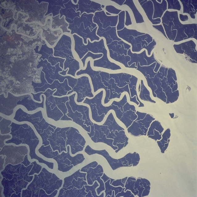
Spacecraft nadir point: 23.3° N, 88.5° E
Photo center point: 22.0° N, 89.5° E
Photo center point by machine learning:
Photo center point: 22.0° N, 89.5° E
Photo center point by machine learning:
Nadir to Photo Center: Southeast
Spacecraft Altitude: 150 nautical miles (278km)
Country or Geographic Name: | BANGLADESH |
Features: | MOUTHS OF THE GANGES |
| Features Found Using Machine Learning: | |
Cloud Cover Percentage: | 0 (no clouds present) |
Sun Elevation Angle: | 43° |
Sun Azimuth: | 157° |
Camera: | Hasselblad |
Focal Length: | 250mm |
Camera Tilt: | 33 degrees |
Format: | 5069: Kodak Elite 100S, E6 Reversal, Replaces Lumiere, Warmer in tone vs. Lumiere |
Film Exposure: | Normal |
| Additional Information | |
| Width | Height | Annotated | Cropped | Purpose | Links |
|---|---|---|---|---|---|
| 5700 pixels | 5900 pixels | No | No | Download Image Download Color Calibration Image for this Image |
|
| 483 pixels | 500 pixels | No | No | Download Image Download Color Calibration Image for this Image |
|
| 4000 pixels | 4000 pixels | Download Image | |||
| 1300 pixels | 1283 pixels | Download Image | |||
| 640 pixels | 624 pixels | No | No | Photographic Highlights | Download Image |
| 639 pixels | 639 pixels | Download Image |
Download Packaged File
Download a Google Earth KML for this Image
View photo footprint information
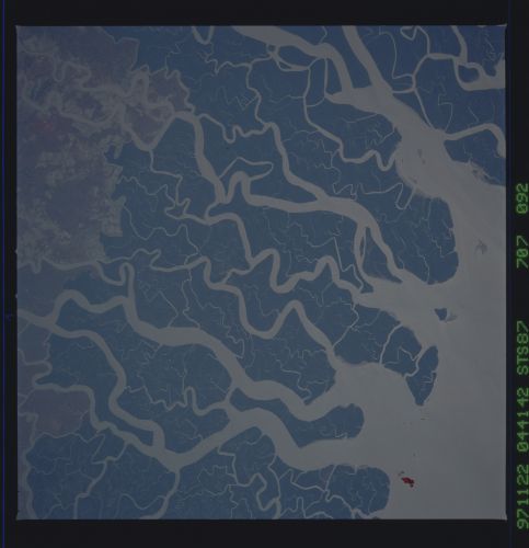
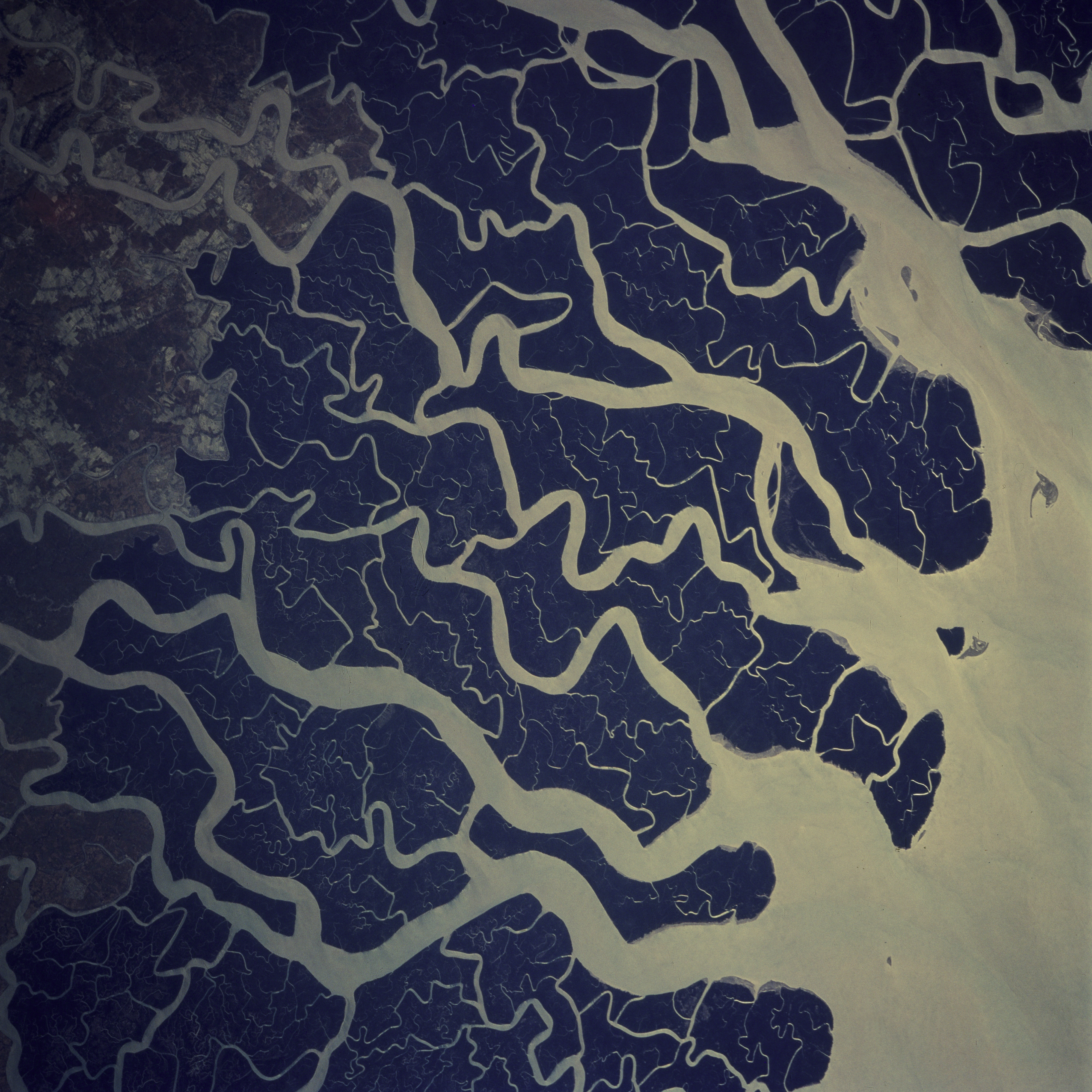
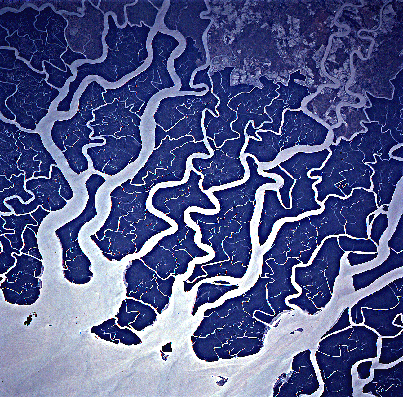
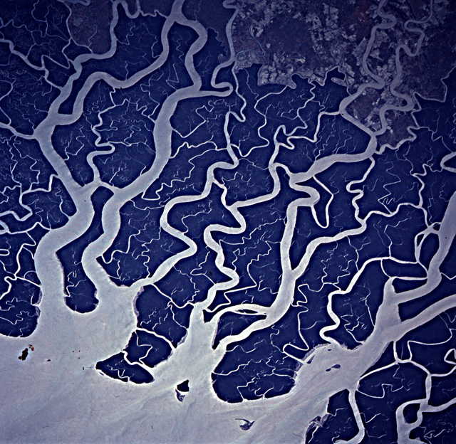
No GeoTIFF is available for this photo.Image Caption: A glacier at about 22,100 feet in the Himalayas is the source of the Ganges river. Hundreds of miles later
and joined by other tributaries the Ganges delta enters the Bay of Bengal. The delta, at 200 miles wide (320
km) is one of the most fertile and densely populated regions of the world. The eastern side of the delta
changes rapidly and forms new land because of rapid sedimentation. The southern part of the delta has a
darker appearance because of tidal forests, swampland, and mangroves. The Sundarbans is the name of this
forested area and it is the site of a tiger preservation project for the governments of India and Bangladesh.
