< STS106-705-9 >
| NASA Photo ID | STS106-705-9 |
| Focal Length | 250mm |
| Date taken | 2000.09.16 |
| Time taken | 07:28:48 GMT |
Resolutions offered for this image:
1031 x 1024 pixels 2063 x 2048 pixels 4127 x 4096 pixels 4400 x 4600 pixels 515 x 512 pixels 478 x 500 pixels 1284 x 1300 pixels 1242 x 1286 pixels 395 x 400 pixels
1031 x 1024 pixels 2063 x 2048 pixels 4127 x 4096 pixels 4400 x 4600 pixels 515 x 512 pixels 478 x 500 pixels 1284 x 1300 pixels 1242 x 1286 pixels 395 x 400 pixels


Cloud masks available for this image:
Spacecraft nadir point: 34.2° N, 74.6° E
Photo center point:
Photo center point by machine learning:
Photo center point:
Photo center point by machine learning:
Nadir to Photo Center:
Spacecraft Altitude: 200 nautical miles (370km)
Country or Geographic Name: | PAKISTAN |
Features: | KARAKORAM RANGE, GLACIERS |
| Features Found Using Machine Learning: | |
Cloud Cover Percentage: | 10 (1-10)% |
Sun Elevation Angle: | 58° |
Sun Azimuth: | 195° |
Camera: | Hasselblad |
Focal Length: | 250mm |
Camera Tilt: | |
Format: | 5069: Kodak Elite 100S, E6 Reversal, Replaces Lumiere, Warmer in tone vs. Lumiere |
Film Exposure: | |
| Additional Information | |
| Width | Height | Annotated | Cropped | Purpose | Links |
|---|---|---|---|---|---|
| 1031 pixels | 1024 pixels | No | No | Download Image | |
| 2063 pixels | 2048 pixels | No | No | Download Image | |
| 4127 pixels | 4096 pixels | No | No | Download Image | |
| 4400 pixels | 4600 pixels | No | No | Download Image Download Color Calibration Image for this Image |
|
| 515 pixels | 512 pixels | No | No | Download Image | |
| 478 pixels | 500 pixels | No | No | Download Image Download Color Calibration Image for this Image |
|
| 1284 pixels | 1300 pixels | No | No | Download Image | |
| 1242 pixels | 1286 pixels | No | No | Download Image | |
| 395 pixels | 400 pixels | Download Image |
Download Packaged File
Download a Google Earth KML for this Image
View photo footprint information
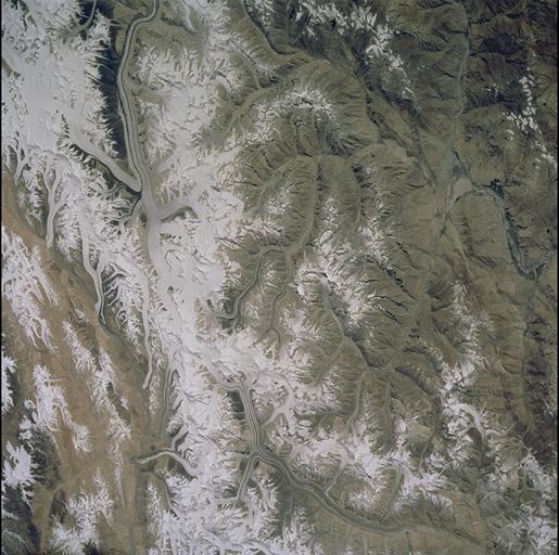
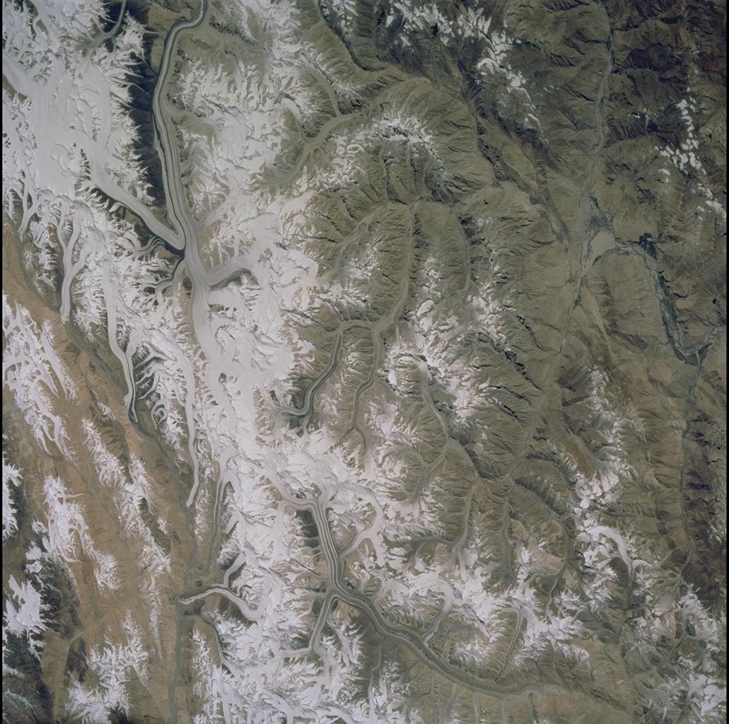
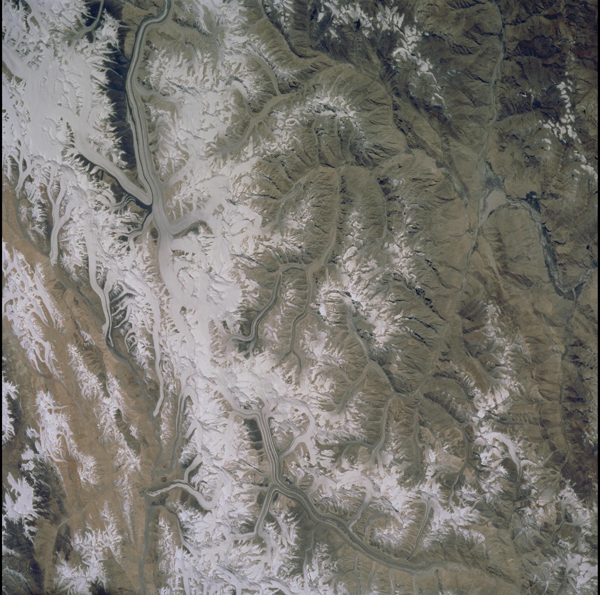
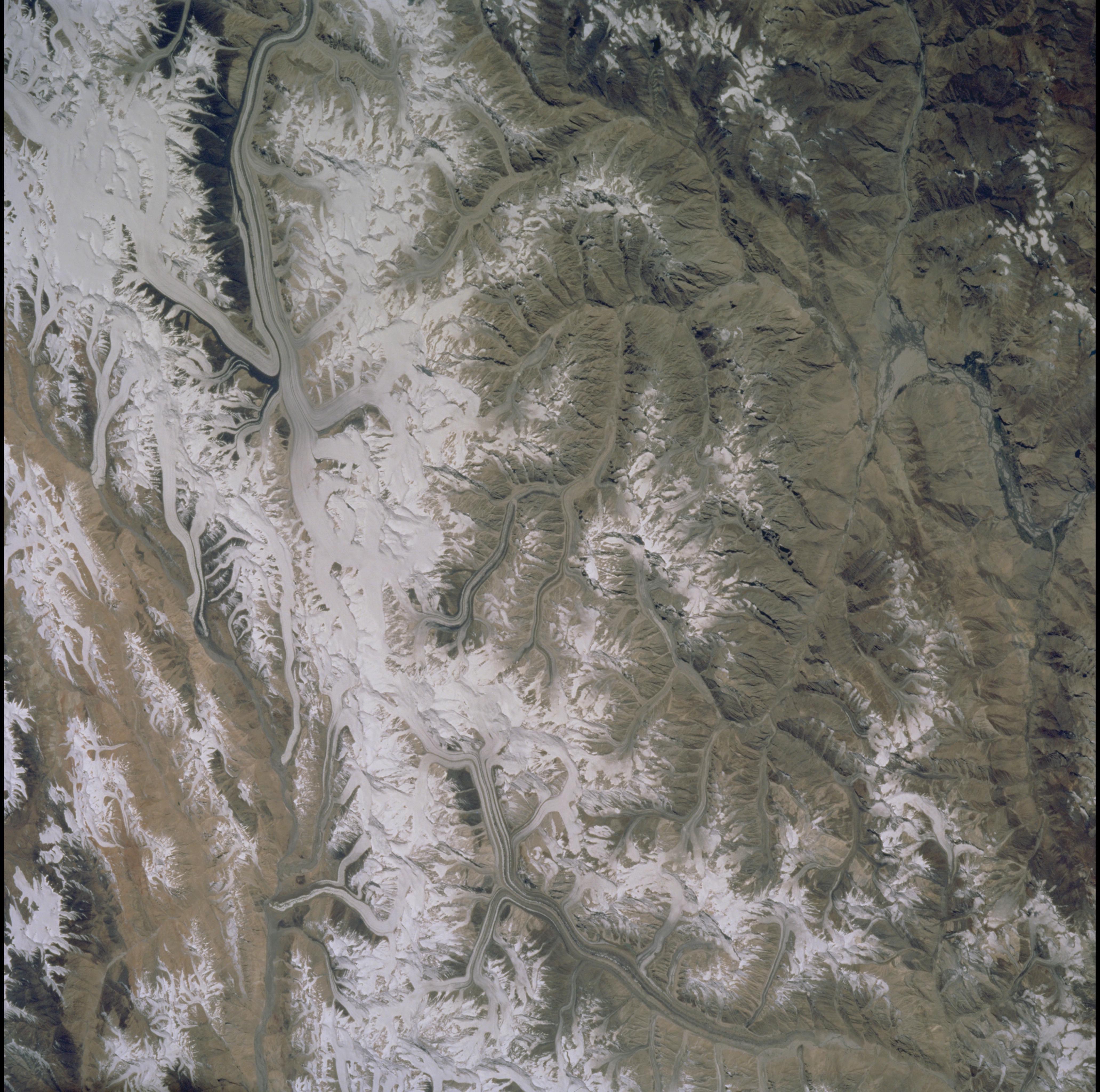
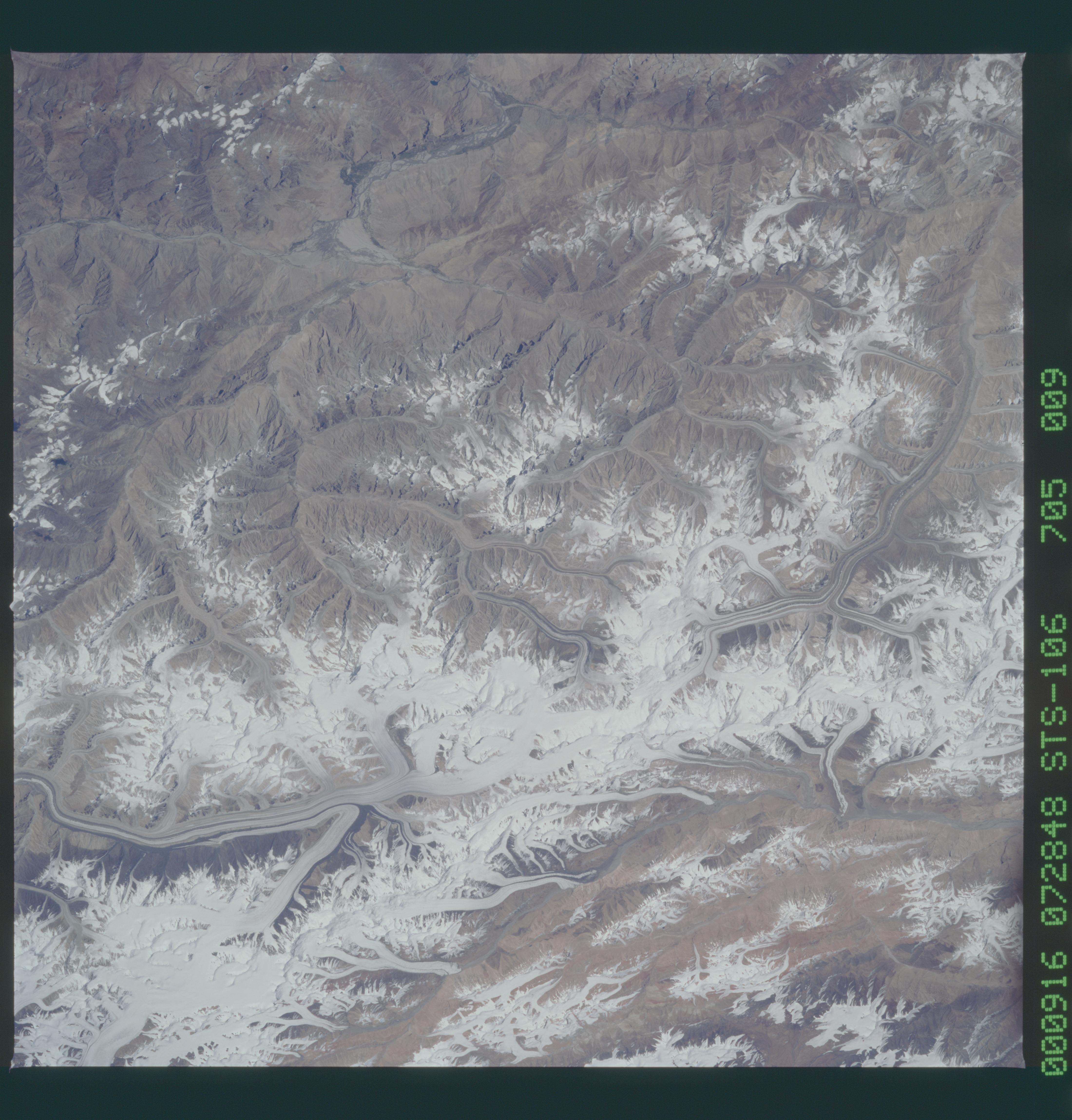
No GeoTIFF is available for this photo.Image Caption: Source:Patricia W. Dickerson
Karakoram Glaciers, Qogir Feng (K2)
Qogir Feng (8611 m; also called K2 or Mt. Godwin Austen), second highest
peak in the world, is at far upper left in this view of the northwestern
Karakoram Range. The Tarim sedimentary basin borders the range on the
north and the Lesser Himalayas on the south. Melt waters from vast
glaciers, such as those south and east of K2, feed agriculture in the
valleys (dark green) and contribute significantly to the regional
fresh-water supply. The Karakoram Range lies along the southern edge of
the Eurasian tectonic plate and is made up of ancient sedimentary rocks
(more than 390 million years old). Those strata were folded and
thrust-faulted, and granite masses were intruded, when the Indo-Pakistan
plate collided with Eurasia, beginning more than 100 million years ago.
