< STS095-715-9 >

| NASA Photo ID | STS095-715-9 |
| Focal Length | 250mm |
| Date taken | 1998.11.06 |
| Time taken | 10:45:20 GMT |
Cloud masks available for this image:
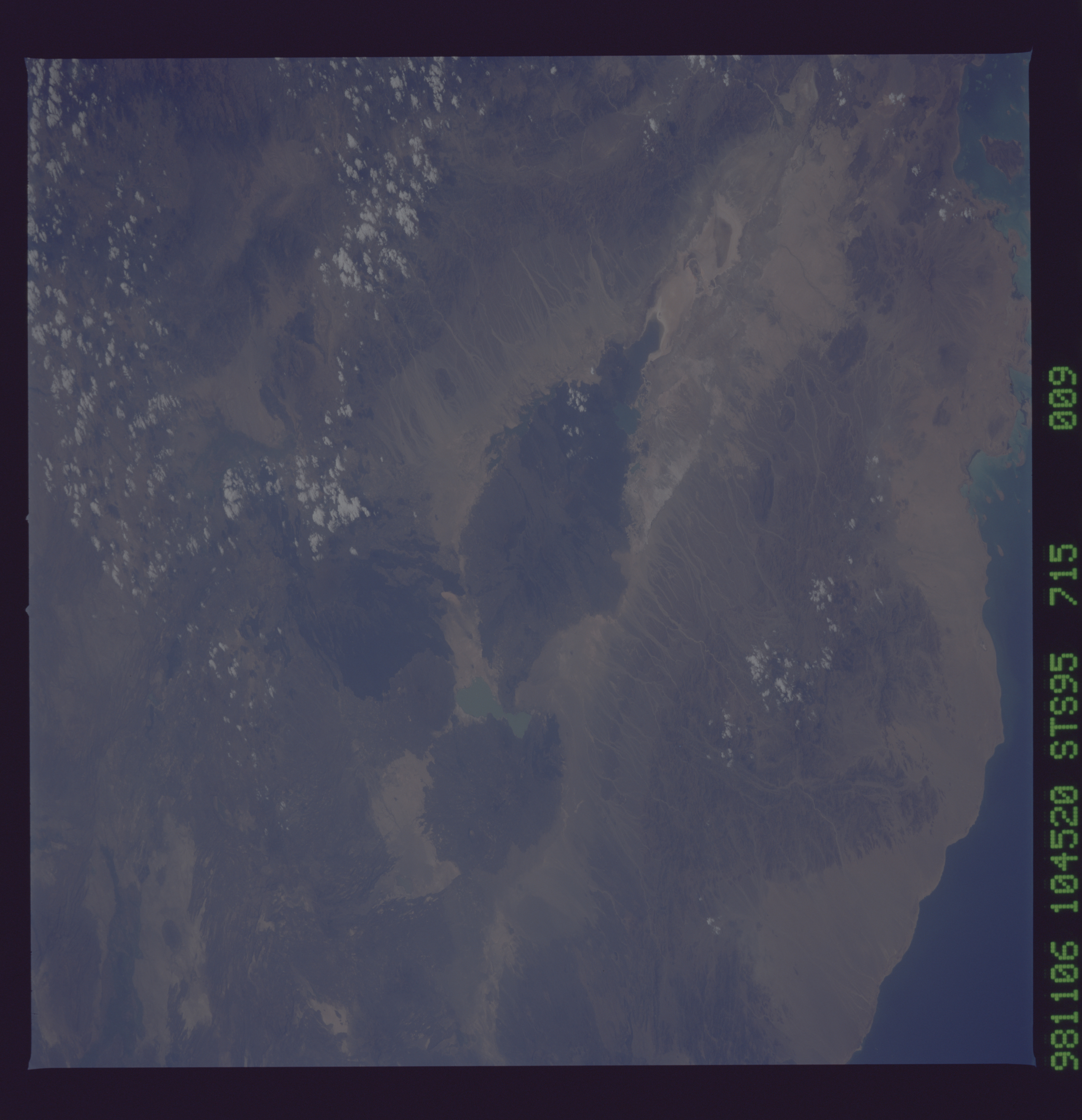
Spacecraft nadir point: 19.6° N, 40.6° E
Photo center point: 13.5° N, 40.5° E
Photo center point by machine learning:
Photo center point: 13.5° N, 40.5° E
Photo center point by machine learning:
Nadir to Photo Center: South
Spacecraft Altitude: 294 nautical miles (544km)
Camera: | Hasselblad |
Focal Length: | 250mm |
Camera Tilt: | 51 degrees |
Format: | 5069: Kodak Elite 100S, E6 Reversal, Replaces Lumiere, Warmer in tone vs. Lumiere |
Film Exposure: | Normal |
| Additional Information | |
| Width | Height | Annotated | Cropped | Purpose | Links |
|---|---|---|---|---|---|
| 5700 pixels | 5900 pixels | No | No | Download Image Download Color Calibration Image for this Image |
|
| 483 pixels | 500 pixels | No | No | Download Image Download Color Calibration Image for this Image |
Download Packaged File
Download a Google Earth KML for this Image
View photo footprint information
No GeoTIFF is available for this photo.Image Caption: Erte Ale. Erte Ale is one of the volcanic vents that is aligned along a fault in the Danakil segment of the Red Sea rift system. Several generations of lava flows can be discerned, the blacker ones generally being more recent.
