< STS078-734-9 >
| NASA Photo ID | STS078-734-9 |
| Focal Length | 250mm |
| Date taken | 1996.06.25 |
| Time taken | 14:42:42 GMT |
Resolutions offered for this image:
4054 x 4054 pixels 640 x 640 pixels 5700 x 5900 pixels 483 x 500 pixels 653 x 654 pixels 479 x 479 pixels
4054 x 4054 pixels 640 x 640 pixels 5700 x 5900 pixels 483 x 500 pixels 653 x 654 pixels 479 x 479 pixels


Cloud masks available for this image:
Spacecraft nadir point: 35.3° N, 97.7° W
Photo center point: 35.5° N, 97.5° W
Photo center point by machine learning:
Photo center point: 35.5° N, 97.5° W
Photo center point by machine learning:
Nadir to Photo Center: Northeast
Spacecraft Altitude: 144 nautical miles (267km)
Country or Geographic Name: | USA-OKLAHOMA |
Features: | OKLAHOMA CITY, CANADIAN R |
| Features Found Using Machine Learning: | |
Cloud Cover Percentage: | 5 (1-10)% |
Sun Elevation Angle: | 39° |
Sun Azimuth: | 87° |
Camera: | Hasselblad |
Focal Length: | 250mm |
Camera Tilt: | 7 degrees |
Format: | 5046: Kodak, natural color positive, Lumiere 100/5046, ASA 100, standard base |
Film Exposure: | Normal |
| Additional Information | |
| Width | Height | Annotated | Cropped | Purpose | Links |
|---|---|---|---|---|---|
| 4054 pixels | 4054 pixels | No | No | Earth From Space collection | Download Image |
| 640 pixels | 640 pixels | No | No | Earth From Space collection | Download Image |
| 5700 pixels | 5900 pixels | No | No | Download Image Download Color Calibration Image for this Image |
|
| 483 pixels | 500 pixels | No | No | Download Image Download Color Calibration Image for this Image |
|
| 653 pixels | 654 pixels | No | No | Download Image | |
| 479 pixels | 479 pixels | Download Image |
Download Packaged File
Download a Google Earth KML for this Image
View photo footprint information
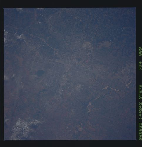
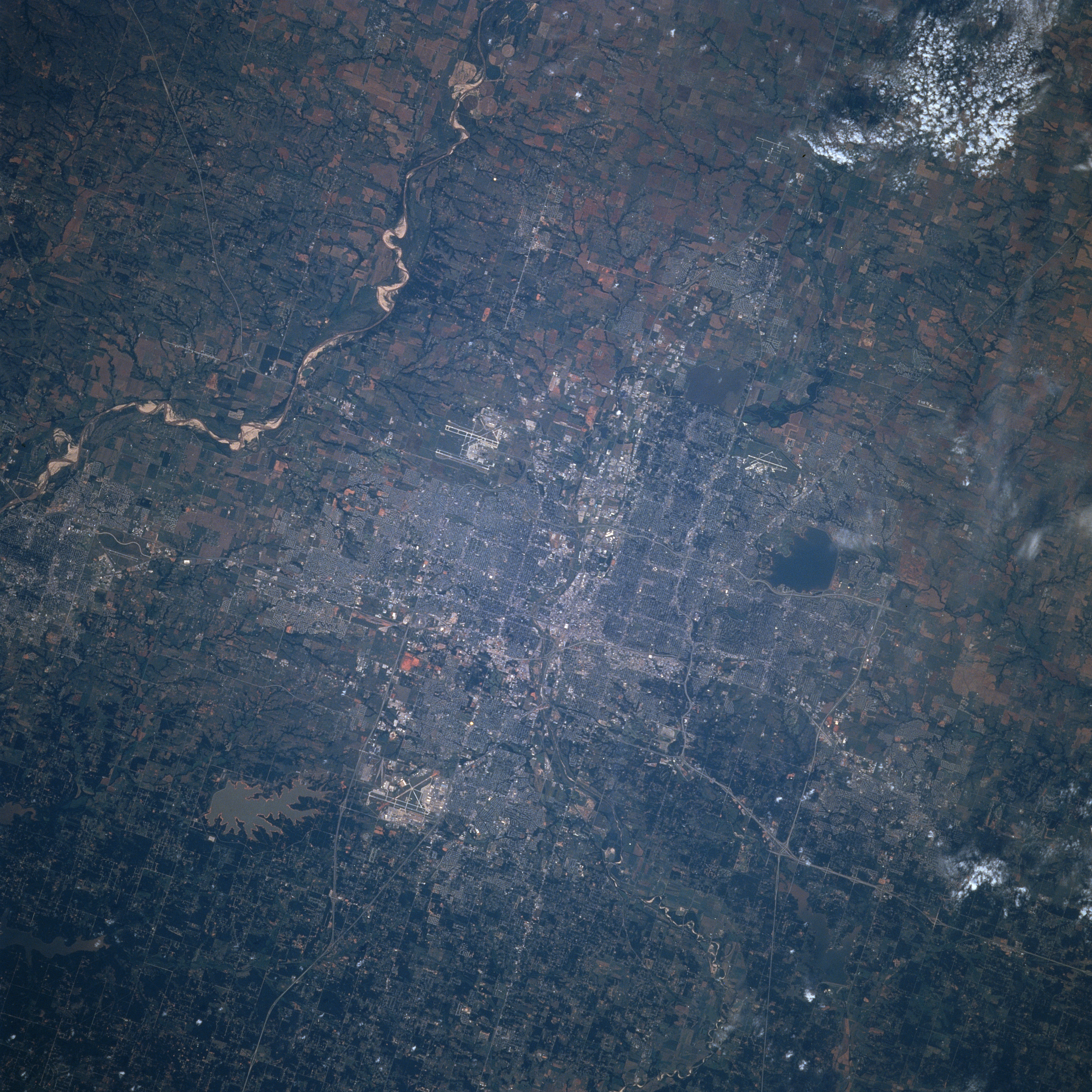
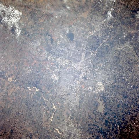
No GeoTIFF is available for this photo.Image Caption: STS078-734-9 Oklahoma City, Oklahoma, USA June 1996
Oklahoma City can be considered a major transportation hub for this region of the Great Plains. Three airports, Tinker Air Force Base (southeast of downtown); Will Rogers World Airport (southwest of downtown); and Wiley Post Airport (northwest of downtown) are recognizable by their runways and taxi-ways. The checkerboard street pattern of Oklahoma City and numerous highways that crisscross the city delineate the urban center. Even the downtown core section of the city is easy to identify by the concentration of highly reflective surfaces. Three sizable irregular shaped features, Lake Hefner, Arcadia Lake, and Lake Stanley Draper can be identified northwest, northeast, and southeast respectively around the downtown core. The meandering stream channel and the white sandbars of the Canadian River can be observed southwest of the city. Although it is more difficult to see, a section of the North Canadian River is also visible as it heads eastward through the central part of the downtown before it makes a gentle curve to the northeast. Most of Norman, home of the University of Oklahoma, can be seen south of Oklahoma City (bottom center).
Oklahoma City can be considered a major transportation hub for this region of the Great Plains. Three airports, Tinker Air Force Base (southeast of downtown); Will Rogers World Airport (southwest of downtown); and Wiley Post Airport (northwest of downtown) are recognizable by their runways and taxi-ways. The checkerboard street pattern of Oklahoma City and numerous highways that crisscross the city delineate the urban center. Even the downtown core section of the city is easy to identify by the concentration of highly reflective surfaces. Three sizable irregular shaped features, Lake Hefner, Arcadia Lake, and Lake Stanley Draper can be identified northwest, northeast, and southeast respectively around the downtown core. The meandering stream channel and the white sandbars of the Canadian River can be observed southwest of the city. Although it is more difficult to see, a section of the North Canadian River is also visible as it heads eastward through the central part of the downtown before it makes a gentle curve to the northeast. Most of Norman, home of the University of Oklahoma, can be seen south of Oklahoma City (bottom center).
