< STS091-725-88 >

| NASA Photo ID | STS091-725-88 |
| Focal Length | 250mm |
| Date taken | 1998.06.__ |
| Time taken | GMT |
Resolutions offered for this image:
5700 x 5900 pixels 483 x 500 pixels 2160 x 2030 pixels 640 x 601 pixels
5700 x 5900 pixels 483 x 500 pixels 2160 x 2030 pixels 640 x 601 pixels
Cloud masks available for this image:
Spacecraft nadir point:
Photo center point: 18.5° N, 94.5° W
Photo center point by machine learning:
Photo center point: 18.5° N, 94.5° W
Photo center point by machine learning:
Nadir to Photo Center:
Spacecraft Altitude: nautical miles (0km)
Country or Geographic Name: | MEXICO |
Features: | SMOKE, MOUNT PAJAPAN |
| Features Found Using Machine Learning: | |
Cloud Cover Percentage: | 5 (1-10)% |
Sun Elevation Angle: | ° |
Sun Azimuth: | ° |
Camera: | Hasselblad |
Focal Length: | 250mm |
Camera Tilt: | Low Oblique |
Format: | 5069: Kodak Elite 100S, E6 Reversal, Replaces Lumiere, Warmer in tone vs. Lumiere |
Film Exposure: | Normal |
| Additional Information | |
| Width | Height | Annotated | Cropped | Purpose | Links |
|---|---|---|---|---|---|
| 5700 pixels | 5900 pixels | No | No | Download Image Download Color Calibration Image for this Image |
|
| 483 pixels | 500 pixels | No | No | Download Image Download Color Calibration Image for this Image |
|
| 2160 pixels | 2030 pixels | Download Image | |||
| 640 pixels | 601 pixels | Download Image |
Download Packaged File
Download a Google Earth KML for this Image
View photo footprint information
No GeoTIFF is available for this photo.Image Caption:
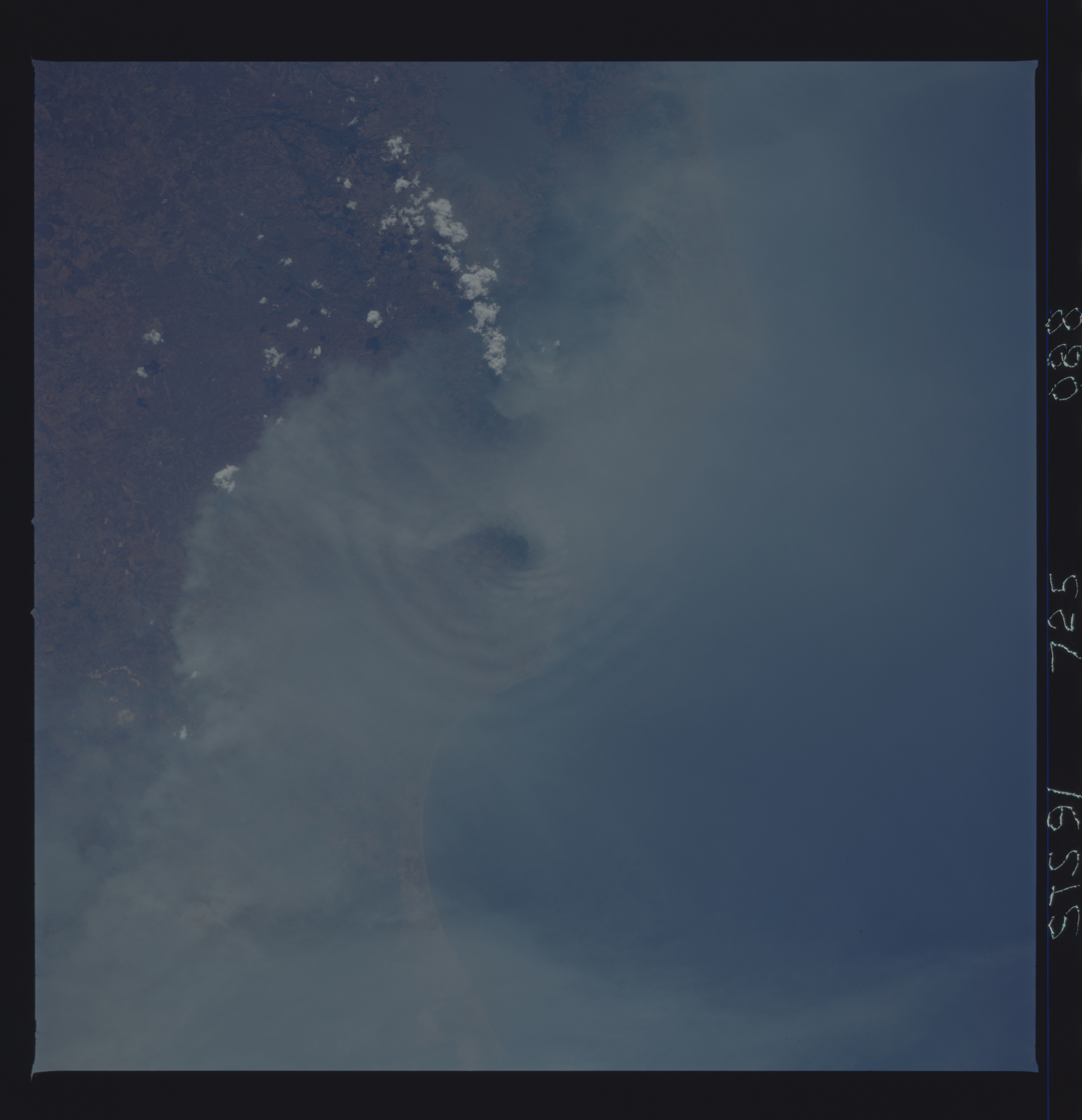
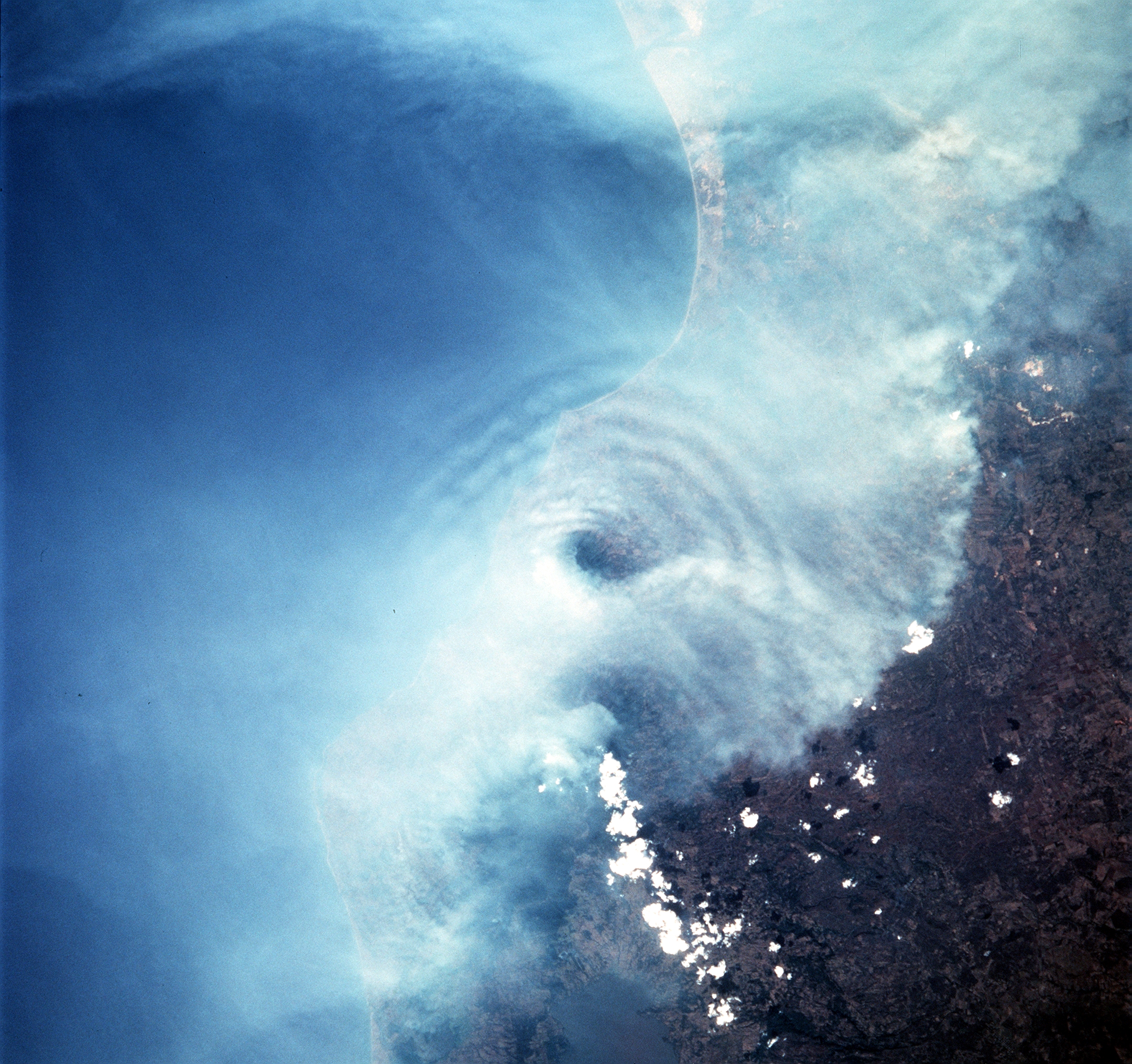
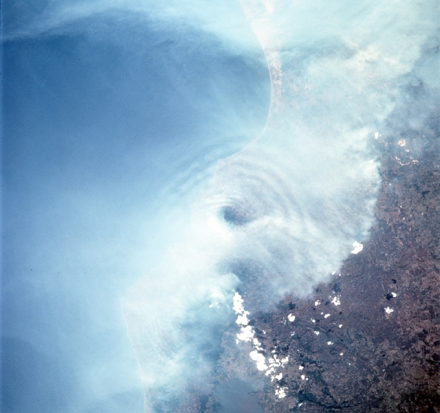
STS091-725-088 Gravity Waves in the Heavy Smoke of Mexico.Waves are generated by the volcanic peaks as the wind carrying the smoke moves by the peaks. Along the coast of the Bay of Campeche, the fires burn around the peak of the Cerro San Martin (5577 feet), which is west and higher than the peak with the waves around it. Lago Catemaco is on the west, center edge of the photo. Fires across Mexico and Central America, set by both man and nature, created heavy smoke plumes for a few weeks in May and June, 1998. The smoke circulated around a high pressure system over the Gulf of Mexico and brought thick smoke and soot to the south central United States. Scientists are looking at burning regions like this around the world to study the smokes affect on the albedo or the reflectance of the suns rays and how it may influence our world's climate.
STS091-725-088 Gravity Waves in the Heavy Smoke of Mexico.Waves are generated by the volcanic peaks as the wind carrying the smoke moves by the peaks. Along the coast of the Bay of Campeche, the fires burn around the peak of the Cerro San Martin (5577 feet), which is west and higher than the peak with the waves around it. Lago Catemaco is on the west, center edge of the photo. Fires across Mexico and Central America, set by both man and nature, created heavy smoke plumes for a few weeks in May and June, 1998. The smoke circulated around a high pressure system over the Gulf of Mexico and brought thick smoke and soot to the south central United States. Scientists are looking at burning regions like this around the world to study the smokes affect on the albedo or the reflectance of the suns rays and how it may influence our world's climate.
