< STS078-734-7 >

| NASA Photo ID | STS078-734-7 |
| Focal Length | 250mm |
| Date taken | 1996.06.25 |
| Time taken | 14:42:23 GMT |
Resolutions offered for this image:
4048 x 4048 pixels 639 x 639 pixels 5700 x 5900 pixels 483 x 500 pixels 652 x 656 pixels 480 x 479 pixels
4048 x 4048 pixels 639 x 639 pixels 5700 x 5900 pixels 483 x 500 pixels 652 x 656 pixels 480 x 479 pixels


Cloud masks available for this image:
Spacecraft nadir point: 34.9° N, 99.1° W
Photo center point: 34.0° N, 98.5° W
Photo center point by machine learning:
Photo center point: 34.0° N, 98.5° W
Photo center point by machine learning:
Nadir to Photo Center: Southeast
Spacecraft Altitude: 144 nautical miles (267km)
Country or Geographic Name: | USA-TEXAS |
Features: | WICHITA FALLS, RED R., AGR |
| Features Found Using Machine Learning: | |
Cloud Cover Percentage: | 0 (no clouds present) |
Sun Elevation Angle: | 38° |
Sun Azimuth: | 86° |
Camera: | Hasselblad |
Focal Length: | 250mm |
Camera Tilt: | 24 degrees |
Format: | 5046: Kodak, natural color positive, Lumiere 100/5046, ASA 100, standard base |
Film Exposure: | Normal |
| Additional Information | |
| Width | Height | Annotated | Cropped | Purpose | Links |
|---|---|---|---|---|---|
| 4048 pixels | 4048 pixels | No | No | Earth From Space collection | Download Image |
| 639 pixels | 639 pixels | No | No | Earth From Space collection | Download Image |
| 5700 pixels | 5900 pixels | No | No | Download Image Download Color Calibration Image for this Image |
|
| 483 pixels | 500 pixels | No | No | Download Image Download Color Calibration Image for this Image |
|
| 652 pixels | 656 pixels | No | No | Download Image | |
| 480 pixels | 479 pixels | Download Image |
Download Packaged File
Download a Google Earth KML for this Image
View photo footprint information
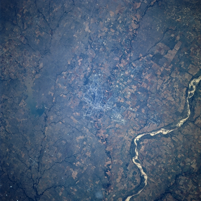
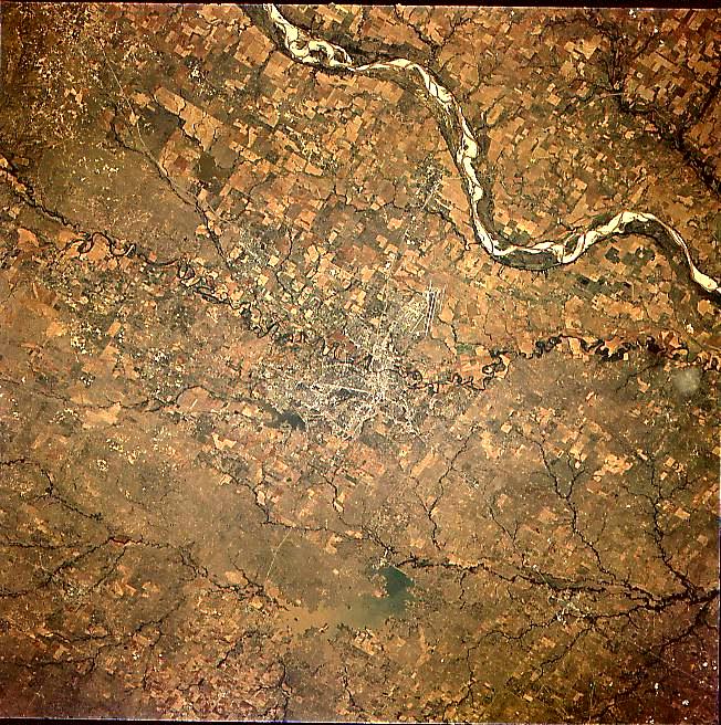
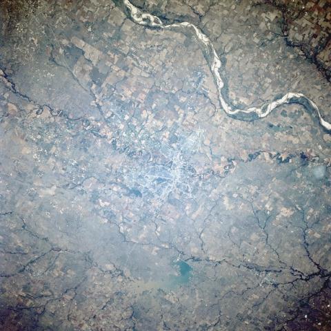
No GeoTIFF is available for this photo.Image Caption: STS078-734-007 Wichita Falls, Texas, USA June 1996
The urban area of Wichita Falls can be identified by the numerous intersecting roads and highways near the center of the image. A section of Interstate Highway 44 that extends northward from Wichita Falls to Lawton, Oklahoma, can be traced across the landscape, especially where the highway crosses the Red River. The combined runways of Sheppard Air Force Base and the Wichita Falls commercial airport are visible north of Wichita Falls. Large cultivated field patterns on both the Oklahoma (upper right) side and the Texas side of the Red River are visible. Several meandering tributary streams (dark, linear features) of the Red River are visible. Lake Arrowhead with a light-colored sediment plume in the southern section of the lake can be seen near the southern edge of the picture. A smaller, unnamed reservoir is also visible immediately southwest of Wichita Falls.
The urban area of Wichita Falls can be identified by the numerous intersecting roads and highways near the center of the image. A section of Interstate Highway 44 that extends northward from Wichita Falls to Lawton, Oklahoma, can be traced across the landscape, especially where the highway crosses the Red River. The combined runways of Sheppard Air Force Base and the Wichita Falls commercial airport are visible north of Wichita Falls. Large cultivated field patterns on both the Oklahoma (upper right) side and the Texas side of the Red River are visible. Several meandering tributary streams (dark, linear features) of the Red River are visible. Lake Arrowhead with a light-colored sediment plume in the southern section of the lake can be seen near the southern edge of the picture. A smaller, unnamed reservoir is also visible immediately southwest of Wichita Falls.
