< STS062-100-63 >
| NASA Photo ID | STS062-100-63 |
| Focal Length | 40mm |
| Date taken | 1994.03.09 |
| Time taken | 16:08:31 GMT |
Resolutions offered for this image:
3904 x 3904 pixels 639 x 639 pixels 5700 x 5900 pixels 500 x 518 pixels 640 x 480 pixels
3904 x 3904 pixels 639 x 639 pixels 5700 x 5900 pixels 500 x 518 pixels 640 x 480 pixels
Cloud masks available for this image:
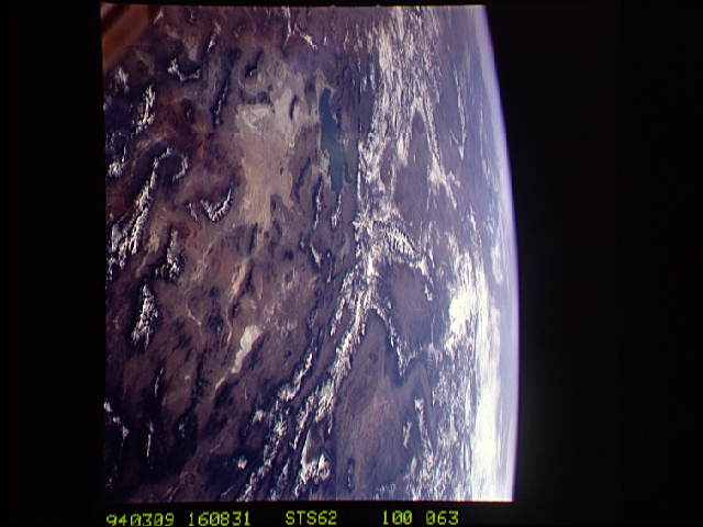
Spacecraft nadir point: 38.5° N, 116.3° W
Photo center point: 40.5° N, 113.0° W
Photo center point by machine learning:
Photo center point: 40.5° N, 113.0° W
Photo center point by machine learning:
Nadir to Photo Center: Northeast
Spacecraft Altitude: 160 nautical miles (296km)
Country or Geographic Name: | USA-UTAH |
Features: | PAN-VIEW OF SALT L.& DES |
| Features Found Using Machine Learning: | |
Cloud Cover Percentage: | 10 (1-10)% |
Sun Elevation Angle: | 22° |
Sun Azimuth: | 116° |
Camera: | Hasselblad |
Focal Length: | 40mm |
Camera Tilt: | High Oblique |
Format: | 5048: Kodak, natural color positive, Lumiere 100x/5048, ASA 100x, standard base |
Film Exposure: | Normal |
| Additional Information | |
| Width | Height | Annotated | Cropped | Purpose | Links |
|---|---|---|---|---|---|
| 3904 pixels | 3904 pixels | No | No | Earth From Space collection | Download Image |
| 639 pixels | 639 pixels | No | No | Earth From Space collection | Download Image |
| 5700 pixels | 5900 pixels | No | No | Download Image Download Color Calibration Image for this Image |
|
| 500 pixels | 518 pixels | No | No | Download Image Download Color Calibration Image for this Image |
|
| 640 pixels | 480 pixels | No | No | Download Image |
Download Packaged File
Download a Google Earth KML for this Image
View photo footprint information
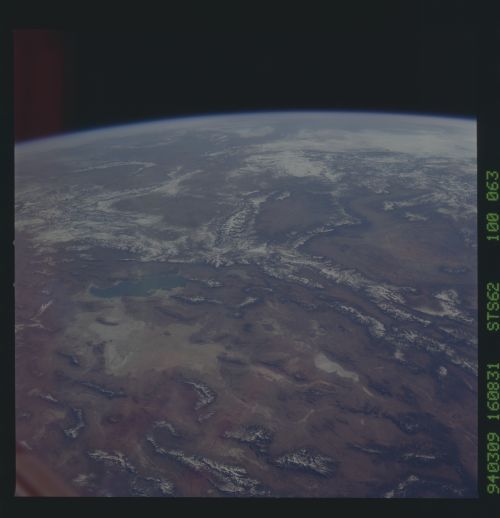
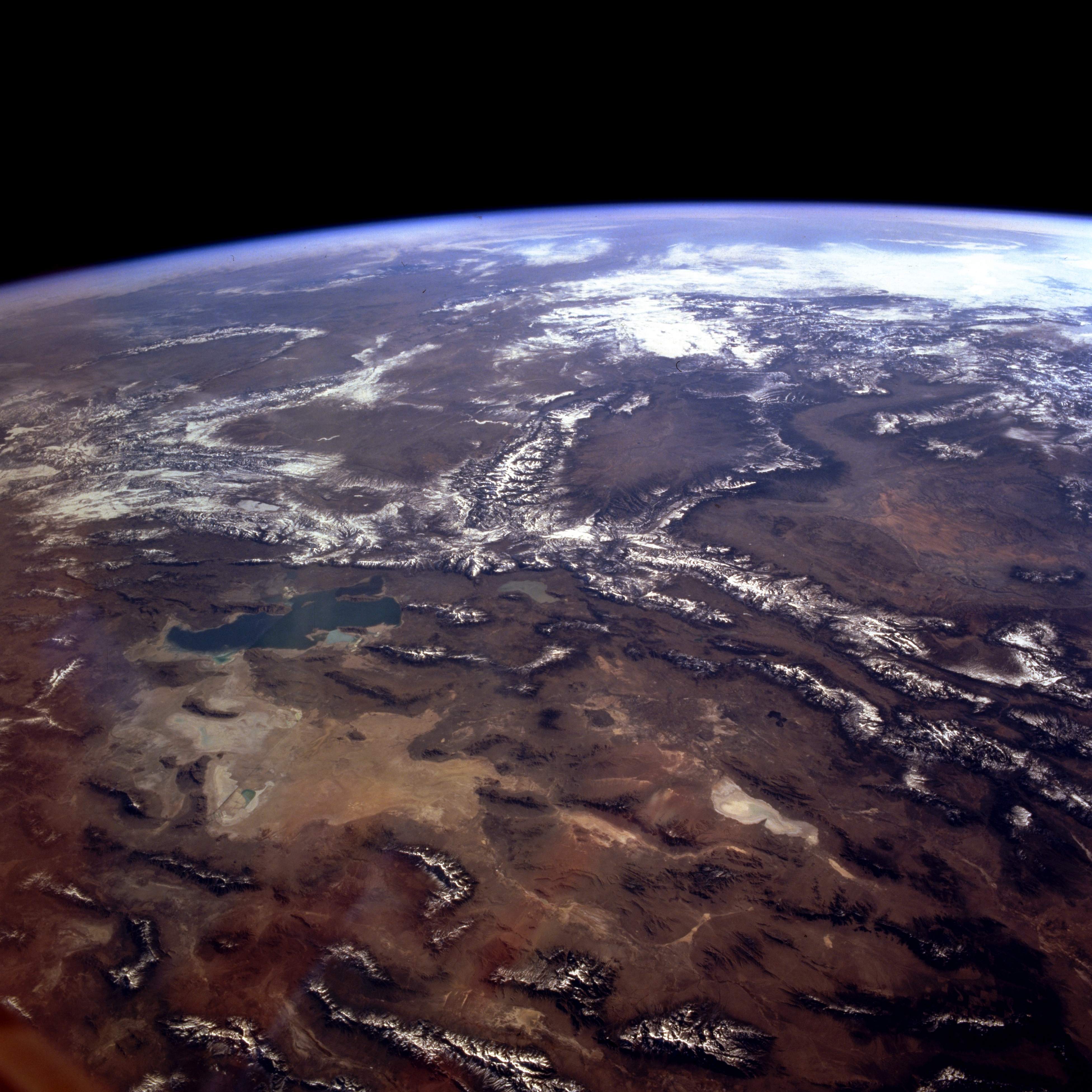
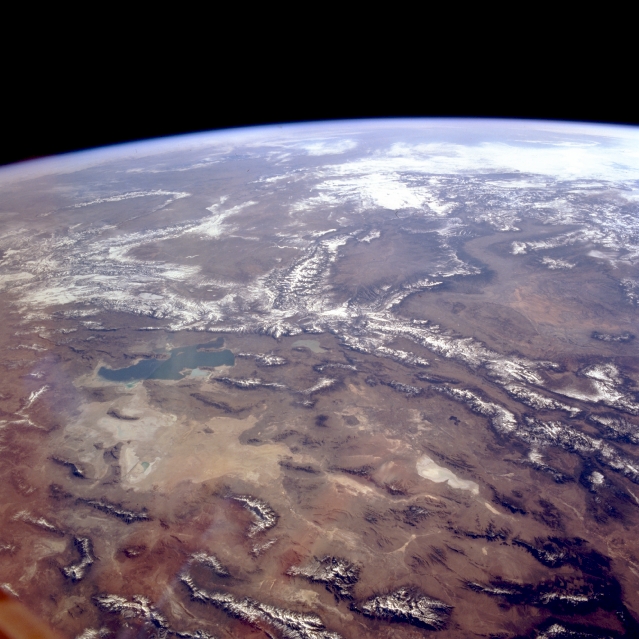
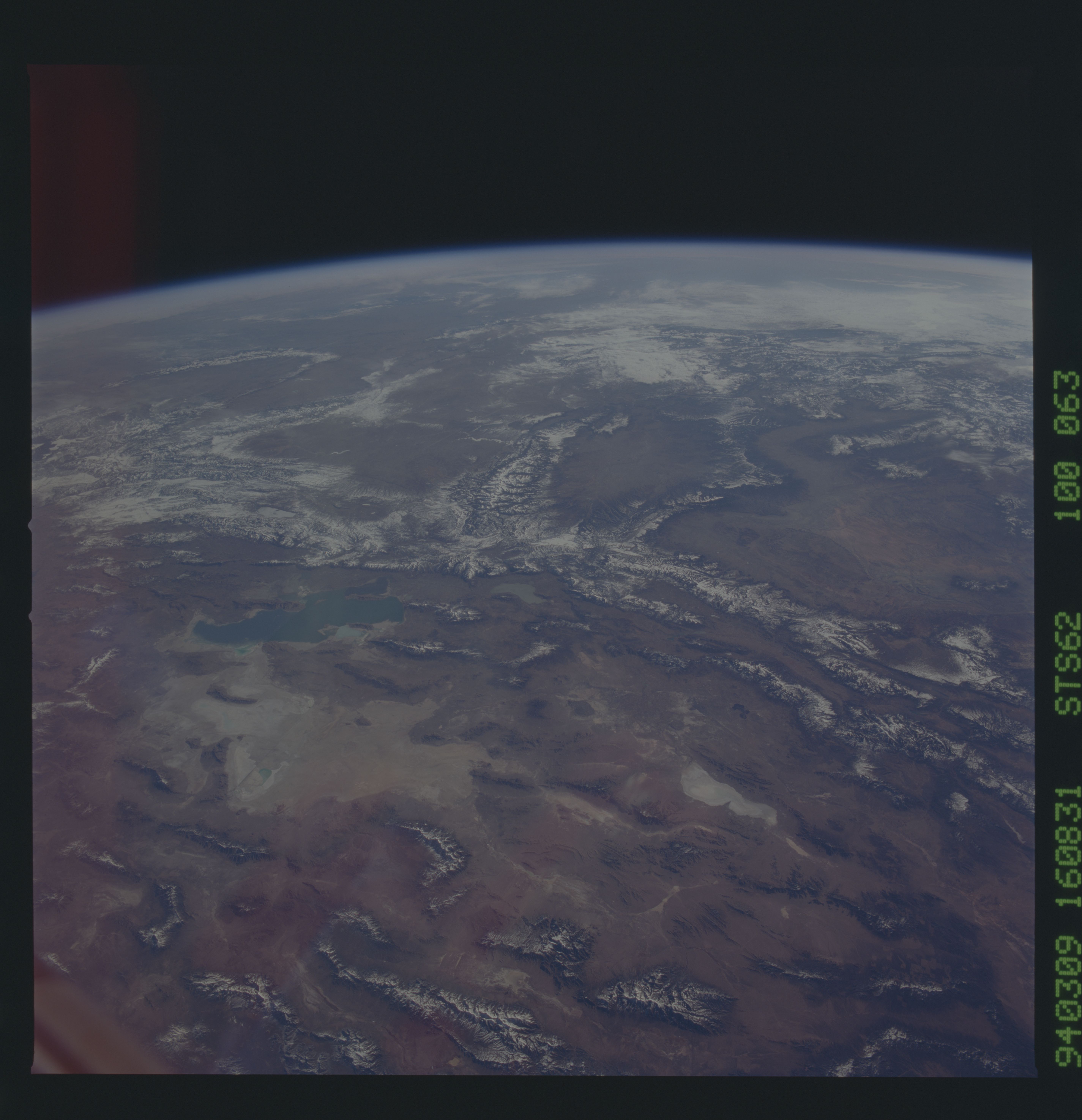
No GeoTIFF is available for this photo.Image Caption: STS062-100-063 Colorado, Nevada, Utah, and Wyoming, U.S.A. March 1994
Portions of Colorado, Nevada, Utah, and Wyoming are discernible in this panoramic, east-northeast-looking, high-oblique photograph. Visible are the basin and range region of eastern Nevada; the north-south-trending, snow-covered Wasatch Range, west of which lie the Great Salt Lake and the Great Salt Lake Desert; and dry Sevier Lake, south of the Great Salt Lake Desert. The east-west-trending Uinta Mountains extend eastward from the Wasatch Range. The Yellowstone National Park area of northwest Wyoming and the Great Divide Basin to its south are apparent. Near the horizon, clouds overhang the Rocky Mountains.
Portions of Colorado, Nevada, Utah, and Wyoming are discernible in this panoramic, east-northeast-looking, high-oblique photograph. Visible are the basin and range region of eastern Nevada; the north-south-trending, snow-covered Wasatch Range, west of which lie the Great Salt Lake and the Great Salt Lake Desert; and dry Sevier Lake, south of the Great Salt Lake Desert. The east-west-trending Uinta Mountains extend eastward from the Wasatch Range. The Yellowstone National Park area of northwest Wyoming and the Great Divide Basin to its south are apparent. Near the horizon, clouds overhang the Rocky Mountains.
