< STS057-100-61 >
| NASA Photo ID | STS057-100-61 |
| Focal Length | 50mm |
| Date taken | 1993.06.23 |
| Time taken | 12:14:35 GMT |
Resolutions offered for this image:
5700 x 6000 pixels 500 x 526 pixels 640 x 480 pixels 639 x 640 pixels
5700 x 6000 pixels 500 x 526 pixels 640 x 480 pixels 639 x 640 pixels

Cloud masks available for this image:
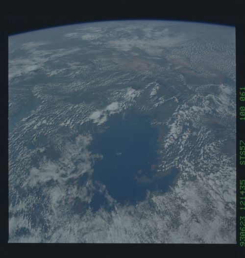
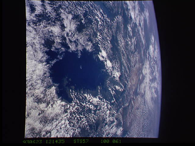
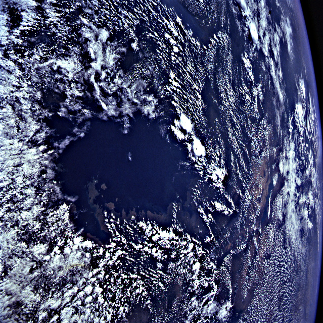
Spacecraft nadir point: 3.6° S, 31.1° E
Photo center point: 1.0° S, 33.0° E
Photo center point by machine learning:
Photo center point: 1.0° S, 33.0° E
Photo center point by machine learning:
Nadir to Photo Center: Northeast
Spacecraft Altitude: 245 nautical miles (454km)
Country or Geographic Name: | UGANDA |
Features: | LAKE VICTORIA, CLOUDS |
| Features Found Using Machine Learning: | |
Cloud Cover Percentage: | 60 (51-75)% |
Sun Elevation Angle: | 47° |
Sun Azimuth: | 311° |
Camera: | Hasselblad |
Focal Length: | 50mm |
Camera Tilt: | 38 degrees |
Format: | 5017: Kodak, natural color positive, Ektachrome, X Professional, ASA 64, standard base |
Film Exposure: | Under Exposed |
| Additional Information | |
| Width | Height | Annotated | Cropped | Purpose | Links |
|---|---|---|---|---|---|
| 5700 pixels | 6000 pixels | No | No | Download Image Download Color Calibration Image for this Image |
|
| 500 pixels | 526 pixels | No | No | Download Image Download Color Calibration Image for this Image |
|
| 640 pixels | 480 pixels | No | No | Download Image | |
| 639 pixels | 640 pixels | No | No | Download Image |
Download Packaged File
Download a Google Earth KML for this Image
View photo footprint information
No GeoTIFF is available for this photo.Image Caption: STS-57 Earth observation taken aboard Endeavour, Orbiter Vehicle (OV) 105, is of Africa's Lake Victoria, which sits in the middle of the East African Rift Valley System.Lake Victoria is a major resource in eastern Africa, especially to the countries bordering the lake -- Uganda, Kenya and Tanzania. Typical summer indicators in equatorial Africa -- puffy clouds over land mass and clear skies over the lakes -- are in the view. Lake Albert in the western section of the Rift Valley and Lake Turkana in the eastern section can be seen to the west and east of Lake Victoria, respectively. Most of the other features on the right are obscured by clouds. NASA scientists studying the STS-57 Earth photography point out that the wide perspective of this scene gives a sense of the three-dimensional profile of the whole rift system. The scientists cite the way in which the component valleys of the rift system ramp up to Lake Victoria on either side.
