< STS047-94-6 >

| NASA Photo ID | STS047-94-6 |
| Focal Length | 250mm |
| Date taken | 1992.09.15 |
| Time taken | 15:15:38 GMT |
Resolutions offered for this image:
3948 x 3948 pixels 639 x 639 pixels 5700 x 6000 pixels 500 x 526 pixels 640 x 480 pixels
3948 x 3948 pixels 639 x 639 pixels 5700 x 6000 pixels 500 x 526 pixels 640 x 480 pixels


Cloud masks available for this image:
Spacecraft nadir point: 49.3° N, 1.0° E
Photo center point: 49.5° N, 0.0° E
Photo center point by machine learning:
Photo center point: 49.5° N, 0.0° E
Photo center point by machine learning:
Nadir to Photo Center: West
Spacecraft Altitude: 170 nautical miles (315km)
Country or Geographic Name: | FRANCE |
Features: | LE HAVRE AREA |
| Features Found Using Machine Learning: | |
Cloud Cover Percentage: | 20 (11-25)% |
Sun Elevation Angle: | 26° |
Sun Azimuth: | 240° |
Camera: | Hasselblad |
Focal Length: | 250mm |
Camera Tilt: | 20 degrees |
Format: | VELVI: Fuji, natural color positive, Velvia 50, CS 135-36, ASA 32, standard base |
Film Exposure: | Normal |
| Additional Information | |
| Width | Height | Annotated | Cropped | Purpose | Links |
|---|---|---|---|---|---|
| 3948 pixels | 3948 pixels | No | No | Earth From Space collection | Download Image |
| 639 pixels | 639 pixels | No | No | Earth From Space collection | Download Image |
| 5700 pixels | 6000 pixels | No | No | Download Image Download Color Calibration Image for this Image |
|
| 500 pixels | 526 pixels | No | No | Download Image Download Color Calibration Image for this Image |
|
| 640 pixels | 480 pixels | No | No | Download Image |
Download Packaged File
Download a Google Earth KML for this Image
View photo footprint information
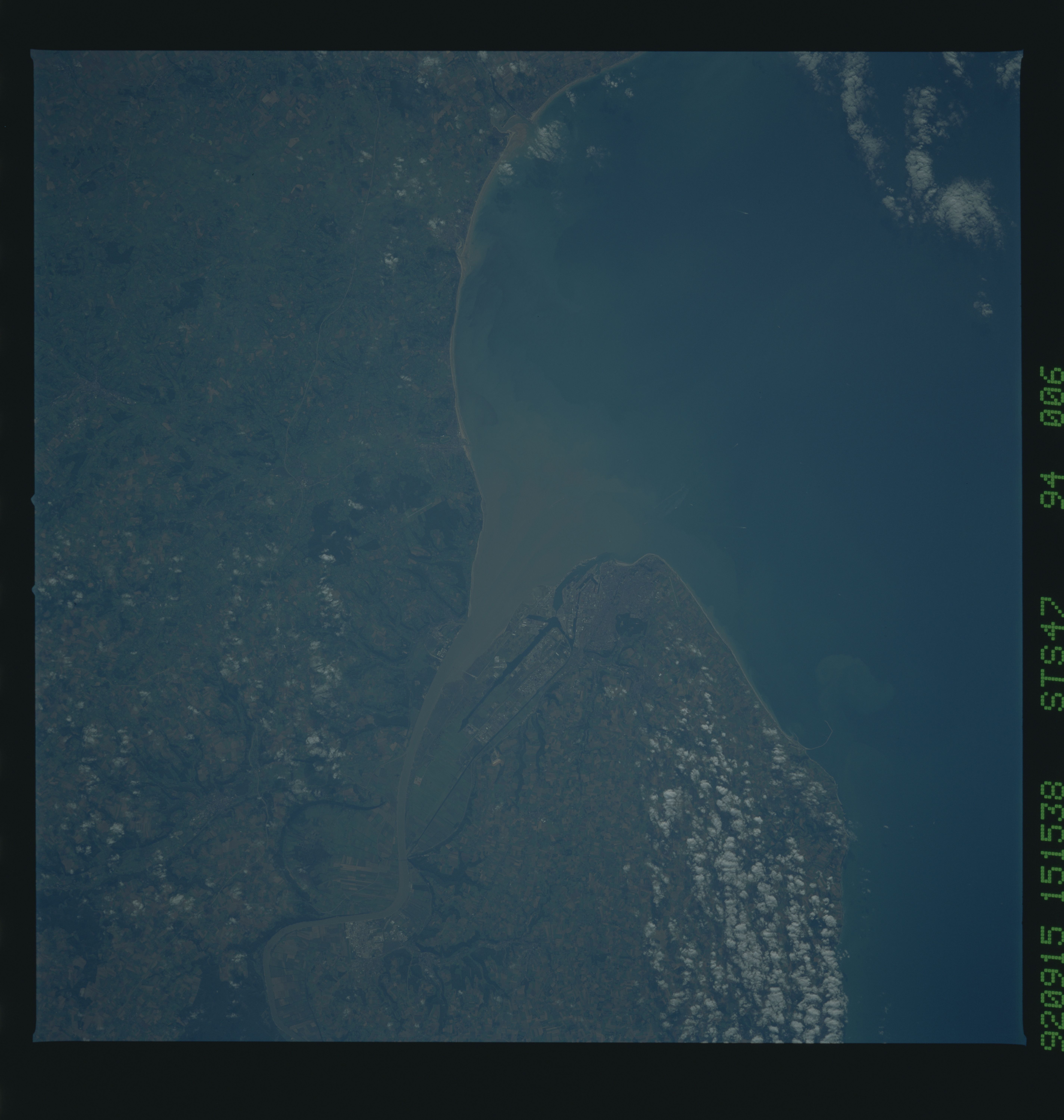
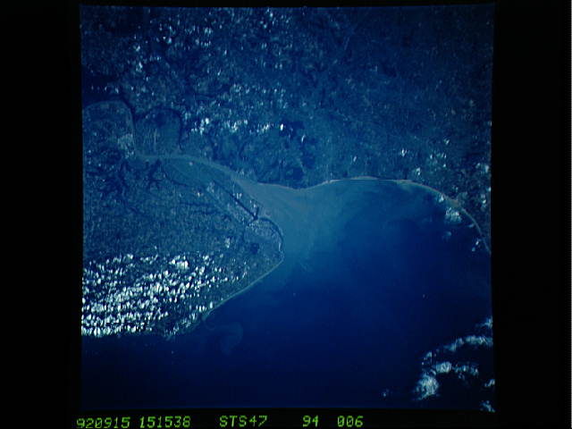
No GeoTIFF is available for this photo.Image Caption: STS047-094-006 Le Havre, France September 1992
The city of Le Havre, located on the northwest coast of France, is a major seaport and window to the world for France. Located on the north side of the Seine River estuary, Le Havre, with a population that exceeds 200 000, is a key port for transatlantic passenger service, as well as a transshipment center for oceangoing freight. A large percentage of the labor force in this region of France is involved in the movement of manufactured goods and people into and out of France. A ferry line connects Le Havre with Southampton, England, and the city has an excellent harbor and fine shipbuilding facilities. Outside the city, agriculture is the predominant occupation; wheat is a major crop. This area is part of the much larger region known as the lowlands of north-central Europe, a highly productive farm belt.
The city of Le Havre, located on the northwest coast of France, is a major seaport and window to the world for France. Located on the north side of the Seine River estuary, Le Havre, with a population that exceeds 200 000, is a key port for transatlantic passenger service, as well as a transshipment center for oceangoing freight. A large percentage of the labor force in this region of France is involved in the movement of manufactured goods and people into and out of France. A ferry line connects Le Havre with Southampton, England, and the city has an excellent harbor and fine shipbuilding facilities. Outside the city, agriculture is the predominant occupation; wheat is a major crop. This area is part of the much larger region known as the lowlands of north-central Europe, a highly productive farm belt.
