< STS085-750-57 >
| NASA Photo ID | STS085-750-57 |
| Focal Length | 250mm |
| Date taken | 1997.08.__ |
| Time taken | GMT |
Resolutions offered for this image:
4037 x 4037 pixels 639 x 639 pixels 5700 x 5900 pixels 483 x 500 pixels
4037 x 4037 pixels 639 x 639 pixels 5700 x 5900 pixels 483 x 500 pixels

Cloud masks available for this image:
Spacecraft nadir point:
Photo center point: 36.0° N, 14.5° E
Photo center point by machine learning:
Photo center point: 36.0° N, 14.5° E
Photo center point by machine learning:
Nadir to Photo Center:
Spacecraft Altitude: nautical miles (0km)
Camera: | Hasselblad |
Focal Length: | 250mm |
Camera Tilt: | |
Format: | 5069: Kodak Elite 100S, E6 Reversal, Replaces Lumiere, Warmer in tone vs. Lumiere |
Film Exposure: | Normal |
| Additional Information | |
| Width | Height | Annotated | Cropped | Purpose | Links |
|---|---|---|---|---|---|
| 4037 pixels | 4037 pixels | No | No | Earth From Space collection | Download Image |
| 639 pixels | 639 pixels | No | No | Earth From Space collection | Download Image |
| 5700 pixels | 5900 pixels | No | No | Download Image | |
| 483 pixels | 500 pixels | No | No | Download Image |
Download Packaged File
Download a Google Earth KML for this Image
View photo footprint information
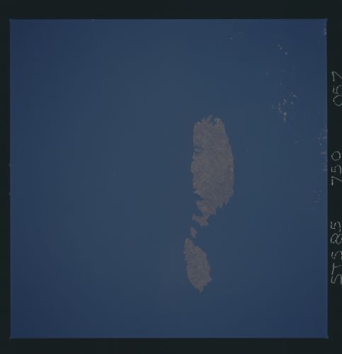
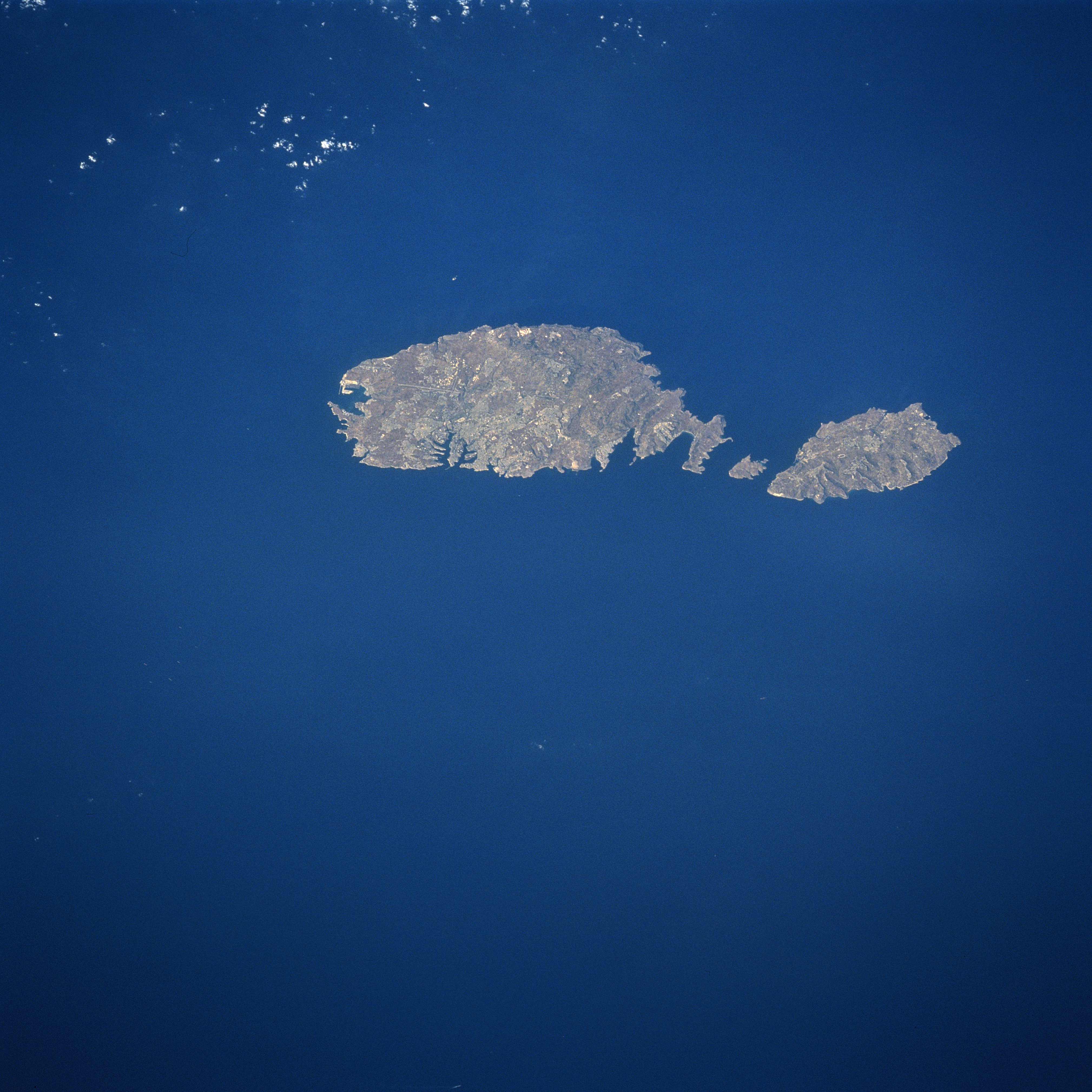
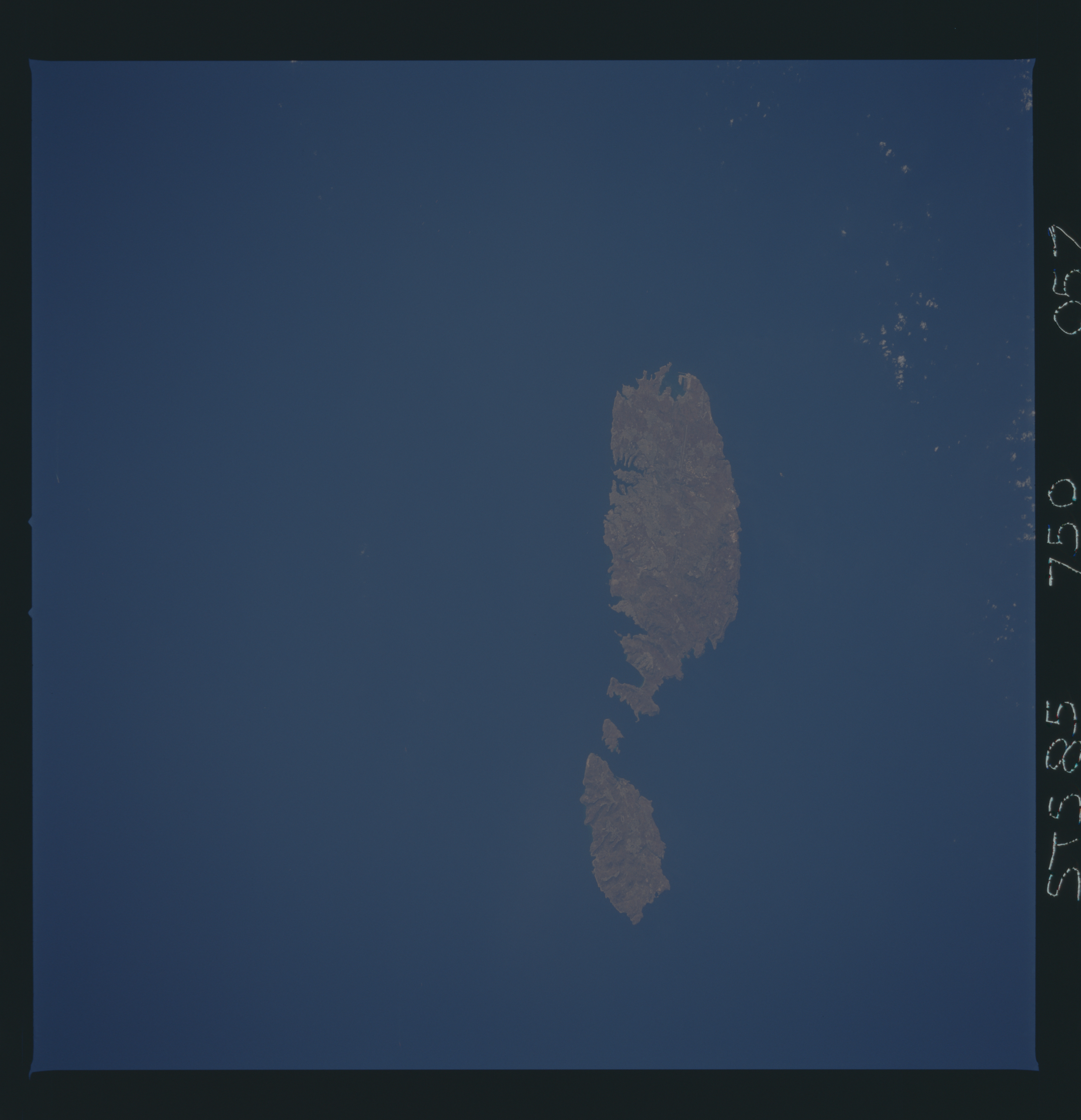
No GeoTIFF is available for this photo.Image Caption: STS085-750-057 Malta August 1997
Although small in size (122 square miles-316 square km), the independent republic of Malta is strategically located midway between the Strait of Gibraltar and the Suez Canal in the Mediterranean Sea. The country is made up of three inhabited islands that are visible in this image: the island of Malta, the largest, Gozo, and Comino, the smallest, is situated between the two larger islands. The capital and largest city, Valletta, is mainly built on a rocky peninsula along the northeast coast of Malta. Valletta can be identified even on this small image where the peninsula extends northeast between two natural harbors (small, narrow, dark features). The geological faulting in this area has produced numerous fine natural harbors around the periphery of Malta. Although the islands are composed of sedimentary rocks, mainly limestone and clays, the alkaline soils provide fertile conditions for the well-established agricultural economy. Precipitation amounts can be a problem in that the islands average only about 12 inches (32 cm) per year. Malta has few natural resources so the growth of tourism, especially since World War II, has gradually added to the Maltese economy.
Although small in size (122 square miles-316 square km), the independent republic of Malta is strategically located midway between the Strait of Gibraltar and the Suez Canal in the Mediterranean Sea. The country is made up of three inhabited islands that are visible in this image: the island of Malta, the largest, Gozo, and Comino, the smallest, is situated between the two larger islands. The capital and largest city, Valletta, is mainly built on a rocky peninsula along the northeast coast of Malta. Valletta can be identified even on this small image where the peninsula extends northeast between two natural harbors (small, narrow, dark features). The geological faulting in this area has produced numerous fine natural harbors around the periphery of Malta. Although the islands are composed of sedimentary rocks, mainly limestone and clays, the alkaline soils provide fertile conditions for the well-established agricultural economy. Precipitation amounts can be a problem in that the islands average only about 12 inches (32 cm) per year. Malta has few natural resources so the growth of tourism, especially since World War II, has gradually added to the Maltese economy.
