< ISS061-E-52055 >

| NASA Photo ID | ISS061-E-52055 |
| Focal Length | 50mm |
| Date taken | 2019.11.20 |
| Time taken | 13:44:45 GMT |
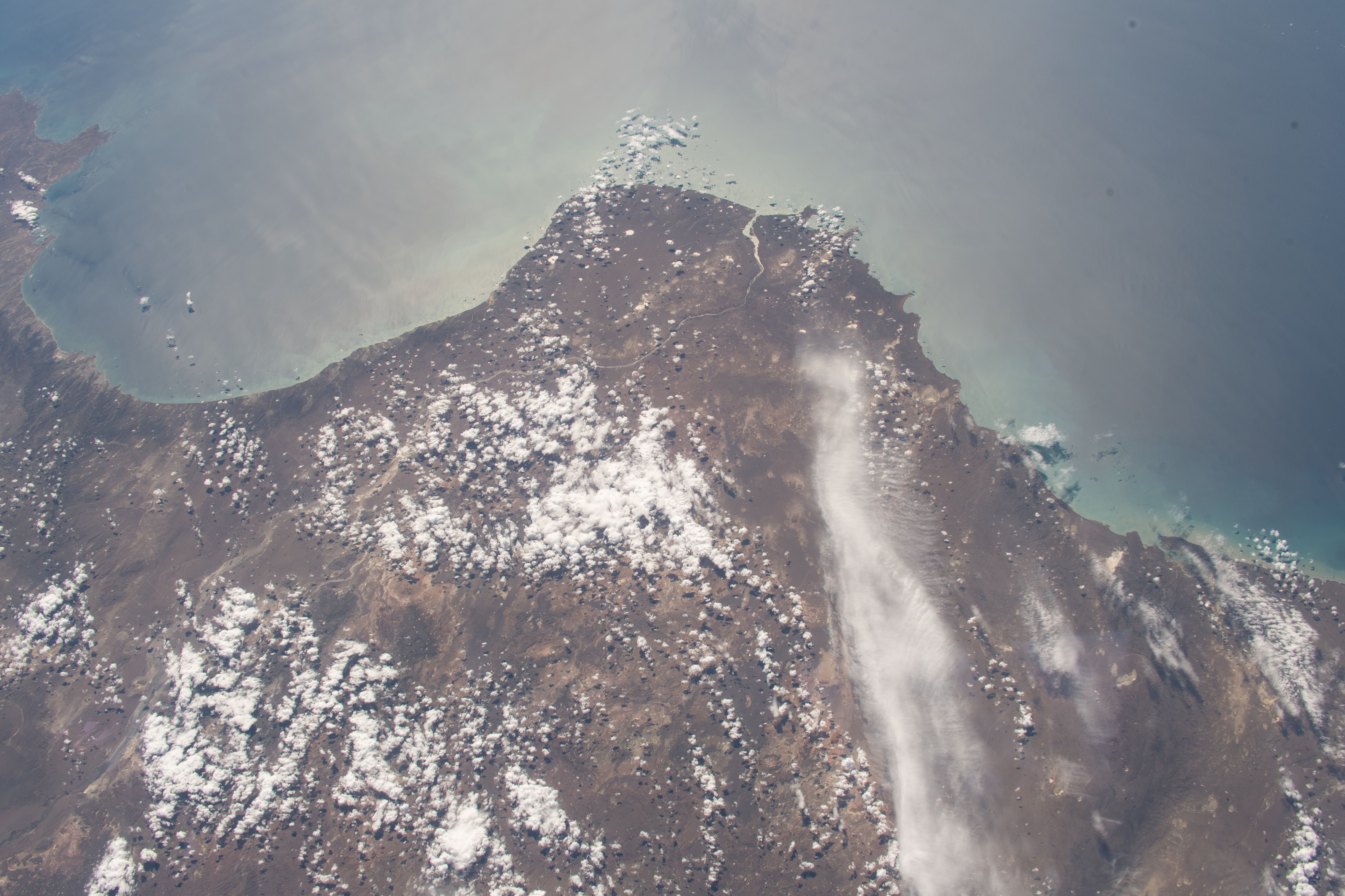
Spacecraft nadir point: 49.4° S, 72.9° W
Photo center point: 47.5° S, 67.0° W
Photo center point by machine learning:
Photo center point: 47.5° S, 67.0° W
Photo center point by machine learning:
Nadir to Photo Center: East
Spacecraft Altitude: 226 nautical miles (419km)
Country or Geographic Name: | ARGENTINA |
Features: | GOLFO SAN JORGE |
| Features Found Using Machine Learning: | |
Cloud Cover Percentage: | 50 (26-50)% |
Sun Elevation Angle: | 45° |
Sun Azimuth: | 65° |
Camera: | Nikon D5 Electronic Still Camera |
Focal Length: | 50mm |
Camera Tilt: | High Oblique |
Format: | 5568E: 5568 x 3712 pixel CMOS sensor, 35.9 x 23.9 mm, total pixels: 21.33 million, Nikon FX format |
Film Exposure: | |
| Additional Information | |
| Width | Height | Annotated | Cropped | Purpose | Links |
|---|---|---|---|---|---|
| 5568 pixels | 3712 pixels | No | No | Download Image | |
| 640 pixels | 427 pixels | No | No | Download Image |
Download Packaged File
Download a Google Earth KML for this Image
View photo footprint information
No GeoTIFF is available for this photo.Image Caption: CATALOGED BY TEXAS STATE UNIVERSITY
