< STS51B-38-50 >
| NASA Photo ID | STS51B-38-50 |
| Focal Length | 250mm |
| Date taken | 1985.__.__ |
| Time taken | GMT |
Resolutions offered for this image:
3904 x 3904 pixels 639 x 639 pixels 5700 x 5900 pixels 500 x 518 pixels
3904 x 3904 pixels 639 x 639 pixels 5700 x 5900 pixels 500 x 518 pixels

Cloud masks available for this image:
Spacecraft nadir point:
Photo center point: 34.0° N, 109.5° W
Photo center point by machine learning:
Photo center point: 34.0° N, 109.5° W
Photo center point by machine learning:
Nadir to Photo Center:
Spacecraft Altitude: nautical miles (0km)
Country or Geographic Name: | USA-ARIZONA |
Features: | BALDY PEAK |
| Features Found Using Machine Learning: | |
Cloud Cover Percentage: | 20 (11-25)% |
Sun Elevation Angle: | ° |
Sun Azimuth: | ° |
Camera: | Hasselblad |
Focal Length: | 250mm |
Camera Tilt: | Near Vertical |
Format: | 5017: Kodak, natural color positive, Ektachrome, X Professional, ASA 64, standard base |
Film Exposure: | Normal |
| Additional Information | |
| Width | Height | Annotated | Cropped | Purpose | Links |
|---|---|---|---|---|---|
| 3904 pixels | 3904 pixels | No | No | Earth From Space collection | Download Image |
| 639 pixels | 639 pixels | No | No | Earth From Space collection | Download Image |
| 5700 pixels | 5900 pixels | No | No | Download Image | |
| 500 pixels | 518 pixels | No | No | Download Image |
Download Packaged File
Download a Google Earth KML for this Image
View photo footprint information
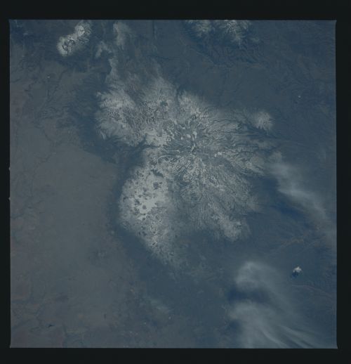
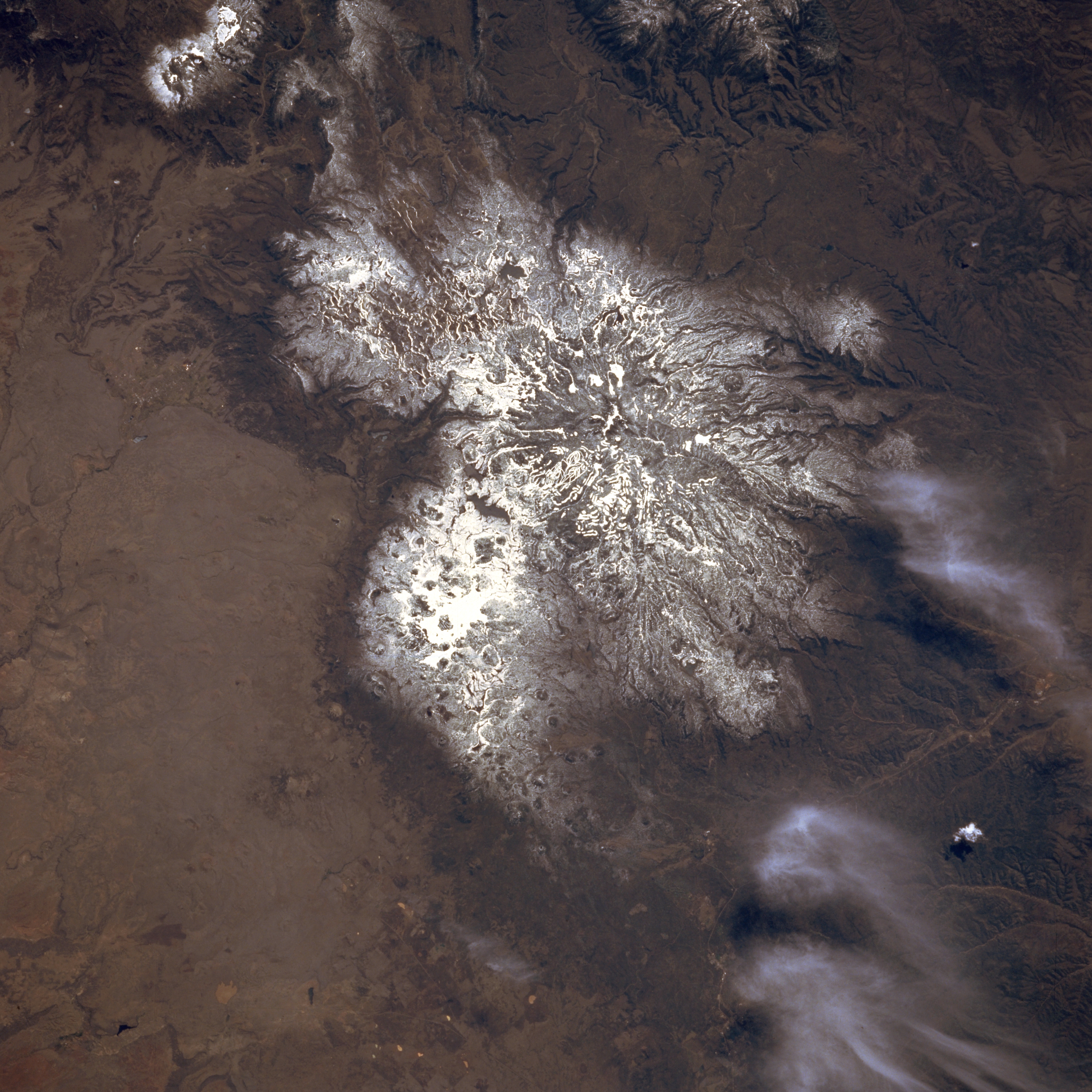
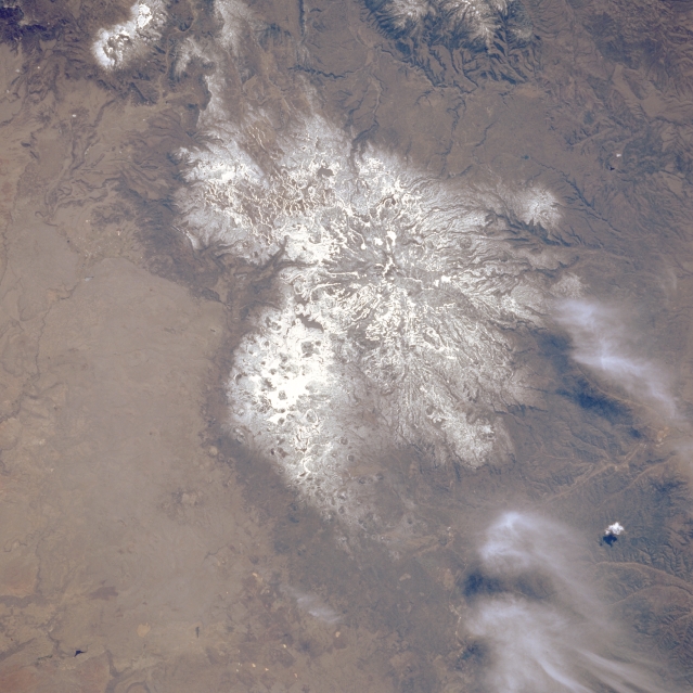
No GeoTIFF is available for this photo.Image Caption: STS51B-038-0050 Baldy Peak, Arizona, U.S.A. May 1985
Snow cover accentuates the radial drainage pattern around Baldy Peak, a large stratovolcano [11 403 feet (3476 meters) above sea level] degraded by erosion. On the northern flank of Baldy Peak is Springerville Field, a large, youthful volcanic field that consists of numerous vents and lava flows.
Snow cover accentuates the radial drainage pattern around Baldy Peak, a large stratovolcano [11 403 feet (3476 meters) above sea level] degraded by erosion. On the northern flank of Baldy Peak is Springerville Field, a large, youthful volcanic field that consists of numerous vents and lava flows.
