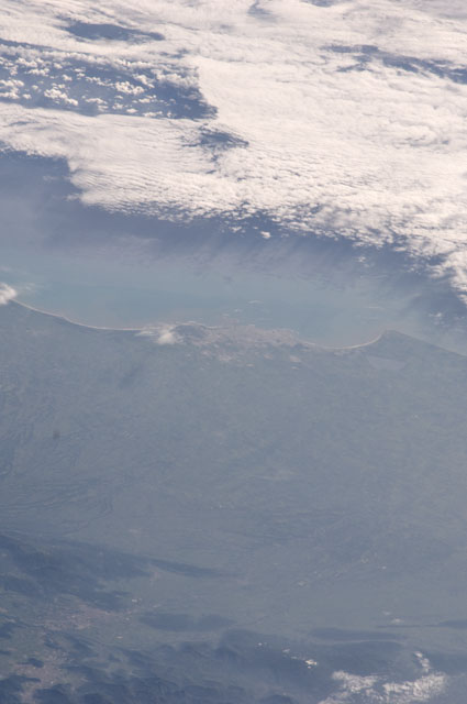
< ISS028-E-45797 >
| NASA Photo ID | ISS028-E-45797 |
| Focal Length | 180mm |
| Date taken | 2011.09.09 |
| Time taken | 14:48:26 GMT |


Spacecraft nadir point: 16.1° N, 101.5° W
Photo center point: 19.1° N, 96.2° W
Photo center point by machine learning:
Photo center point: 19.1° N, 96.2° W
Photo center point by machine learning:
Nadir to Photo Center: Northeast
Spacecraft Altitude: 211 nautical miles (391km)
Camera: | Nikon D2Xs Electronic Still Camera |
Focal Length: | 180mm |
Camera Tilt: | High Oblique |
Format: | 4288E: 4288 x 2848 pixel CMOS sensor, RGBG imager color filter |
Film Exposure: | |
| Additional Information | |
| Width | Height | Annotated | Cropped | Purpose | Links |
|---|---|---|---|---|---|
| 2848 pixels | 4288 pixels | No | No | Download Image | |
| 425 pixels | 640 pixels | No | No | Download Image |
Download Packaged File
Download a Google Earth KML for this Image
View photo footprint information
No GeoTIFF is available for this photo.Image Caption: none
