< STS073-736-45 >

| NASA Photo ID | STS073-736-45 |
| Focal Length | 250mm |
| Date taken | 1995.10.30 |
| Time taken | 00:07:30 GMT |
Resolutions offered for this image:
5700 x 5900 pixels 500 x 518 pixels 640 x 480 pixels 2065 x 2019 pixels
5700 x 5900 pixels 500 x 518 pixels 640 x 480 pixels 2065 x 2019 pixels

Cloud masks available for this image:
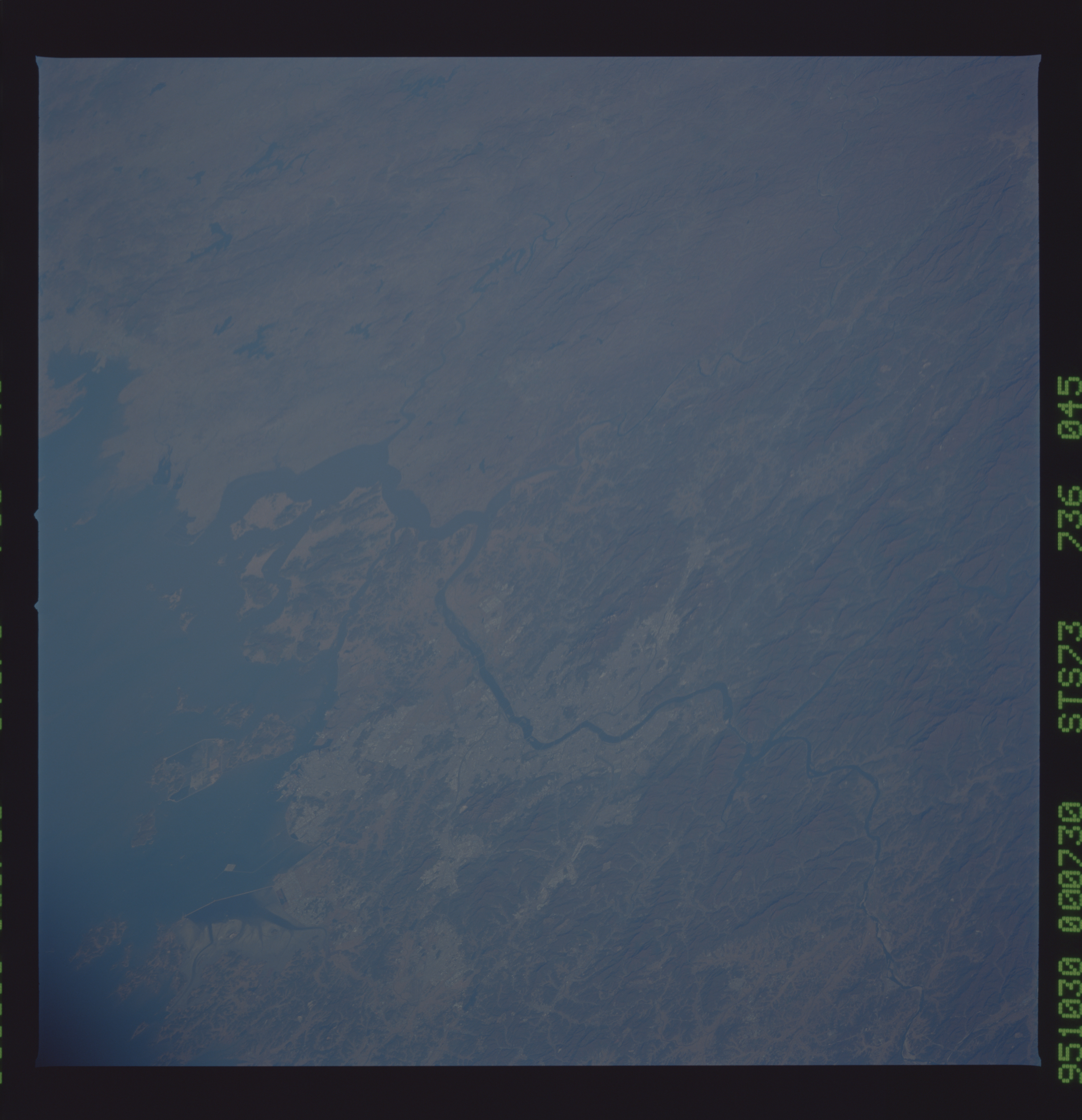
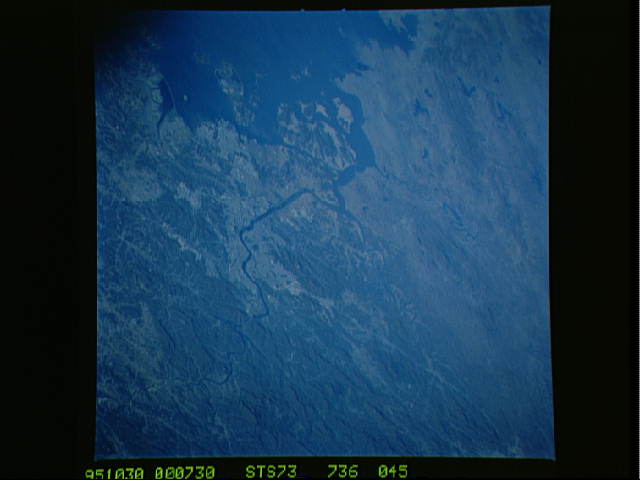
Spacecraft nadir point: 35.8° N, 130.2° E
Photo center point: 38.0° N, 127.0° E
Photo center point by machine learning:
Photo center point: 38.0° N, 127.0° E
Photo center point by machine learning:
Nadir to Photo Center: Northwest
Spacecraft Altitude: 142 nautical miles (263km)
Country or Geographic Name: | SOUTH KOREA |
Features: | SEOUL, NAMHAN RIVER, MTS. |
| Features Found Using Machine Learning: | |
Cloud Cover Percentage: | 0 (no clouds present) |
Sun Elevation Angle: | 26° |
Sun Azimuth: | 132° |
Camera: | Hasselblad |
Focal Length: | 250mm |
Camera Tilt: | Low Oblique |
Format: | 5046: Kodak, natural color positive, Lumiere 100/5046, ASA 100, standard base |
Film Exposure: | Normal |
| Additional Information | |
| Width | Height | Annotated | Cropped | Purpose | Links |
|---|---|---|---|---|---|
| 5700 pixels | 5900 pixels | No | No | Download Image Download Color Calibration Image for this Image |
|
| 500 pixels | 518 pixels | No | No | Download Image Download Color Calibration Image for this Image |
|
| 640 pixels | 480 pixels | No | No | Download Image | |
| 2065 pixels | 2019 pixels | Download Image |
Download Packaged File
Download a Google Earth KML for this Image
View photo footprint information
No GeoTIFF is available for this photo.Image Caption: Seoul and adjacent coastline, landfilling and loss of tidal flats around islands off the coast of Inchon is the predominant change, October 1995.
