< STS068-249-39 >
| NASA Photo ID | STS068-249-39 |
| Focal Length | 100mm |
| Date taken | 1994.10.09 |
| Time taken | 17:35:05 GMT |
Resolutions offered for this image:
3936 x 3872 pixels 639 x 629 pixels 5700 x 5900 pixels 500 x 518 pixels 640 x 480 pixels
3936 x 3872 pixels 639 x 629 pixels 5700 x 5900 pixels 500 x 518 pixels 640 x 480 pixels

Cloud masks available for this image:
Spacecraft nadir point: 43.8° N, 106.6° W
Photo center point: 44.5° N, 107.0° W
Photo center point by machine learning:
Photo center point: 44.5° N, 107.0° W
Photo center point by machine learning:
Nadir to Photo Center: Northwest
Spacecraft Altitude: 111 nautical miles (206km)
Country or Geographic Name: | USA-WYOMING |
Features: | BIG HORN MOUNTAINS |
| Features Found Using Machine Learning: | |
Cloud Cover Percentage: | 0 (no clouds present) |
Sun Elevation Angle: | 37° |
Sun Azimuth: | 155° |
Camera: | Hasselblad |
Focal Length: | 100mm |
Camera Tilt: | 24 degrees |
Format: | 5046: Kodak, natural color positive, Lumiere 100/5046, ASA 100, standard base |
Film Exposure: | Normal |
| Additional Information | |
| Width | Height | Annotated | Cropped | Purpose | Links |
|---|---|---|---|---|---|
| 3936 pixels | 3872 pixels | No | No | Earth From Space collection | Download Image |
| 639 pixels | 629 pixels | No | No | Earth From Space collection | Download Image |
| 5700 pixels | 5900 pixels | No | No | Download Image Download Color Calibration Image for this Image |
|
| 500 pixels | 518 pixels | No | No | Download Image Download Color Calibration Image for this Image |
|
| 640 pixels | 480 pixels | No | No | Download Image |
Download Packaged File
Download a Google Earth KML for this Image
View photo footprint information
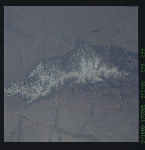
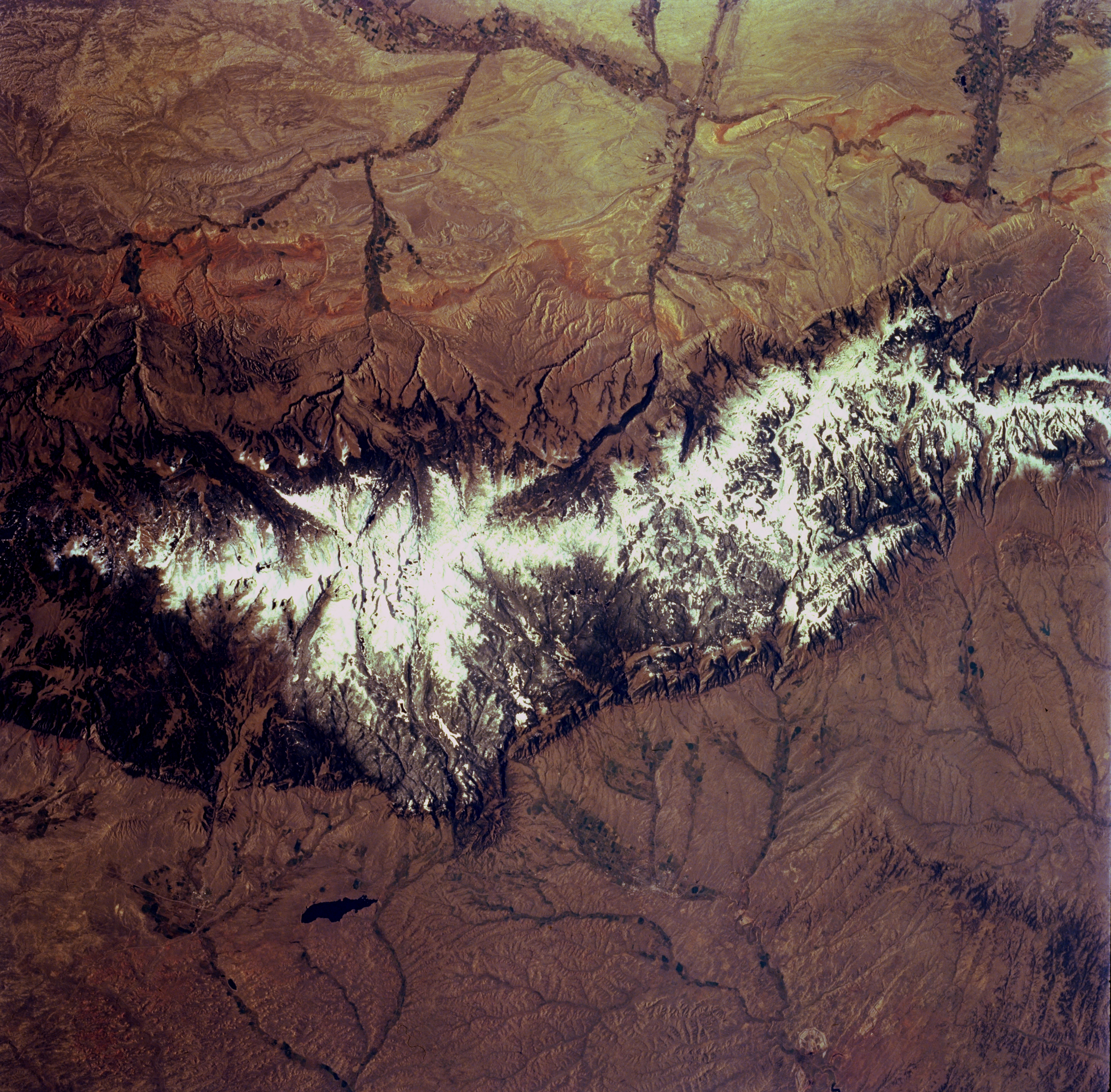
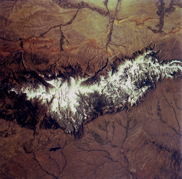
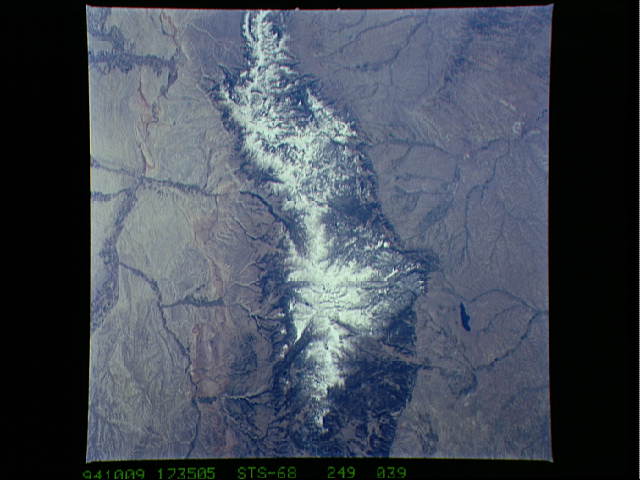
No GeoTIFF is available for this photo.Image Caption: STS068-249-039 Bighorn Mountains, Wyoming, U.S.A. October 1994
Formed 55 to 60 million years ago, the Bighorn Mountains shown in this southwest-looking, low-oblique photograph consist mostly of basement rocks more than 1 billion years old. The fault-thrust, glacier-carved range extends approximately 120 miles (195 kilometers) from the Pryor Mountains of south-central Montana (not visible) southeastward to the Bridger Mountains of central Wyoming (not visible). Snow covers the higher peaks of the Bighorn Mountains throughout the year; forests cover the lower slopes; and wildlife is abundant throughout the mountains. To the west are the Bighorn Basin and the Bighorn River with irrigated agricultural areas in its valley. Visible east of the Bighorn Mountains are the western portion of the Powder River Basin; long, narrow Lake De Smet; and Sheridan (barely discernible) on Goose Creek. To the north are the Wolf Mountains of south-central Montana (bottom right).
Formed 55 to 60 million years ago, the Bighorn Mountains shown in this southwest-looking, low-oblique photograph consist mostly of basement rocks more than 1 billion years old. The fault-thrust, glacier-carved range extends approximately 120 miles (195 kilometers) from the Pryor Mountains of south-central Montana (not visible) southeastward to the Bridger Mountains of central Wyoming (not visible). Snow covers the higher peaks of the Bighorn Mountains throughout the year; forests cover the lower slopes; and wildlife is abundant throughout the mountains. To the west are the Bighorn Basin and the Bighorn River with irrigated agricultural areas in its valley. Visible east of the Bighorn Mountains are the western portion of the Powder River Basin; long, narrow Lake De Smet; and Sheridan (barely discernible) on Goose Creek. To the north are the Wolf Mountains of south-central Montana (bottom right).
