< STS056-75-35 >
| NASA Photo ID | STS056-75-35 |
| Focal Length | 100mm |
| Date taken | 1993.04.10 |
| Time taken | 15:29:03 GMT |
Resolutions offered for this image:
4032 x 4032 pixels 640 x 640 pixels 5700 x 6000 pixels 500 x 526 pixels 640 x 480 pixels
4032 x 4032 pixels 640 x 640 pixels 5700 x 6000 pixels 500 x 526 pixels 640 x 480 pixels


Cloud masks available for this image:
Spacecraft nadir point: 12.5° S, 75.0° W
Photo center point: 14.5° S, 76.0° W
Photo center point by machine learning:
Photo center point: 14.5° S, 76.0° W
Photo center point by machine learning:
Nadir to Photo Center: South
Spacecraft Altitude: 161 nautical miles (298km)
Country or Geographic Name: | PERU |
Features: | COAST RIVERS, AGR., ANDES |
| Features Found Using Machine Learning: | |
Cloud Cover Percentage: | 25 (11-25)% |
Sun Elevation Angle: | 59° |
Sun Azimuth: | 49° |
Camera: | Hasselblad |
Focal Length: | 100mm |
Camera Tilt: | 40 degrees |
Format: | 5017: Kodak, natural color positive, Ektachrome, X Professional, ASA 64, standard base |
Film Exposure: | Normal |
| Additional Information | |
| Width | Height | Annotated | Cropped | Purpose | Links |
|---|---|---|---|---|---|
| 4032 pixels | 4032 pixels | No | No | Earth From Space collection | Download Image |
| 640 pixels | 640 pixels | No | No | Earth From Space collection | Download Image |
| 5700 pixels | 6000 pixels | No | No | Download Image Download Color Calibration Image for this Image |
|
| 500 pixels | 526 pixels | No | No | Download Image Download Color Calibration Image for this Image |
|
| 640 pixels | 480 pixels | No | No | Download Image |
Download Packaged File
Download a Google Earth KML for this Image
View photo footprint information
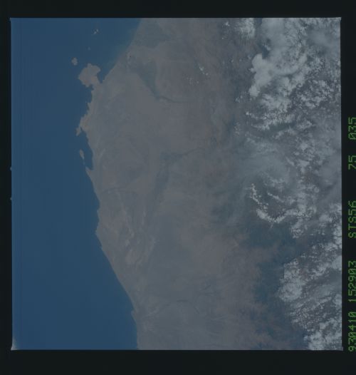
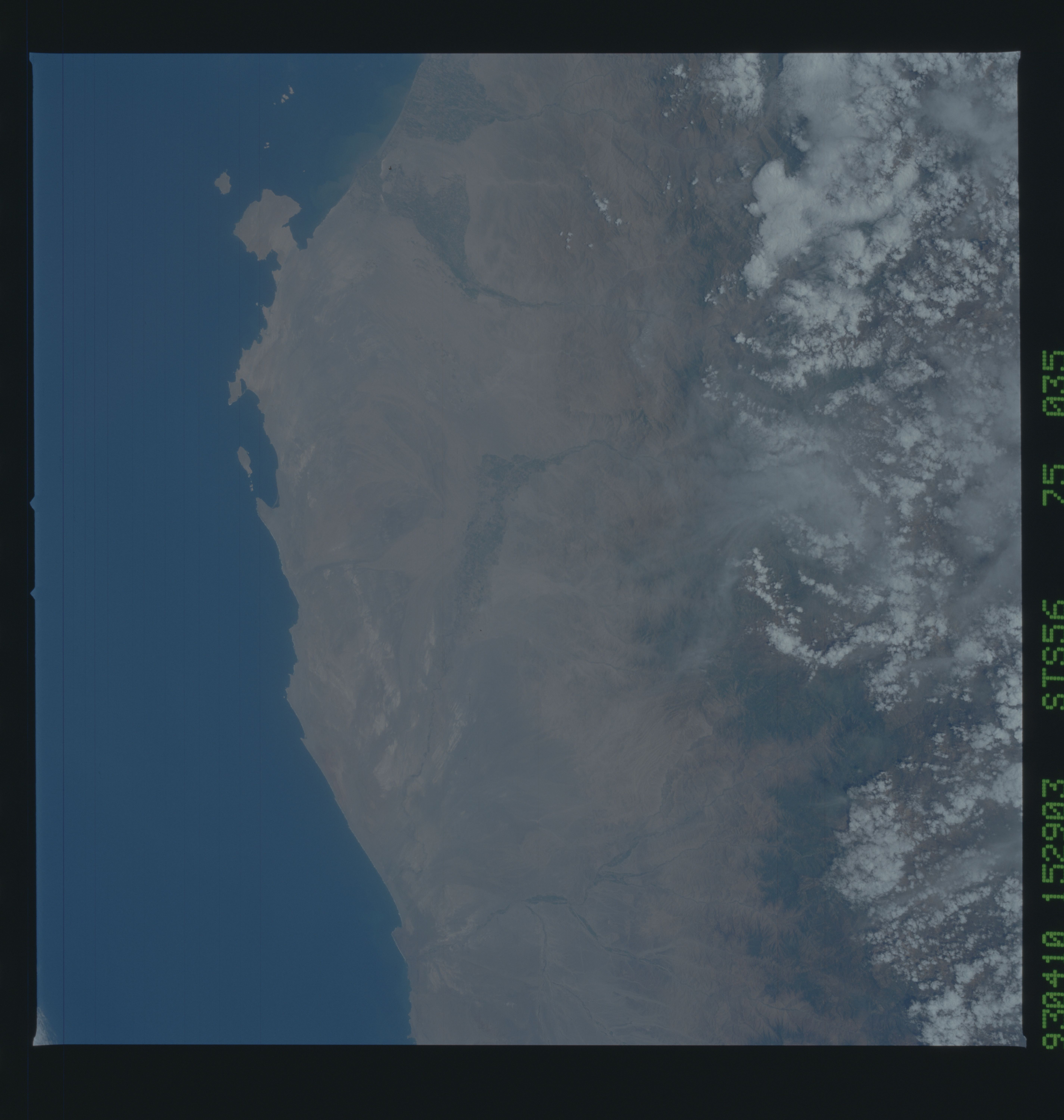
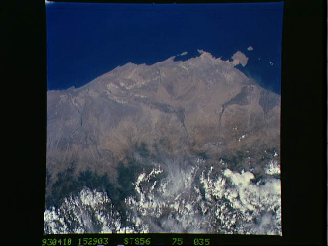
No GeoTIFF is available for this photo.Image Caption: STS056-075-035 Coastal Area Around Pisco, Peru April 1993
The narrow, arid but elevated coastal plains of southern Peru are visible in this image that extends inland from the Pacific coast to the western flank of the Andes Mountains (mainly obscured by white clouds at the bottom of the image). Several ephemeral stream channels can be identified as they drain generally westward. The darker-looking landscape along the streams are cultivated, irrigated regions where mainly cotton and grapes are grown. The square-looking peninsula toward the upper right corner of the picture is Pararas Peninsula. The coastal port city of Pisco is located a few miles north of the peninsula near the mouth of the Pisco River (along the first stream channel to the right of the peninsula). The Ica River Valley drains southward near the center of the image. The climate along the section of the Peruvian coast is desert, but some moisture is provided by the seasonal snowmelt from the Andes Mountains.
The narrow, arid but elevated coastal plains of southern Peru are visible in this image that extends inland from the Pacific coast to the western flank of the Andes Mountains (mainly obscured by white clouds at the bottom of the image). Several ephemeral stream channels can be identified as they drain generally westward. The darker-looking landscape along the streams are cultivated, irrigated regions where mainly cotton and grapes are grown. The square-looking peninsula toward the upper right corner of the picture is Pararas Peninsula. The coastal port city of Pisco is located a few miles north of the peninsula near the mouth of the Pisco River (along the first stream channel to the right of the peninsula). The Ica River Valley drains southward near the center of the image. The climate along the section of the Peruvian coast is desert, but some moisture is provided by the seasonal snowmelt from the Andes Mountains.
