< ISS035-E-34029 >
| NASA Photo ID | ISS035-E-34029 |
| Focal Length | 50mm |
| Date taken | 2013.05.02 |
| Time taken | 14:59:23 GMT |


Spacecraft nadir point: 38.1° N, 73.1° W
Photo center point: 40.5° N, 74.0° W
Photo center point by machine learning:
Photo center point: 40.5° N, 74.0° W
Photo center point by machine learning:
Nadir to Photo Center: North
Spacecraft Altitude: 222 nautical miles (411km)
Country or Geographic Name: | USA-MARYLAND |
Features: | O. |
| Features Found Using Machine Learning: | |
Cloud Cover Percentage: | 25 (11-25)% |
Sun Elevation Angle: | 57° |
Sun Azimuth: | 125° |
Camera: | Nikon D3S Electronic Still Camera |
Focal Length: | 50mm |
Camera Tilt: | 34 degrees |
Format: | 4256E: 4256 x 2832 pixel CMOS sensor, 36.0mm x 23.9mm, total pixels: 12.87 million, Nikon FX format |
Film Exposure: | |
| Additional Information | |
| Width | Height | Annotated | Cropped | Purpose | Links |
|---|---|---|---|---|---|
| 4256 pixels | 2832 pixels | No | No | Download Image | |
| 640 pixels | 426 pixels | No | No | Download Image |
Download Packaged File
Download a Google Earth KML for this Image
View photo footprint information
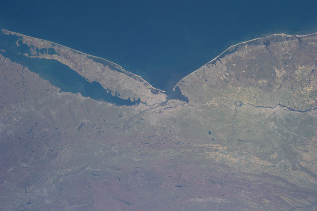
No GeoTIFF is available for this photo.Image Caption: ISS035-E-034029 --- One of the Expedition 35 crew members aboard the International Space Station recorded this image featuring parts of the Northeast. Long Island, New York is the most conspicuous tell-tale feature, which juts out into the Atlantic Ocean. The entire length of Long Island is visible from Lower Bay to Block Island Sound. According to geologists, the origin and shape of Long Island are due to continental collision and glaciers that once dominated the landscape.
CATALOGED BY UT-BROWNSVILLE/STARGATE
CATALOGED BY UT-BROWNSVILLE/STARGATE
