< ISS040-E-33077 >

| NASA Photo ID | ISS040-E-33077 |
| Focal Length | 800mm |
| Date taken | 2014.07.04 |
| Time taken | 12:09:48 GMT |
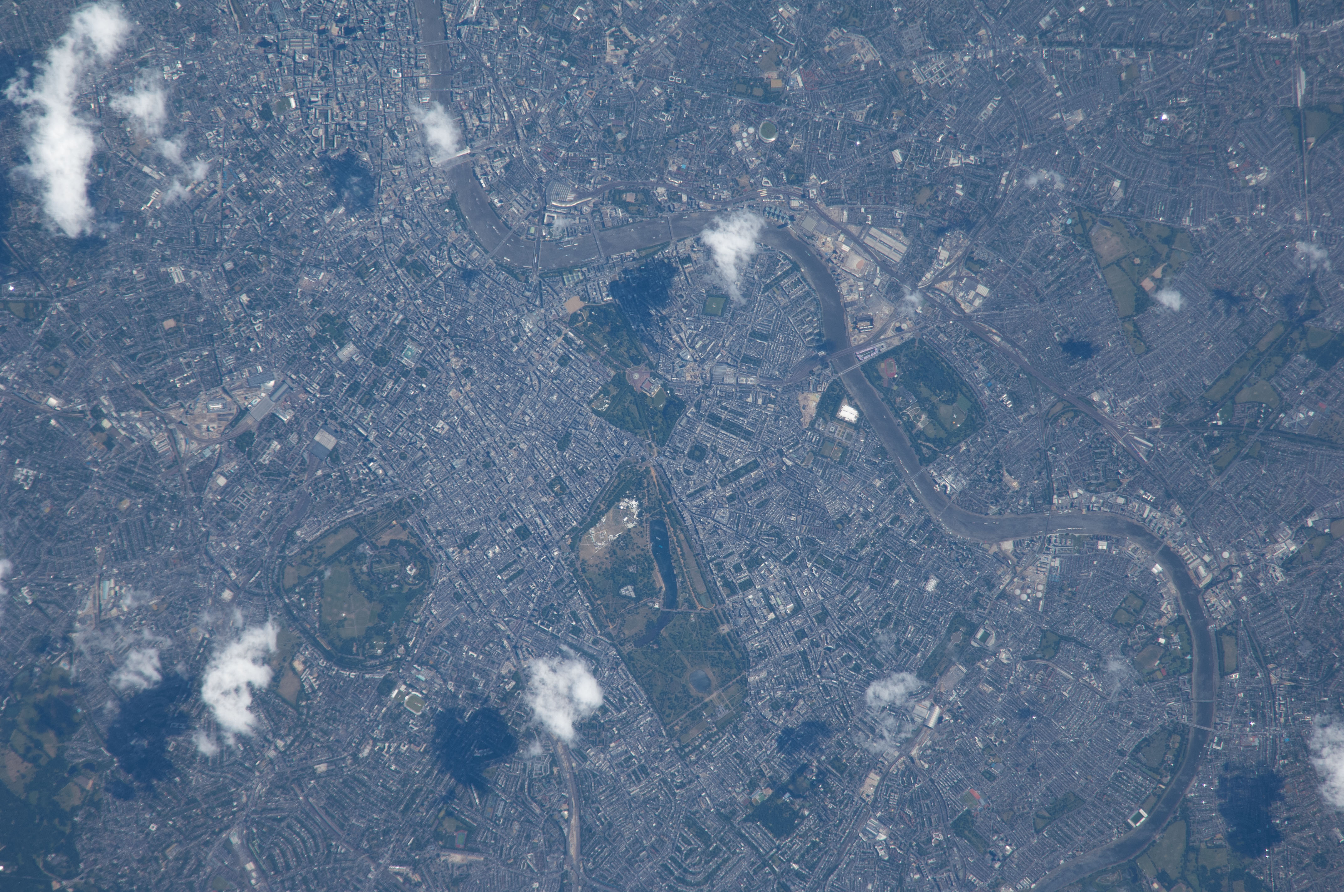


Spacecraft nadir point: 51.8° N, 0.8° W
Photo center point:
Photo center point by machine learning:
Photo center point:
Photo center point by machine learning:
Nadir to Photo Center:
Spacecraft Altitude: 221 nautical miles (409km)
Country or Geographic Name: | |
Features: | |
| Features Found Using Machine Learning: | |
Cloud Cover Percentage: | 3 (1-10)% |
Sun Elevation Angle: | 61° |
Sun Azimuth: | 181° |
Camera: | NIKON D2Xs S/N: 6027269 |
Focal Length: | 800mm |
Camera Tilt: | |
Format: | |
Film Exposure: | |
| Additional Information | |
| Width | Height | Annotated | Cropped | Purpose | Links |
|---|---|---|---|---|---|
| 4288 pixels | 2848 pixels | No | No | Download Image | |
| 640 pixels | 425 pixels | No | No | Download Image |
Download Packaged File
Download a Google Earth KML for this Image
View photo footprint information
No GeoTIFF is available for this photo.Image Caption: ISS040-E-033077 (4 July 2014) --- Because the Expedition 40 crew member on the International Space Station, flying at an altitude of 221 nautical miles, was using an 800mm focal length on his camera, great detail can be seen in this picture featuring a large portion of London, England. The Thames River is easily spotted snaking through the large city.
