< STS082-730-30 >
| NASA Photo ID | STS082-730-30 |
| Focal Length | 100mm |
| Date taken | 1997.02.13 |
| Time taken | 13:49:27 GMT |
Cloud masks available for this image:
Spacecraft nadir point: 14.0° N, 91.5° W
Photo center point: 13.5° N, 89.0° W
Photo center point by machine learning:
Photo center point: 13.5° N, 89.0° W
Photo center point by machine learning:
Nadir to Photo Center: East
Spacecraft Altitude: 317 nautical miles (587km)
Country or Geographic Name: | HONDURAS |
Features: | GULF OF FONSECA |
| Features Found Using Machine Learning: | |
Cloud Cover Percentage: | 25 (11-25)% |
Sun Elevation Angle: | 18° |
Sun Azimuth: | 109° |
Camera: | Hasselblad |
Focal Length: | 100mm |
Camera Tilt: | 26 degrees |
Format: | 5069: Kodak Elite 100S, E6 Reversal, Replaces Lumiere, Warmer in tone vs. Lumiere |
Film Exposure: | Normal |
| Additional Information | |
| Width | Height | Annotated | Cropped | Purpose | Links |
|---|---|---|---|---|---|
| 5700 pixels | 5900 pixels | No | No | Download Image Download Color Calibration Image for this Image |
|
| 483 pixels | 500 pixels | No | No | Download Image Download Color Calibration Image for this Image |
|
| 640 pixels | 624 pixels | No | No | Photographic Highlights | Download Image |
Download Packaged File
Download a Google Earth KML for this Image
View photo footprint information
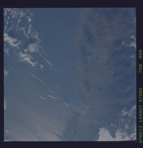
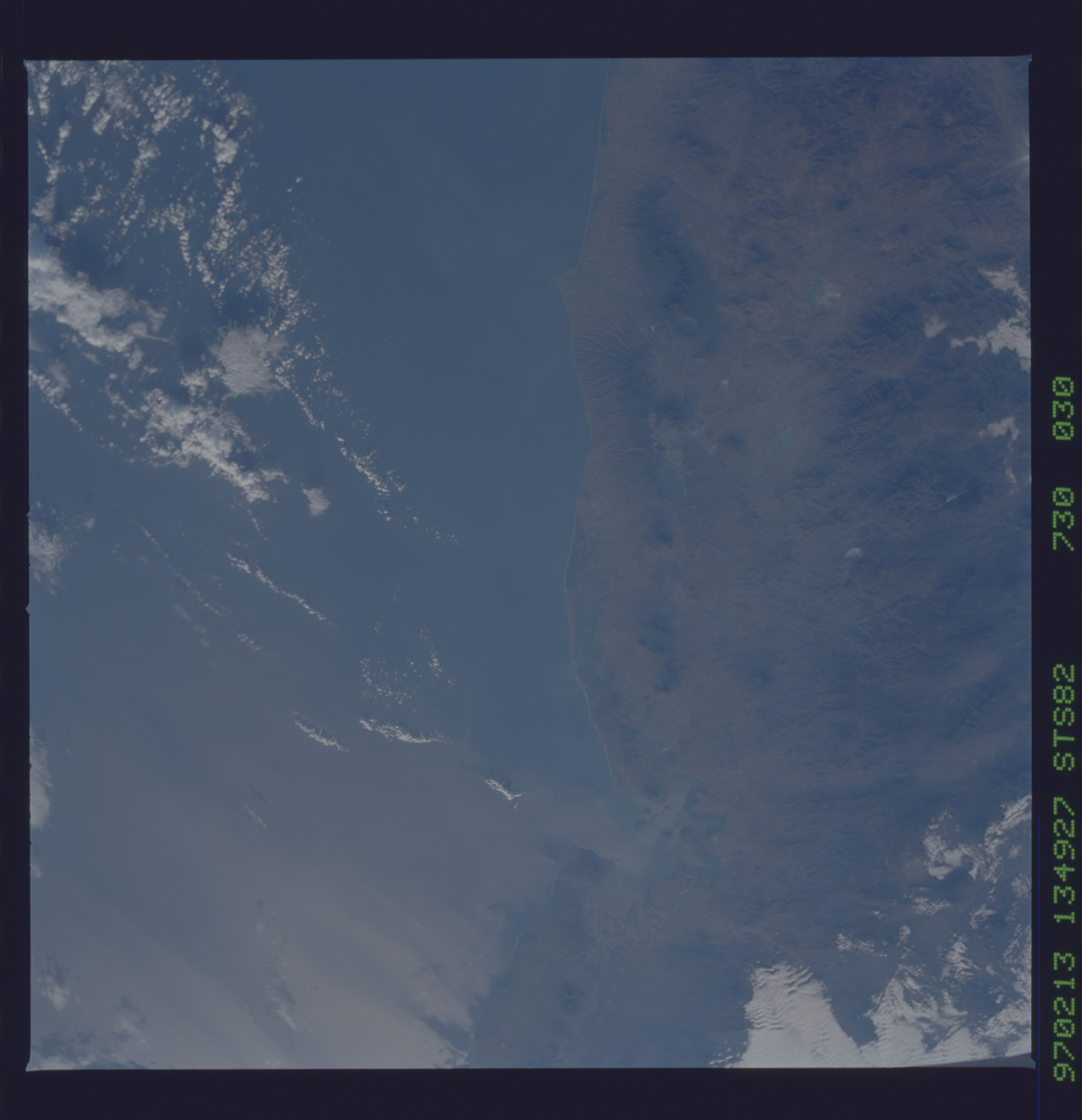
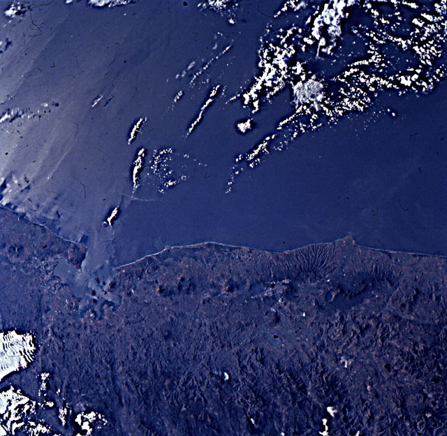
No GeoTIFF is available for this photo.Image Caption: El Salvador, Nicaragua. Fine photo of the volcanic arc including the
bend in plate boundary, expressed in the alignment of the
volcanoes. Cosiguina (see next frame) is at the corner where the plate
margin changes strike. Landward of the volcano line is a wide easterly
fault valley that has formed by back-arc extension. That
east-southeast trending graben becomes wider and deeper to the south,
where it contains huge lakes such as Lago Nicaragua (not in this
view).
