< STS095-715-25 >
| NASA Photo ID | STS095-715-25 |
| Focal Length | 250mm |
| Date taken | 1998.11.06 |
| Time taken | 10:47:22 GMT |
Cloud masks available for this image:
Spacecraft nadir point: 16.7° N, 47.6° E
Photo center point: 14.0° N, 48.0° E
Photo center point by machine learning:
Photo center point: 14.0° N, 48.0° E
Photo center point by machine learning:
Nadir to Photo Center: South
Spacecraft Altitude: 294 nautical miles (544km)
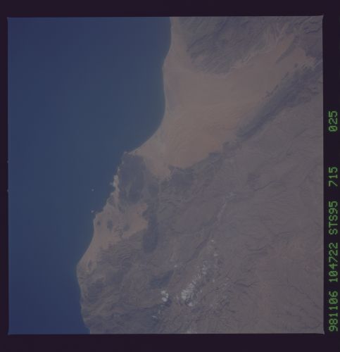
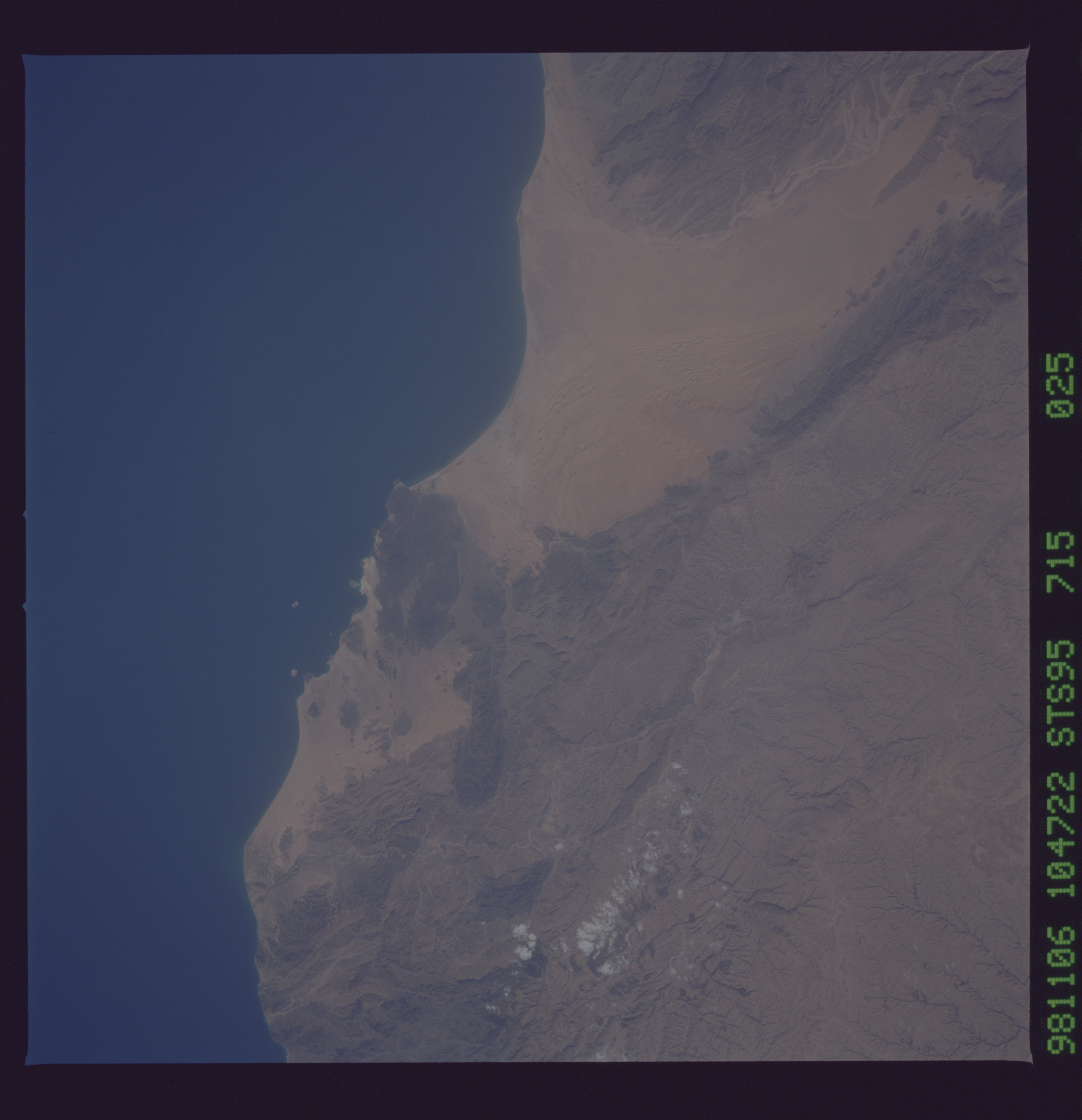
Country or Geographic Name: | YEMEN |
Features: | DISSECTED PLAT., COAST |
| Features Found Using Machine Learning: | |
Cloud Cover Percentage: | 5 (1-10)% |
Sun Elevation Angle: | 44° |
Sun Azimuth: | 227° |
Camera: | Hasselblad |
Focal Length: | 250mm |
Camera Tilt: | 29 degrees |
Format: | 5069: Kodak Elite 100S, E6 Reversal, Replaces Lumiere, Warmer in tone vs. Lumiere |
Film Exposure: | Normal |
| Additional Information | |
| Width | Height | Annotated | Cropped | Purpose | Links |
|---|---|---|---|---|---|
| 5700 pixels | 5900 pixels | No | No | Download Image Download Color Calibration Image for this Image |
|
| 483 pixels | 500 pixels | No | No | Download Image Download Color Calibration Image for this Image |
Download Packaged File
Download a Google Earth KML for this Image
View photo footprint information
No GeoTIFF is available for this photo.Image Caption: Yemen. The south coast is defined by faults of the Gulf of Aden rift. Long, straight fault scarps, as seen here, and volcanic vents are common along both continental and oceanic rifts.
