< ISS010-E-23748 >
| NASA Photo ID | ISS010-E-23748 |
| Focal Length | 180mm |
| Date taken | 2005.04.09 |
| Time taken | 17:08:50 GMT |
1000 x 1104 pixels 540 x 596 pixels 540 x 348 pixels 540 x 711 pixels 3032 x 2064 pixels 639 x 435 pixels
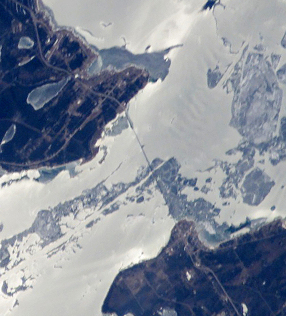
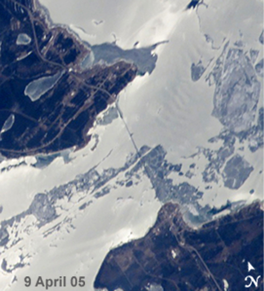
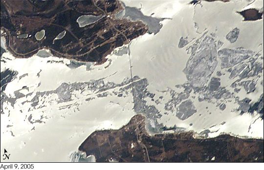
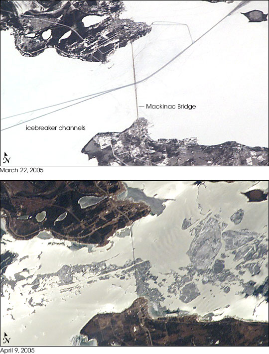

Photo center point: 46.0° N, 85.0° W
Photo center point by machine learning:
Country or Geographic Name: | USA-MICHIGAN |
Features: | STR. OF MACKINAC, GLINT, ICE |
| Features Found Using Machine Learning: | |
Cloud Cover Percentage: | 10 (1-10)% |
Sun Elevation Angle: | 50° |
Sun Azimuth: | 169° |
Camera: | Kodak DCS760c Electronic Still Camera |
Focal Length: | 180mm |
Camera Tilt: | 33 degrees |
Format: | 3060E: 3060 x 2036 pixel CCD, RGBG array |
Film Exposure: | |
| Additional Information | |
| Width | Height | Annotated | Cropped | Purpose | Links |
|---|---|---|---|---|---|
| 1000 pixels | 1104 pixels | No | Yes | Earth From Space collection | Download Image |
| 540 pixels | 596 pixels | Yes | Yes | Earth From Space collection | Download Image |
| 540 pixels | 348 pixels | Yes | Yes | NASA's Earth Observatory web site | Download Image |
| 540 pixels | 711 pixels | Yes | Yes | NASA's Earth Observatory web site | Download Image |
| 3032 pixels | 2064 pixels | No | No | Download Image | |
| 639 pixels | 435 pixels | No | No | Download Image |
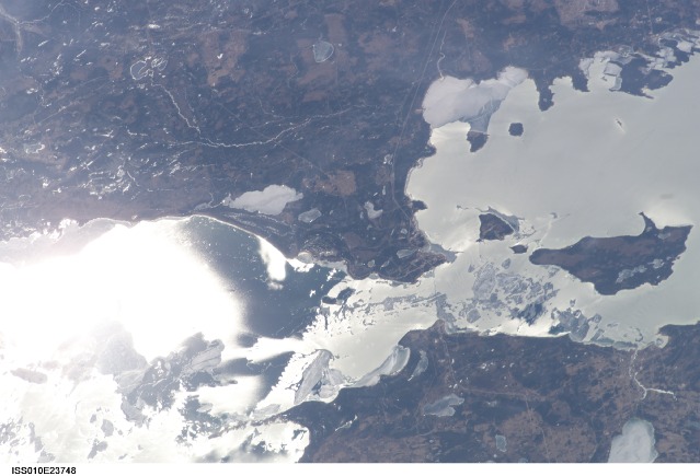
The Mackinac Bridge spans a stretch of water five miles wide between Michigan's lower and upper peninsulas. The strait connects Lakes Michigan (left) and Huron (right). The bridge is a combination of pier-supported spans with a high, central suspension sector that allows passage of lake steamers. The suspension sector is the longest in the Americas (8, 614 feet or 1.6 miles). Prior to construction of the bridge, the only passage across the straits was by ferryboat.
This pair of images shows the Mackinac Straits while they were still frozen (top) and as they began to thaw (below). The March 22 view shows shipping lanes opened by ice breakers. A narrow passage connects the cleared shipping channel to the small town of St. Ignace at the north end of the bridge (Mackinaw City appears at the south end). The April view shows the ice broken into a series of irregular rafts that appear gray against bright water. The whitish appearance of the water is not snow or ice, but instead is sunlight glinting off the water back to camera. The shipping channel is maintained even through remnants of the ice mass, but the ice ridges can be hazardous to shipping until the last of the ice breaks up.
