< STS103-728-22 >
| NASA Photo ID | STS103-728-22 |
| Focal Length | 250mm |
| Date taken | 1999.12.26 |
| Time taken | 15:34:52 GMT |
Resolutions offered for this image:
4400 x 4600 pixels 1031 x 1024 pixels 2067 x 2048 pixels 4135 x 4096 pixels 478 x 500 pixels 515 x 512 pixels 1535 x 1510 pixels 640 x 629 pixels
4400 x 4600 pixels 1031 x 1024 pixels 2067 x 2048 pixels 4135 x 4096 pixels 478 x 500 pixels 515 x 512 pixels 1535 x 1510 pixels 640 x 629 pixels


Cloud masks available for this image:
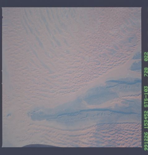
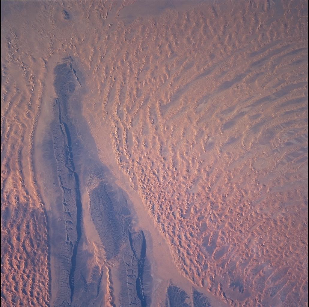
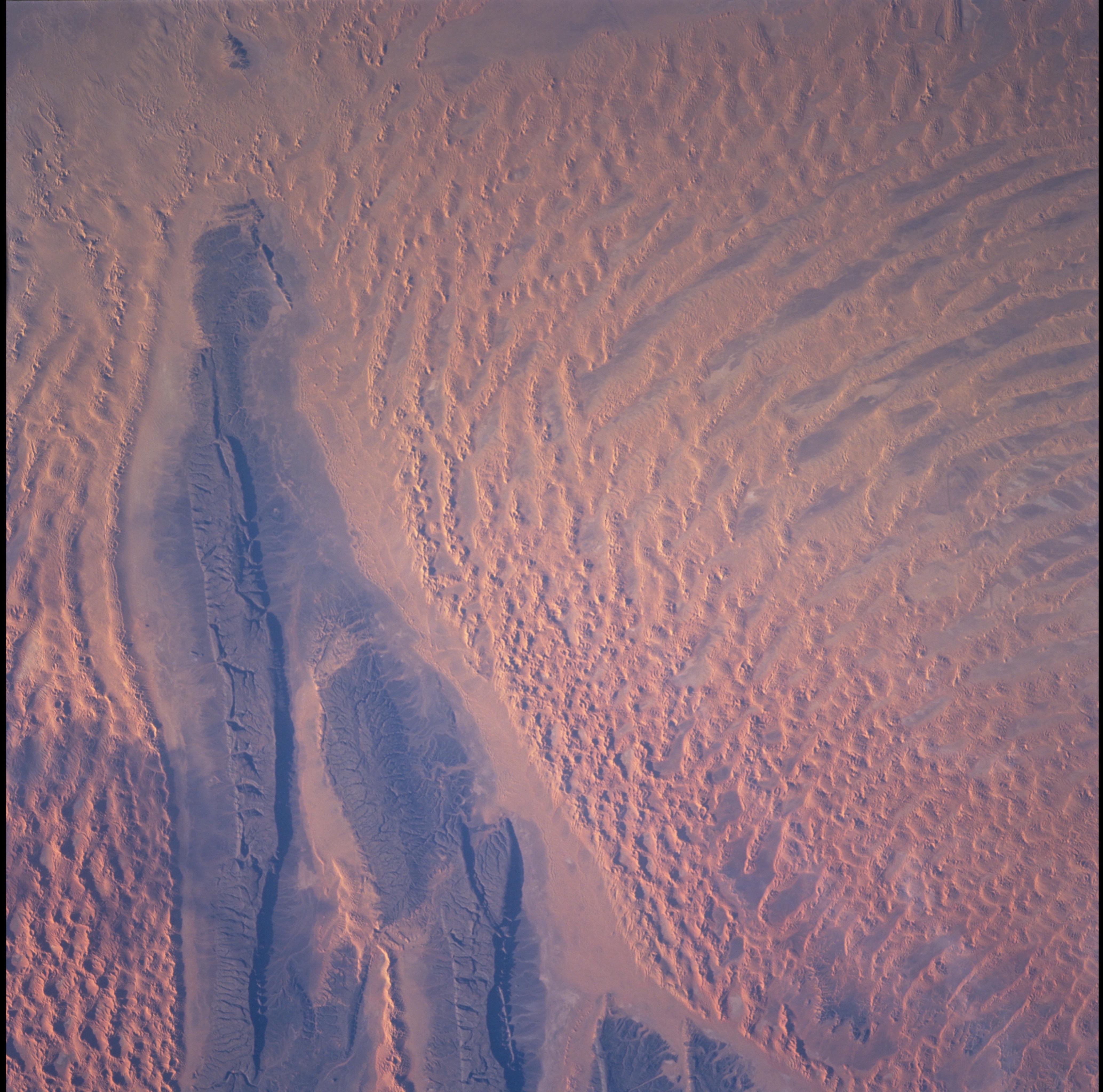
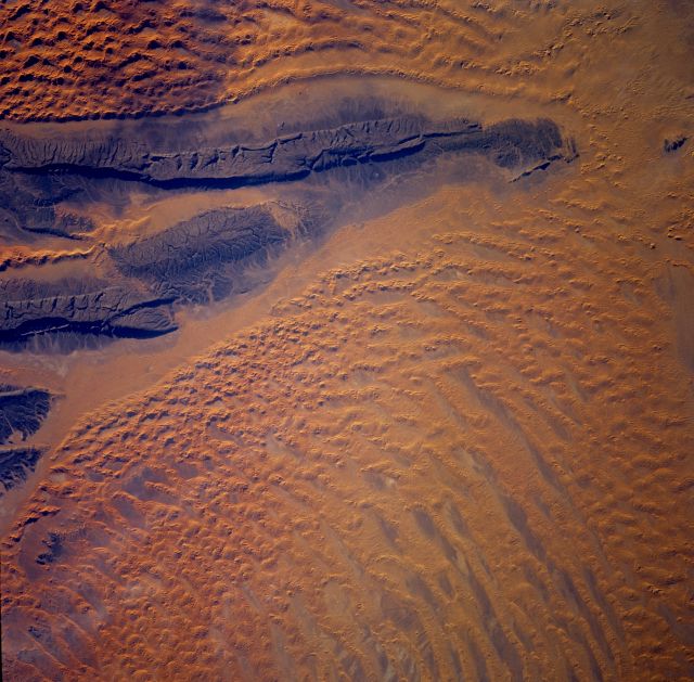
Spacecraft nadir point: 27.4° N, 7.5° E
Photo center point: 27.0° N, 7.5° E
Photo center point by machine learning:
Photo center point: 27.0° N, 7.5° E
Photo center point by machine learning:
Nadir to Photo Center: South
Spacecraft Altitude: 315 nautical miles (583km)
Country or Geographic Name: | ALGERIA |
Features: | ERG ISSAOUANE, OUTCROPS |
| Features Found Using Machine Learning: | |
Cloud Cover Percentage: | 10 (1-10)% |
Sun Elevation Angle: | 12° |
Sun Azimuth: | 235° |
Camera: | Hasselblad |
Focal Length: | 250mm |
Camera Tilt: | 4 degrees |
Format: | 5069: Kodak Elite 100S, E6 Reversal, Replaces Lumiere, Warmer in tone vs. Lumiere |
Film Exposure: | |
| Additional Information | |
| Width | Height | Annotated | Cropped | Purpose | Links |
|---|---|---|---|---|---|
| 4400 pixels | 4600 pixels | No | No | Download Image | |
| 1031 pixels | 1024 pixels | No | No | Download Image | |
| 2067 pixels | 2048 pixels | No | No | Download Image | |
| 4135 pixels | 4096 pixels | No | No | Download Image | |
| 478 pixels | 500 pixels | No | No | Download Image | |
| 515 pixels | 512 pixels | No | No | Download Image | |
| 1535 pixels | 1510 pixels | No | No | Public Affairs Office (PAO) | Download Image |
| 640 pixels | 629 pixels | No | No | Public Affairs Office (PAO) | Download Image |
Download Packaged File
Download a Google Earth KML for this Image
View photo footprint information
No GeoTIFF is available for this photo.Image Caption: The Tifernine dunes (note, the Tifernine dunes are below the "beak" of sandstone rock) were created when
the dark sandstone rocks trapped sand. Winds then piled the sand into dunes up to 457.2 m (1,500 ft). The
color of the sandstone is due to a desert varnish. The varnish is composed of manganese, iron oxides,
hydroxides, and clay minerals.
the dark sandstone rocks trapped sand. Winds then piled the sand into dunes up to 457.2 m (1,500 ft). The
color of the sandstone is due to a desert varnish. The varnish is composed of manganese, iron oxides,
hydroxides, and clay minerals.
