< ISS009-E-20909 >

| NASA Photo ID | ISS009-E-20909 |
| Focal Length | 26mm |
| Date taken | 2004.08.30 |
| Time taken | 12:16:47 GMT |
Spacecraft nadir point: 18.7° N, 52.3° W
Photo center point: 19.2° N, 58.1° W
Photo center point by machine learning:
Photo center point: 19.2° N, 58.1° W
Photo center point by machine learning:
Nadir to Photo Center: West
Spacecraft Altitude: 193 nautical miles (357km)
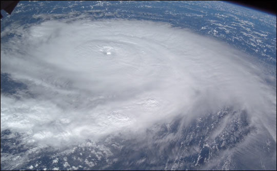
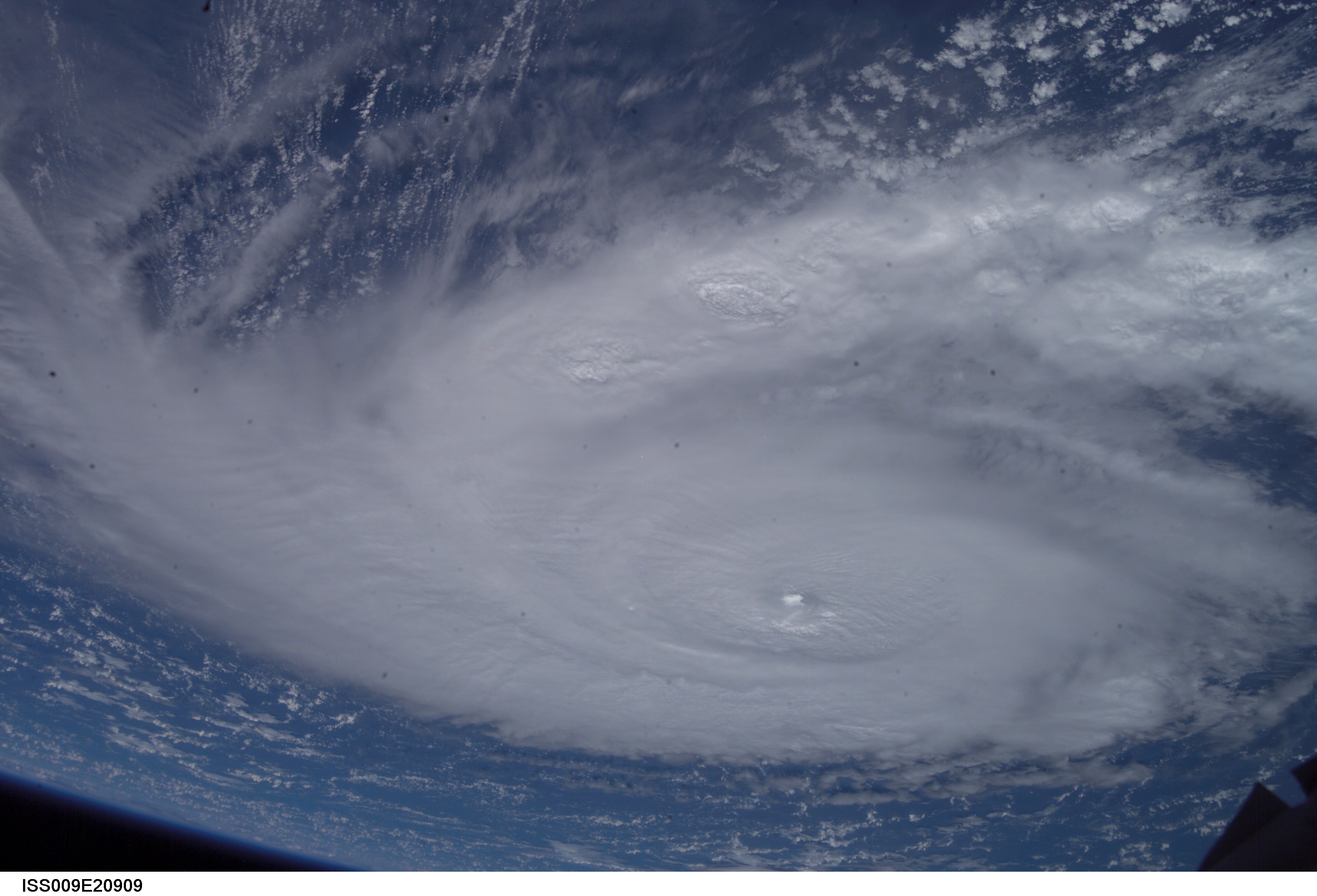
Country or Geographic Name: | ATLANTIC OCEAN |
Features: | PAN-HURRICANE FRANCES, BANDS |
| Features Found Using Machine Learning: | |
Cloud Cover Percentage: | 100 (76-100)% |
Sun Elevation Angle: | 42° |
Sun Azimuth: | 95° |
Camera: | Kodak DCS760c Electronic Still Camera |
Focal Length: | 26mm |
Camera Tilt: | High Oblique |
Format: | 3060E: 3060 x 2036 pixel CCD, RGBG array |
Film Exposure: | |
| Additional Information | |
| Width | Height | Annotated | Cropped | Purpose | Links |
|---|---|---|---|---|---|
| 540 pixels | 334 pixels | No | Yes | Earth From Space collection | Download Image |
| 3032 pixels | 2064 pixels | No | No | Download Image | |
| 639 pixels | 435 pixels | No | No | Download Image |
Download Packaged File
Download a Google Earth KML for this Image
View photo footprint information
No GeoTIFF is available for this photo.Image Caption: This image of Hurricane Frances was acquired by the crew of the International Space Station early on August 30 as the storm was moving westward some 265 miles east-northeast of the northern Windward Islands. The storm was packing winds of 120 miles per hour at the time and appeared to be tracking towards the Bahamas Islands and eventually Florida. A large, ragged eye is visible with a large arc of high clouds flowing away from the top of the storm.
