< ISS008-E-17326 >

| NASA Photo ID | ISS008-E-17326 |
| Focal Length | 400mm |
| Date taken | 2004.02.28 |
| Time taken | 01:01:01 GMT |
Resolutions offered for this image:
2056 x 1806 pixels 3032 x 2004 pixels 540 x 540 pixels 1000 x 878 pixels 1000 x 1000 pixels 3032 x 2064 pixels 639 x 435 pixels
2056 x 1806 pixels 3032 x 2004 pixels 540 x 540 pixels 1000 x 878 pixels 1000 x 1000 pixels 3032 x 2064 pixels 639 x 435 pixels


Spacecraft nadir point: 36.5° N, 138.5° E
Photo center point: 35.5° N, 138.5° E
Photo center point by machine learning:
Photo center point: 35.5° N, 138.5° E
Photo center point by machine learning:
Nadir to Photo Center: South
Spacecraft Altitude: 195 nautical miles (361km)
Country or Geographic Name: | JAPAN |
Features: | MT. FUJI, SNOW, AGRICULTURE, FOREST |
| Features Found Using Machine Learning: | |
Cloud Cover Percentage: | 10 (1-10)% |
Sun Elevation Angle: | 37° |
Sun Azimuth: | 142° |
Camera: | Kodak DCS760c Electronic Still Camera |
Focal Length: | 400mm |
Camera Tilt: | 17 degrees |
Format: | 3060E: 3060 x 2036 pixel CCD, RGBG array |
Film Exposure: | |
| Additional Information | |
| Width | Height | Annotated | Cropped | Purpose | Links |
|---|---|---|---|---|---|
| 2056 pixels | 1806 pixels | No | Yes | Earth From Space collection | Download Image |
| 3032 pixels | 2004 pixels | No | No | Earth From Space collection | Download Image |
| 540 pixels | 540 pixels | Yes | Yes | Earth From Space collection | Download Image |
| 1000 pixels | 878 pixels | No | Yes | NASA's Earth Observatory web site | Download Image |
| 1000 pixels | 1000 pixels | No | Yes | NASA's Earth Observatory web site | Download Image |
| 3032 pixels | 2064 pixels | No | No | Download Image | |
| 639 pixels | 435 pixels | No | No | Download Image |
Download Packaged File
Download a Google Earth KML for this Image
View photo footprint information
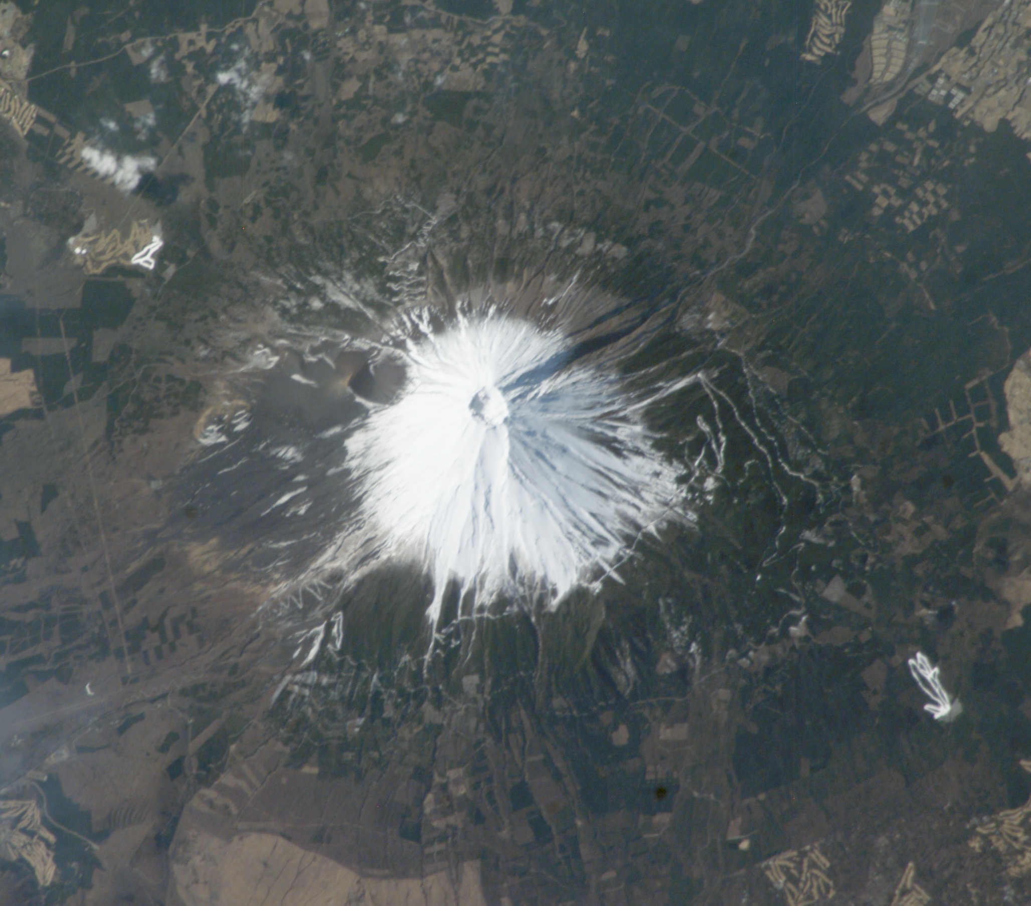
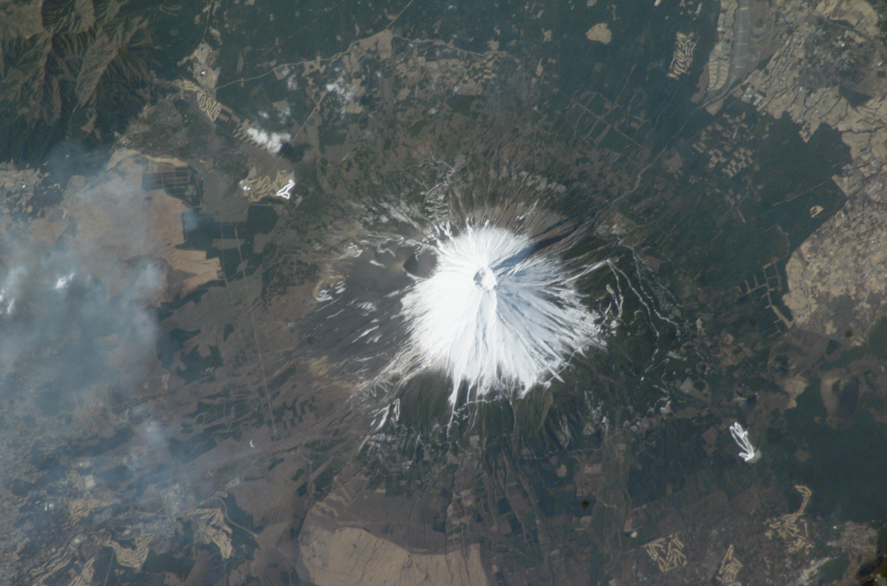
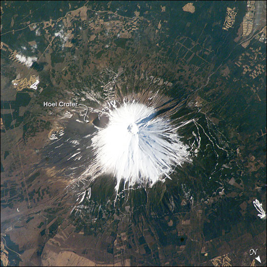
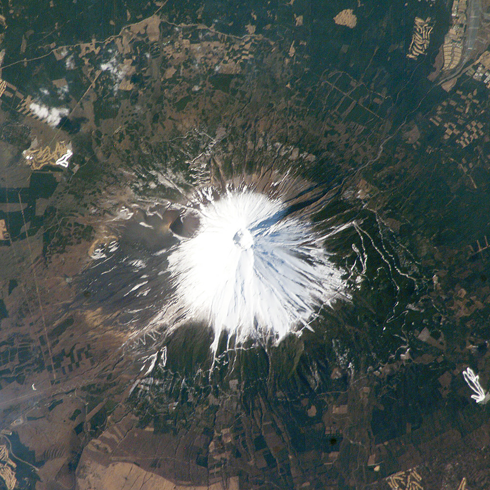
No GeoTIFF is available for this photo.Image Caption: Mt. Fuji, Japan:
Fuji, Japan's tallest volcano (3,776 m) and a national symbol, is located about 110 km (70 miles) west-southwest of Tokyo in central Honshu, Japan. It is a highly recognizable target from space and last week International Space Station crew members peered down onto Fuji's snow-capped cone. The summit crater is about 250 m deep, with a diameter of about 500 meters. Fuji last erupted in 1707 from Hoei crater, a vent on the mountain's southeastern flank.
When this image was taken, the winter snow cover highlighted trails, roads, and other clearings above a certain elevation. Developments on Fuji's lower flanks, which include military installations and tourist resorts, remained snow-free.
