< STS41G-121-139 >
| NASA Photo ID | STS41G-121-139 |
| Focal Length | 90mm |
| Date taken | 1984.10.__ |
| Time taken | GMT |
Resolutions offered for this image:
640 x 480 pixels
640 x 480 pixels
Cloud masks available for this image:
Spacecraft nadir point:
Photo center point: 51.5° N, 2.5° E
Photo center point by machine learning:
Photo center point: 51.5° N, 2.5° E
Photo center point by machine learning:
Nadir to Photo Center:
Spacecraft Altitude: nautical miles (0km)
Country or Geographic Name: | FRANCE |
Features: | ENGLISH CHANNEL |
| Features Found Using Machine Learning: | |
Cloud Cover Percentage: | 65 (51-75)% |
Sun Elevation Angle: | ° |
Sun Azimuth: | ° |
Camera: | Linhof |
Focal Length: | 90mm |
Camera Tilt: | Low Oblique |
Format: | 6017: Kodak Ektachrome 64, 220 Roll Format |
Film Exposure: | Normal |
| Additional Information | |
| Width | Height | Annotated | Cropped | Purpose | Links |
|---|---|---|---|---|---|
| 640 pixels | 480 pixels | No | No | ISD 1 | Download Image |
Download Packaged File
Download a Google Earth KML for this Image
View photo footprint information
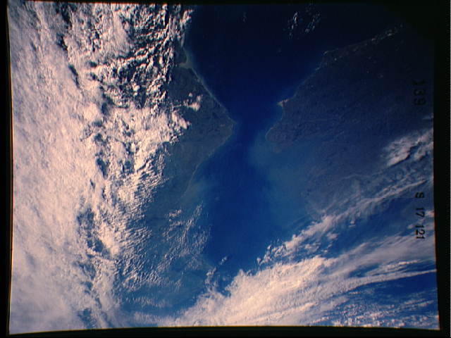
No GeoTIFF is available for this photo.Image Caption: The cloud covered earthscape of Northern Europe demonstrates the difficulty of photographing this elusive subject from space. The English Channel (51.0N, 1.5E) separating the British Islands from Europe is in the center of the scene. The white cliffs of Dover on the SE coast of the UK, the Thames River estuary and a partial view of the city of London can be seen on the north side of the Channel while the Normandy coast of France is to the south.
