< STS054-152-139 >
| NASA Photo ID | STS054-152-139 |
| Focal Length | 90mm |
| Date taken | 1993.01.__ |
| Time taken | GMT |
Resolutions offered for this image:
640 x 480 pixels
640 x 480 pixels
Cloud masks available for this image:
Spacecraft nadir point:
Photo center point: 18.0° N, 103.0° W
Photo center point by machine learning:
Photo center point: 18.0° N, 103.0° W
Photo center point by machine learning:
Nadir to Photo Center:
Spacecraft Altitude: nautical miles (0km)
Country or Geographic Name: | PACIFIC OCEAN |
Features: | PAN WEST MEXICAN COAST |
| Features Found Using Machine Learning: | |
Cloud Cover Percentage: | 15 (11-25)% |
Sun Elevation Angle: | ° |
Sun Azimuth: | ° |
Camera: | Linhof |
Focal Length: | 90mm |
Camera Tilt: | High Oblique |
Format: | QX868: Kodak, natural color positive, Ektachrome QX868(5017 emulsion), ASA 64, thin base |
Film Exposure: | Normal |
| Additional Information | |
| Width | Height | Annotated | Cropped | Purpose | Links |
|---|---|---|---|---|---|
| 640 pixels | 480 pixels | No | No | ISD 1 | Download Image |
Download Packaged File
Download a Google Earth KML for this Image
View photo footprint information
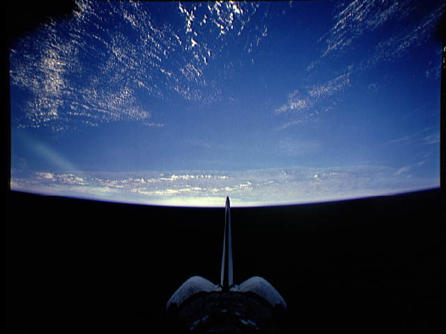
No GeoTIFF is available for this photo.Image Caption: In this scenic panoramic view, the orbiter tail points toward the Mexican Pacific coastline (18.0N, 103.0W) near the international resort of Acapulco on the nearly cloud free eastern Pacific Ocean. Almost all of southern Mexico can be seen from Puerto Vallarta in the north to the Isthmus of Tehuantepec in the south. The cloud covered Gulf of Mexico at the horizon contrasts sharply with the blue Pacific.
