< STS078-734-12 >
| NASA Photo ID | STS078-734-12 |
| Focal Length | 250mm |
| Date taken | 1996.06.25 |
| Time taken | 14:43:06 GMT |
Cloud masks available for this image:
Spacecraft nadir point: 35.8° N, 96.0° W
Photo center point: 36.0° N, 96.0° W
Photo center point by machine learning:
Photo center point: 36.0° N, 96.0° W
Photo center point by machine learning:
Nadir to Photo Center: North
Spacecraft Altitude: 144 nautical miles (267km)
Country or Geographic Name: | USA-OKLAHOMA |
Features: | TULSA, ARKANSAS R., AGR. |
| Features Found Using Machine Learning: | |
Cloud Cover Percentage: | 5 (1-10)% |
Sun Elevation Angle: | 41° |
Sun Azimuth: | 88° |
Camera: | Hasselblad |
Focal Length: | 250mm |
Camera Tilt: | 5 degrees |
Format: | 5046: Kodak, natural color positive, Lumiere 100/5046, ASA 100, standard base |
Film Exposure: | Normal |
| Additional Information | |
| Width | Height | Annotated | Cropped | Purpose | Links |
|---|---|---|---|---|---|
| 5700 pixels | 5900 pixels | No | No | Download Image Download Color Calibration Image for this Image |
|
| 483 pixels | 500 pixels | No | No | Download Image Download Color Calibration Image for this Image |
|
| 640 pixels | 609 pixels | No | No | Photographic Highlights | Download Image |
Download Packaged File
Download a Google Earth KML for this Image
View photo footprint information
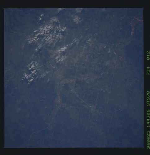
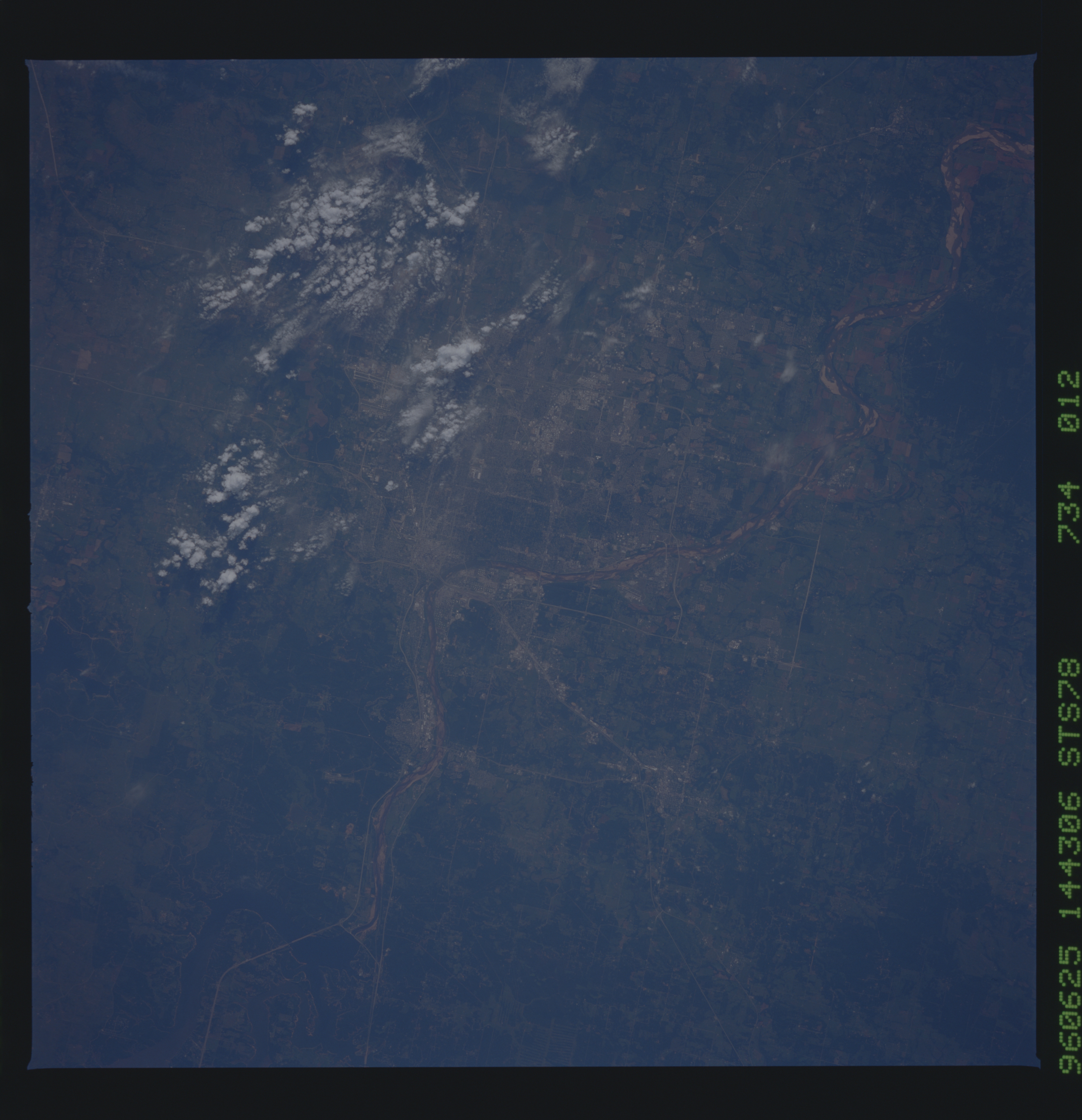
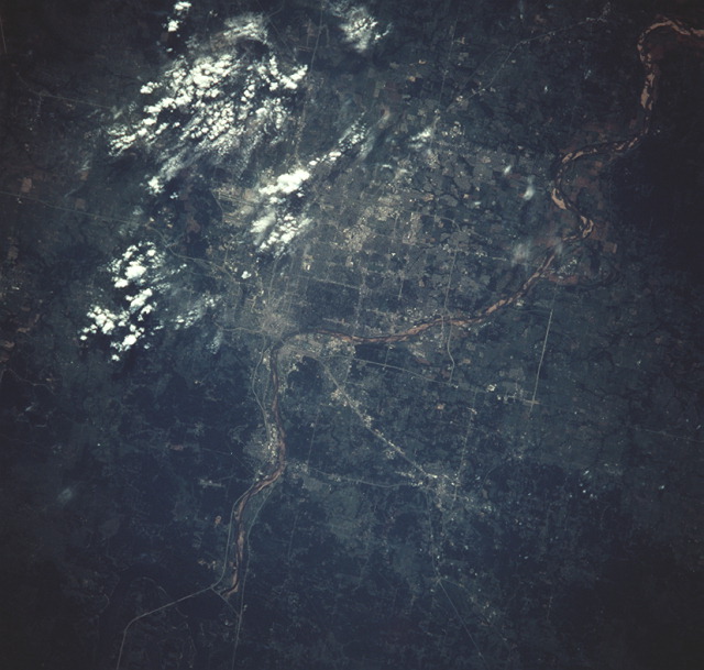
No GeoTIFF is available for this photo.Image Caption: STS078-734-12 Tusla and Sapula, Oklahoma
Seen here are Tulsa and Sapula, Oklahoma. Tulsa is in the northeastern part of the state, on the Arkansas River. Manufacture on petroleum-based products provides the economic basis for the city. Indeed, more than 800 major oil and gas companies have plants and offices in the city. Visible to the west of Tulsa is Keystone Lake.
Seen here are Tulsa and Sapula, Oklahoma. Tulsa is in the northeastern part of the state, on the Arkansas River. Manufacture on petroleum-based products provides the economic basis for the city. Indeed, more than 800 major oil and gas companies have plants and offices in the city. Visible to the west of Tulsa is Keystone Lake.
