< STS078-758-101 >
| NASA Photo ID | STS078-758-101 |
| Focal Length | 250mm |
| Date taken | 1996.06.28 |
| Time taken | 14:37:37 GMT |
Cloud masks available for this image:
Spacecraft nadir point: 39.1° N, 86.4° W
Photo center point: 38.5° N, 86.5° W
Photo center point by machine learning:
Photo center point: 38.5° N, 86.5° W
Photo center point by machine learning:
Nadir to Photo Center: South
Spacecraft Altitude: 142 nautical miles (263km)
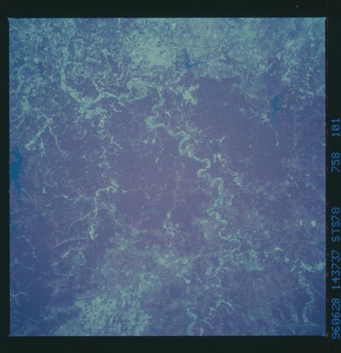
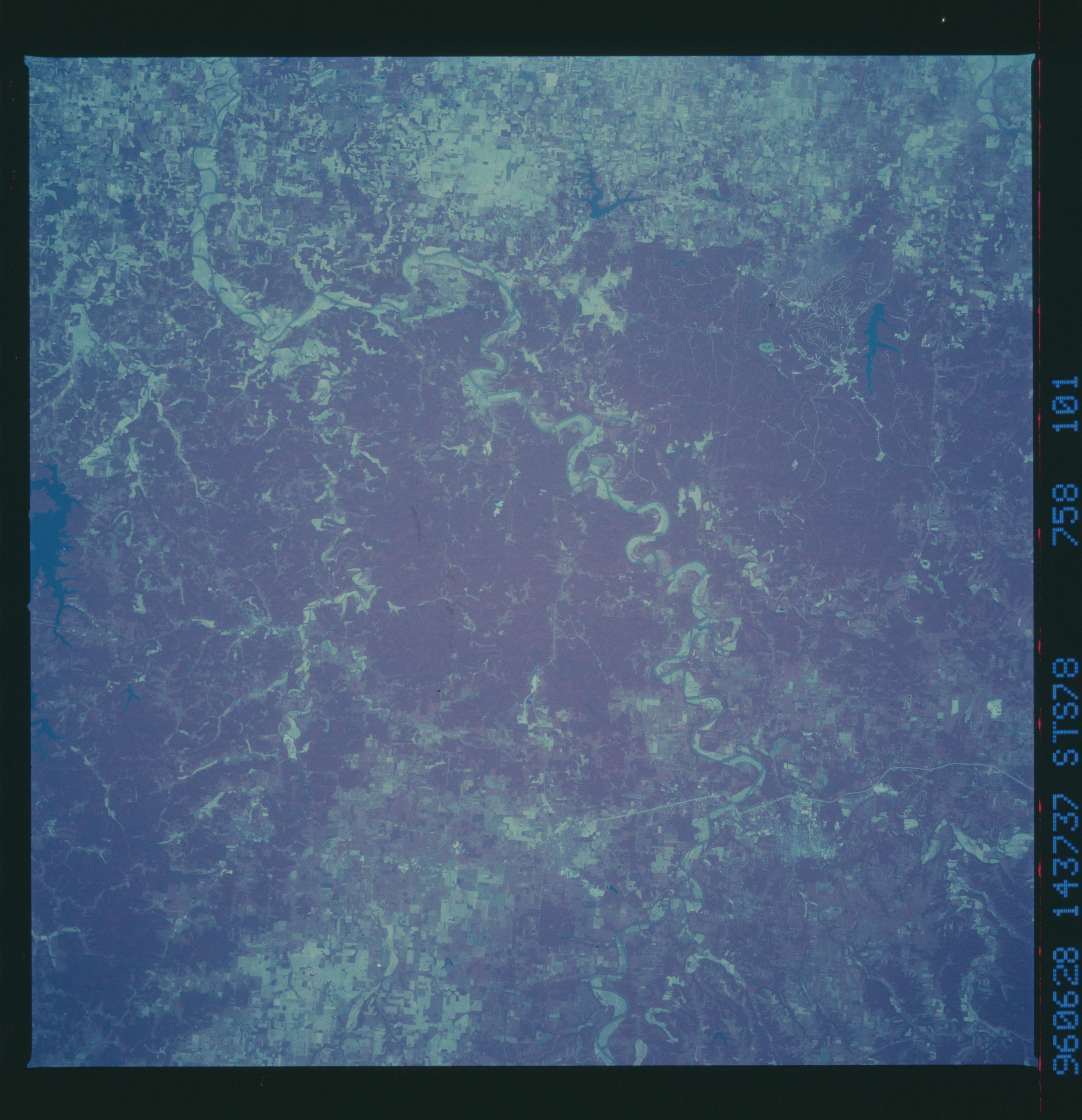
Country or Geographic Name: | USA-INDIANA |
Features: | BEDFORD, WABASH RIVER |
| Features Found Using Machine Learning: | |
Cloud Cover Percentage: | 0 (no clouds present) |
Sun Elevation Angle: | 47° |
Sun Azimuth: | 97° |
Camera: | Hasselblad |
Focal Length: | 250mm |
Camera Tilt: | 14 degrees |
Format: | 2443: Kodak Aerochrome 2443, color IR, thin base, EA-5 process thru June 1999, E-6 process afterward |
Film Exposure: | Normal |
| Additional Information | |
| Width | Height | Annotated | Cropped | Purpose | Links |
|---|---|---|---|---|---|
| 5700 pixels | 5900 pixels | No | No | Download Image Download Color Calibration Image for this Image |
|
| 483 pixels | 500 pixels | No | No | Download Image Download Color Calibration Image for this Image |
Download Packaged File
Download a Google Earth KML for this Image
View photo footprint information
No GeoTIFF is available for this photo.Image Caption: Drainage patterns shown using CIR film. White River,
near Bedford, Indiana (location of the Virgil I. Grissom Airfield).
Kelly Roberts Salton Sea
near Bedford, Indiana (location of the Virgil I. Grissom Airfield).
Kelly Roberts Salton Sea
