< STS094-728-10 >
| NASA Photo ID | STS094-728-10 |
| Focal Length | 100mm |
| Date taken | 1997.07.05 |
| Time taken | 09:31:25 GMT |
Resolutions offered for this image:
5700 x 5900 pixels 483 x 500 pixels 1263 x 1247 pixels 624 x 640 pixels
5700 x 5900 pixels 483 x 500 pixels 1263 x 1247 pixels 624 x 640 pixels


Cloud masks available for this image:
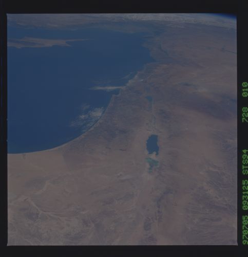
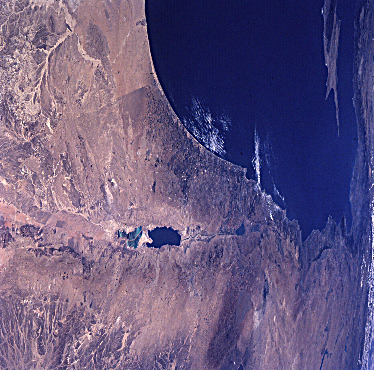
Spacecraft nadir point: 27.5° N, 34.7° E
Photo center point: 32.5° N, 35.5° E
Photo center point by machine learning:
Photo center point: 32.5° N, 35.5° E
Photo center point by machine learning:
Nadir to Photo Center: North
Spacecraft Altitude: 160 nautical miles (296km)
Country or Geographic Name: | JORDAN |
Features: | PAN-DEAD SEA |
| Features Found Using Machine Learning: | |
Cloud Cover Percentage: | 5 (1-10)% |
Sun Elevation Angle: | 84° |
Sun Azimuth: | 144° |
Camera: | Hasselblad |
Focal Length: | 100mm |
Camera Tilt: | High Oblique |
Format: | 5069: Kodak Elite 100S, E6 Reversal, Replaces Lumiere, Warmer in tone vs. Lumiere |
Film Exposure: | Normal |
| Additional Information | |
| Width | Height | Annotated | Cropped | Purpose | Links |
|---|---|---|---|---|---|
| 5700 pixels | 5900 pixels | No | No | Download Image Download Color Calibration Image for this Image |
|
| 483 pixels | 500 pixels | No | No | Download Image Download Color Calibration Image for this Image |
|
| 1263 pixels | 1247 pixels | Download Image | |||
| 624 pixels | 640 pixels | No | No | Photographic Highlights | Download Image |
Download Packaged File
Download a Google Earth KML for this Image
View photo footprint information
No GeoTIFF is available for this photo.Image Caption: Across the Arabian Peninsula from the Red Sea is the Dead Sea fault zone, another region of rifting as well
as strike-slip faulting. This view places the Dead Sea zone in the grander context of interactions among the
African plate (Arabian Peninsula, Israel, Lebanon), the Arabian plate (Saudi Arabia, Syria), and the
Eurasian plate (Turkey, Gulf of Iskenderun in upper part of photo). The African-Arabian plate boundary,
like most plate boundaries, is irregular with steps, jogs and differing styles of deformation. The blocks
flanking the long straight faults of the Dead Sea zone are moving laterally past each other, as well as rifting
apart.
