Great Britain and Ireland Show Their Colors
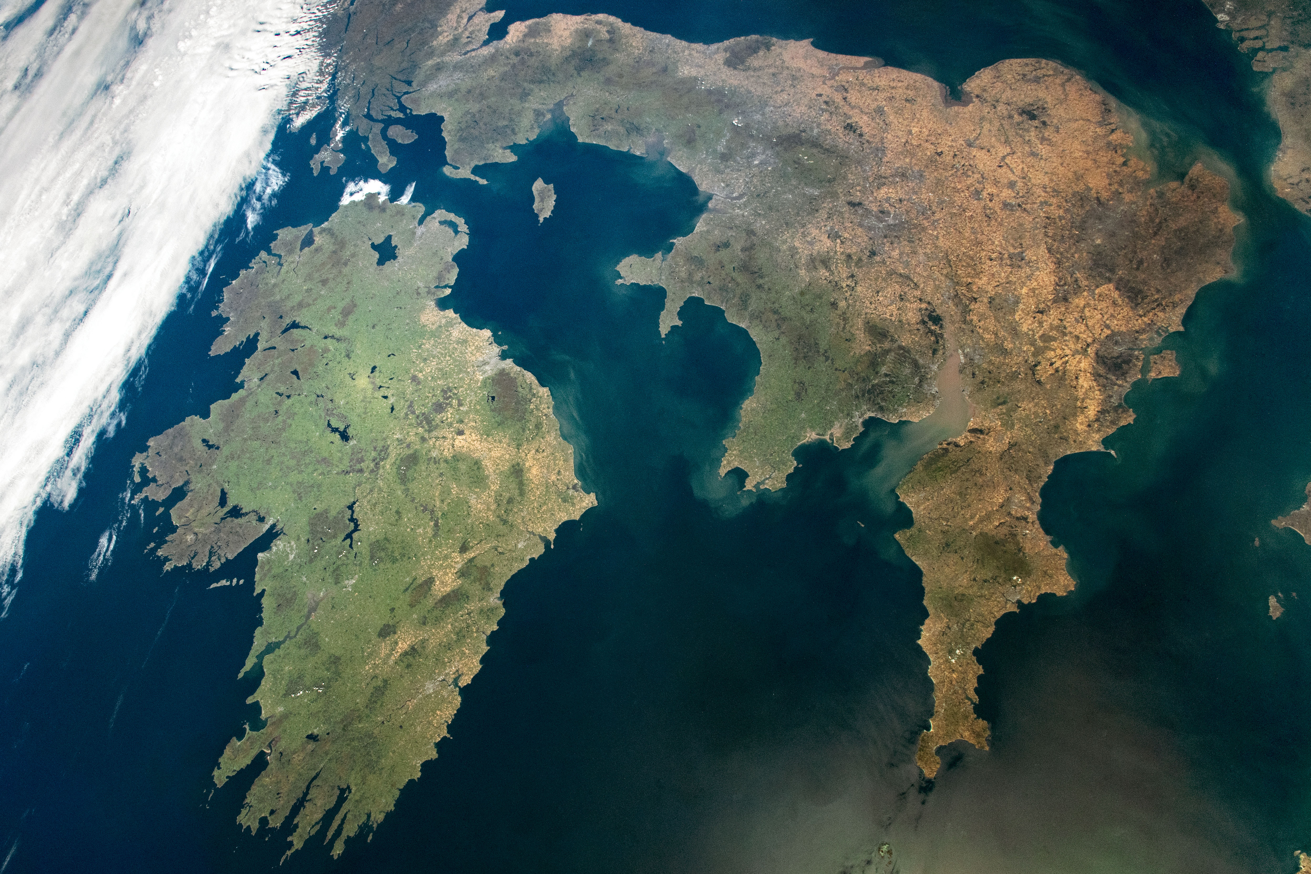
An astronaut on the International Space Station took this photograph during a rare clear day over Ireland and Great Britain. The wide view captures the contrasting colors of various land cover types present across the two islands.
Coastal mountains and rough terrain flank the western edge of Ireland, making the peninsulas there appear browner than the more vegetated (green) areas of central Ireland. The central region is composed of plains with bogs and hilly lowlands, largely consisting of assorted forests, agriculture, and pastures. Similar green tones carry over to the western side of Great Britain.
Many of the tan areas on the eastern side of Great Britain are within a rain shadow created by the uplands and mountains to the west. Weather systems move from west to east, and higher elevation areas on the west receive more rainfall than the lower eastern side. The tan color reflects grasslands where the vegetation was stressed due to high temperatures and drought conditions when this image was taken in summer 2022.
Cities are scattered across both islands, visible as dark-gray and white areas. Great Britain has the highest population density in the region, as indicated by the spatially extensive urban and suburban colors around London, Birmingham, and Manchester.
Across both islands, more than 78,200 square kilometers (30,200 square miles) of land (24 percent) is dedicated to conservation. These areas protect over 10,000 habitats that are used for breeding, migration, and shelter to flora and fauna, such as wildfowl, bats, and mosses.
Astronaut photograph ISS067-E-253753 was acquired on August 11, 2022, with a Nikon D5 digital camera using an 17 millimeter lens and is provided by the ISS Crew Earth Observations Facility and the Earth Science and Remote Sensing Unit, Johnson Space Center. The image was taken by a member of the Expedition 66 crew. The image has been cropped and enhanced to improve contrast, and lens artifacts have been removed. The International Space Station Program supports the laboratory as part of the ISS National Lab to help astronauts take pictures of Earth that will be of the greatest value to scientists and the public, and to make those images freely available on the Internet. Additional images taken by astronauts and cosmonauts can be viewed at the NASA/JSC Gateway to Astronaut Photography of Earth. Caption by Sara Schmidt, GeoControl Systems, JETS Contract at NASA-JSC.
