[Skip to Content]
Earth From Space
Earth from Space logo  11 Matches Search ResultsEarth from Space logo

Image: gray corner Image: gray corner
View Image Information
Image: Geographic Location
Image: gray corner Image: gray corner

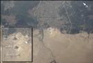
Photo #: ISS003-E-5120 Technical Info
All Available Images Lo-Resolution 37k
Features: PYRAMID, PYRAMIDS, GIZA, PLATEAU
Geographic Region: EGYPT


Image: gray corner Image: gray corner
View Image Information
Image: Geographic Location
Image: gray corner Image: gray corner

Photo #: ISS007-E-12915 Technical Info
All Available Images Lo-Resolution 95k
Features: PYRAMIDS, CAIRO, ROADS, NILE RIVER, DESERT, GIZA
Geographic Region: EGYPT


Image: gray corner Image: gray corner
View Image Information
Image: Geographic Location
Image: gray corner Image: gray corner

Photo #: ISS017-E-8285 Technical Info
All Available Images Lo-Resolution 270k
Features: NILE R. V., DESERT, PYRAMID, RIVER, DELTA, DAHSHUR, PYRAMIDS
Geographic Region: EGYPT


Image: gray corner Image: gray corner
View Image Information
Image: Geographic Location
Image: gray corner Image: gray corner

Photo #: ISS018-E-6540 Technical Info
All Available Images Lo-Resolution 225k
Features: SAQQARA, DELTA, RIVER, VALLEY, PLATEAU, PYRAMIDS, DESERT, ABU SIR, PYRAMID
Geographic Region: EGYPT


Image: gray corner Image: gray corner
View Image Information
Image: Geographic Location
Image: gray corner Image: gray corner

Photo #: ISS025-E-5259 Technical Info
All Available Images Lo-Resolution 210k
Features: GLINT FEATURES, PYRAMID LAKE, MTS., LAKE, DRAINAGE, WINNEMUCCA LAKEBED, SWIRLS, SUNGLINT
Geographic Region: USA-NEVADA


Image: gray corner Image: gray corner
View Image Information
Image: Geographic Location
Image: gray corner Image: gray corner

Photo #: ISS032-E-9123 Technical Info
All Available Images Lo-Resolution 317k
Features: PYRAMIDS OF GIZA, MONSHAAT AL BAKKARI, CAIRO, PYRAMID, KAFR GHATATI, DESERT
Geographic Region: EGYPT


Image: gray corner Image: gray corner
View Image Information
Image: Geographic Location
Image: gray corner Image: gray corner

Photo #: ISS034-E-35548 Technical Info
All Available Images Lo-Resolution 181k
Features: SPARKS, RENO AT NIGHT, PYRAMID LAKE, AIRPORT, FERNLEY AT NIGHT, RENO
Geographic Region: USA-NEVADA


Image: gray corner Image: gray corner
View Image Information
Image: Geographic Location
Image: gray corner Image: gray corner

Photo #: ISS055-E-1038 Technical Info
All Available Images Lo-Resolution 458k
Features: PAN- SIERRA NEVADA MOUNTAINS, BLACK ROCK DESERT, PYRAMID LAKE, LAKE TAHOE
Geographic Region: USA-NEVADA


Image: gray corner Image: gray corner
View Image Information
Image: Geographic Location
Image: gray corner Image: gray corner

Photo #: STS040-606-37 Technical Info
All Available Images Lo-Resolution 361k
Features: LKS. TAHOE, MOUNTAIN, FAULT, FOREST, LAKE, VALLEY, MONO, PYRAMID, BASIN
Geographic Region: USA-CALIFORNIA


Image: gray corner Image: gray corner
View Image Information
Image: Geographic Location
Image: gray corner Image: gray corner

Photo #: STS064-110-91 Technical Info
All Available Images Lo-Resolution 369k
Features: PYRAMID LAKE, LAKE, MOUNTAINS, PLAYA, MOUNTAIN
Geographic Region: USA-NEVADA


Image: gray corner Image: gray corner
View Image Information
Image: Geographic Location
Image: gray corner Image: gray corner

Photo #: STS073-704-84 Technical Info
All Available Images Lo-Resolution 342k
Features: CARSON SINK, LAKE, MOUNTAIN, PYRAMID L., DESERT, PLAYA
Geographic Region: USA-NEVADA


NASA
Home Page
JSC
Home Page
JSC Digital
Image Collection
Earth Science &
Remote Sensing
NASA meatball logo
This service is provided by the International Space Station program and the JSC Earth Science & Remote Sensing Unit, ARES Division, Exploration Integration Science Directorate.
ESRS logo