 Photo #: STS41B-41-2335 Date: Feb. 1984
Geographic Region: BOLIVIA
Feature: RIVER GRANDE GUAPAY

 Photo #: STS41B-41-2335 Date: Feb. 1984 Photo #: STS41B-41-2335 Date: Feb. 1984Geographic Region: BOLIVIA Feature: RIVER GRANDE GUAPAY |
 |
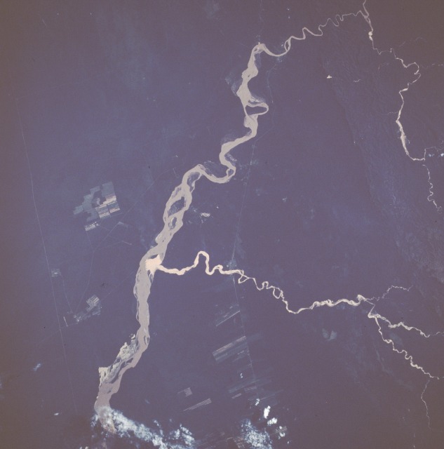
| STS41B-041-2335 Rio Grande, Bolivia February 1984 The Rio Grande of Bolivia gradually arcs northeast as it exits the foothills of the eastern flank of the Andes Mountains. The segment of the Rio Grande shown in this near-vertical photograph is approximately 60 miles (95 kilometers) due south of Santa Cruz in the Bolivian lowlands. The tan water indicates that the river is transporting a large quantity of sediment. A somewhat unusual feature is the smaller tributary that flows for approximately 35 miles (55 kilometers), enters the Rio Grande, and creates its own delta within the much larger river. The source of the silt that is transported by the shorter tributary is unknown. The north-south lines on either side of the Rio Grande are railroad and pipeline rights-of-way on the west and a pipeline right-of-way on the east. Dense vegetation covers most of the area except for some cultivated fields in the northern half of the photograph. |
| Images: | All Available Images Low-Resolution 59k |
|
| Mission: | STS41B |
|
| Roll - Frame: | 41 - 2335 |
|
| Geographical Name: | BOLIVIA |
|
| Features: | RIVER GRANDE GUAPAY |
|
| Center Lat x Lon: | 18.5S x 63.5W |
|
| Film Exposure: | N | N=Normal exposure, U=Under exposed, O=Over exposed, F=out of Focus |
| Percentage of Cloud Cover-CLDP: | 0 |
|
| Camera:: | HB |
|
| Camera Tilt: | NV | LO=Low Oblique, HO=High Oblique, NV=Near Vertical |
| Camera Focal Length: | 250 |
|
| Nadir to Photo Center Direction: | The direction from the nadir to the center point, N=North, S=South, E=East, W=West |
|
| Stereo?: | N | Y=Yes there is an adjacent picture of the same area, N=No there isn't |
| Orbit Number: | 21 |
|
| Date: | 198402__ | YYYYMMDD |
| Time: | GMT HHMMSS |
|
| Nadir Lat: | N |
Latitude of suborbital point of spacecraft |
| Nadir Lon: | E |
Longitude of suborbital point of spacecraft |
| Sun Azimuth: | Clockwise angle in degrees from north to the sun measured at the nadir point |
|
| Space Craft Altitude: | nautical miles |
|
| Sun Elevation: | Angle in degrees between the horizon and the sun, measured at the nadir point |
|
| Land Views: | PLAIN, VALLEY, FOREST, HILL |
|
| Water Views: | RIVER, SEDIMENT |
|
| Atmosphere Views: | |
|
| Man Made Views: | AGRICULTURE, DEFORESTATION |
|
| City Views: | |
|
Photo is not associated with any sequences | ||
| NASA Home Page |
JSC Home Page |
JSC Digital Image Collection |
Earth Science & Remote Sensing |
|
|