Geographic Region: AUSTRALIA-V
Feature: COAST, LAKE CORANGAMITE, MIR
|
Geographic Region: AUSTRALIA-V Feature: COAST, LAKE CORANGAMITE, MIR |
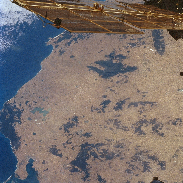 |
| STS081-720-023 Lake Corangamite, Victoria, Australia January 1997 The area included in this synoptic, westerly view of southwest Victoria shows vegetated hills and mountains (dark features), extensive plains (lighter-colored areas), and several lakes (lower left quadrant). The large lake is Lake Corangamite, the largest salt lake in Victoria and also the largest permanent inland lake in Australia. The Grampian range of mountains (larger dark region near center), dating back over 400 million years, provides a dramatic contrast to the flat plains that surround the Grampians. These sandstone mountains are characterized by lush vegetation, massive rock outcrops, and numerous, deep gorges. The Grampians represent the most west point of the Great Dividing Range of Australia. Most of this mountainous terrain is part of Grampian National Park. The object along the top of the image is an array of solar panels. |
| Images: | All Available Images Low-Resolution 400k |
|
| Mission: | STS081 |
|
| Roll - Frame: | 720 - 23 |
|
| Geographical Name: | AUSTRALIA-V |
|
| Features: | COAST, LAKE CORANGAMITE, MIR |
|
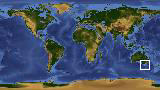
| Center Lat x Lon: | 37S x 143.0E |
|
| Film Exposure: | N | N=Normal exposure, U=Under exposed, O=Over exposed, F=out of Focus |
| Percentage of Cloud Cover-CLDP: | 5 |
|
| Camera:: | HB |
|
| Camera Tilt: | LO=Low Oblique, HO=High Oblique, NV=Near Vertical |
|
| Camera Focal Length: | 100 |
|
| Nadir to Photo Center Direction: | The direction from the nadir to the center point, N=North, S=South, E=East, W=West |
|
| Stereo?: | N | Y=Yes there is an adjacent picture of the same area, N=No there isn't |
| Orbit Number: | |
|
| Date: | 199701__ | YYYYMMDD |
| Time: | GMT HHMMSS |
|
| Nadir Lat: | N |
Latitude of suborbital point of spacecraft |
| Nadir Lon: | E |
Longitude of suborbital point of spacecraft |
| Sun Azimuth: | Clockwise angle in degrees from north to the sun measured at the nadir point |
|
| Space Craft Altitude: | nautical miles |
|
| Sun Elevation: | Angle in degrees between the horizon and the sun, measured at the nadir point |
|
| Land Views: | HILL, PLAIN, MOUNTAIN |
|
| Water Views: | LAKE |
|
| Atmosphere Views: | |
|
| Man Made Views: | |
|
| City Views: | |
|
Photo is not associated with any sequences | ||
| NASA Home Page |
JSC Home Page |
JSC Digital Image Collection |
Earth Science & Remote Sensing |
|
This service is provided by the International Space Station program and the JSC Earth Science & Remote Sensing Unit, ARES Division, Exploration Integration Science Directorate.

|