
Geographic Region: USA-MISSISSIPPI
Feature: GRENADA RES., ENID LAKE
|
Geographic Region: USA-MISSISSIPPI Feature: GRENADA RES., ENID LAKE |
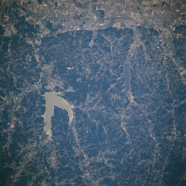 |
| STS079-812-087 Grenada and Enid Lakes, Mississippi September, 1996 The larger of the two lakes shown in this scene, Grenada Lake shown in sun glint, and the smaller Enid Lake are visible in the east-looking low-oblique view. Both lakes are located in a cotton growing and timber-producing region of central Mississippi. Grenada Lake is fed by the Yalobusha and Skuna Rivers and has nearly 90380 acres (36604 hectares) of land and water combined for recreational purposes. The dams for both lakes control flooding, especially downstream for the Tallahatchie River floodplain, which is visible along the lower portion of the image. The dams of both lakes also provide hydroelectric power for the growing industrial base in the region. |
| Images: | All Available Images Low-Resolution 384k |
|
| Mission: | STS079 |
|
| Roll - Frame: | 812 - 87 |
|
| Geographical Name: | USA-MISSISSIPPI |
|
| Features: | GRENADA RES., ENID LAKE |
|
| Center Lat x Lon: | 34.0N x 90W |
|
| Film Exposure: | N | N=Normal exposure, U=Under exposed, O=Over exposed, F=out of Focus |
| Percentage of Cloud Cover-CLDP: | 0 |
|
| Camera:: | HB |
|
| Camera Tilt: | 17 | LO=Low Oblique, HO=High Oblique, NV=Near Vertical |
| Camera Focal Length: | 250 |
|
| Nadir to Photo Center Direction: | NE | The direction from the nadir to the center point, N=North, S=South, E=East, W=West |
| Stereo?: | N | Y=Yes there is an adjacent picture of the same area, N=No there isn't |
| Orbit Number: | 115 |
|
| Date: | 19960923 | YYYYMMDD |
| Time: | 145946 | GMT HHMMSS |
| Nadir Lat: | 33.2N |
Latitude of suborbital point of spacecraft |
| Nadir Lon: | 90.6W |
Longitude of suborbital point of spacecraft |
| Sun Azimuth: | 120 | Clockwise angle in degrees from north to the sun measured at the nadir point |
| Space Craft Altitude: | 201 | nautical miles |
| Sun Elevation: | 37 | Angle in degrees between the horizon and the sun, measured at the nadir point |
| Land Views: | HILL, FOREST, VALLEY, ESCARPMENT |
|
| Water Views: | SEDIMENT, LAKE |
|
| Atmosphere Views: | |
|
| Man Made Views: | AGRICULTURE, DAM |
|
| City Views: | |
|
Photo is not associated with any sequences | ||
| NASA Home Page |
JSC Home Page |
JSC Digital Image Collection |
Earth Science & Remote Sensing |
|
This service is provided by the International Space Station program and the JSC Earth Science & Remote Sensing Unit, ARES Division, Exploration Integration Science Directorate.

|