
Geographic Region: USA-TENNESSEE
Feature: KENTUCKY LAKE,AGR.,MTS,R
|
Geographic Region: USA-TENNESSEE Feature: KENTUCKY LAKE,AGR.,MTS,R |
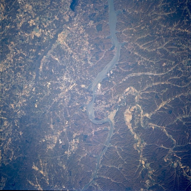 |
| STS073-756-094 Tennessee River, Tennessee October 1995 The Tennessee River, 650 miles (1045 km) long and the principal tributary of the Ohio River, is seen flowing generally northward as it heads toward the Kentucky border and Kentucky Lake. The extensive dark landscape shows a region of rugged, hilly, forested land in this section of west central Tennessee. The thin, light-colored linear feature that roughly parallels across the bottom of the image is Interstate Highway 40, major east-west ground transportation artery through central Tennessee. The other east-west oriented light-colored line that parallels across the center of the image is U. S. Highway 70. Both highways have bridges that can be seen crossing the Tennessee River. |
| Images: | All Available Images Low-Resolution 389k |
|
| Mission: | STS073 |
|
| Roll - Frame: | 756 - 94 |
|
| Geographical Name: | USA-TENNESSEE |
|
| Features: | KENTUCKY LAKE,AGR.,MTS,R |
|
| Center Lat x Lon: | 36.0N x 88W |
|
| Film Exposure: | N | N=Normal exposure, U=Under exposed, O=Over exposed, F=out of Focus |
| Percentage of Cloud Cover-CLDP: | 0 |
|
| Camera:: | HB |
|
| Camera Tilt: | 23 | LO=Low Oblique, HO=High Oblique, NV=Near Vertical |
| Camera Focal Length: | 250 |
|
| Nadir to Photo Center Direction: | W | The direction from the nadir to the center point, N=North, S=South, E=East, W=West |
| Stereo?: | N | Y=Yes there is an adjacent picture of the same area, N=No there isn't |
| Orbit Number: | 131 |
|
| Date: | 19951028 | YYYYMMDD |
| Time: | 151354 | GMT HHMMSS |
| Nadir Lat: | 36.1N |
Latitude of suborbital point of spacecraft |
| Nadir Lon: | 87W |
Longitude of suborbital point of spacecraft |
| Sun Azimuth: | 140 | Clockwise angle in degrees from north to the sun measured at the nadir point |
| Space Craft Altitude: | 143 | nautical miles |
| Sun Elevation: | 31 | Angle in degrees between the horizon and the sun, measured at the nadir point |
| Land Views: | FOREST |
|
| Water Views: | RIVER, LAKE |
|
| Atmosphere Views: | |
|
| Man Made Views: | HIGHWAY |
|
| City Views: | |
|
Photo is not associated with any sequences | ||
| NASA Home Page |
JSC Home Page |
JSC Digital Image Collection |
Earth Science & Remote Sensing |
|
This service is provided by the International Space Station program and the JSC Earth Science & Remote Sensing Unit, ARES Division, Exploration Integration Science Directorate.

|