
Geographic Region: USA-NEBRASKA
Feature: PLATTE RIVER,LAKES, AGR.
|
Geographic Region: USA-NEBRASKA Feature: PLATTE RIVER,LAKES, AGR. |
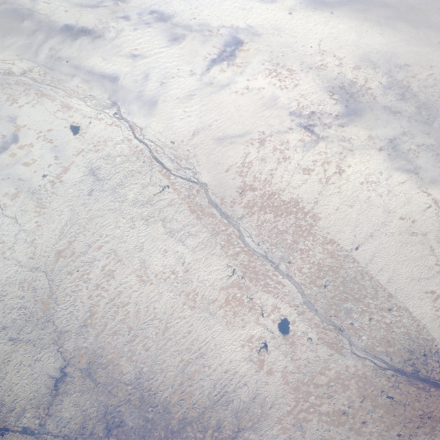 |
| STS073-725-014 Platte River, Nebraska, U.S.A. October 1995 The Platte River traverses west to east between North Platte and Kearney (neither discernible) in this north-northwest-looking, low-oblique photograph. Obvious are early winter snows on either side of the river and some agricultural fields that have been cleared of snow by the wind. |
| Images: | All Available Images Low-Resolution 308k |
|
| Mission: | STS073 |
|
| Roll - Frame: | 725 - 14 |
|
| Geographical Name: | USA-NEBRASKA |
|
| Features: | PLATTE RIVER,LAKES, AGR. |
|
| Center Lat x Lon: | 41.0N x 100W |
|
| Film Exposure: | N | N=Normal exposure, U=Under exposed, O=Over exposed, F=out of Focus |
| Percentage of Cloud Cover-CLDP: | 15 |
|
| Camera:: | HB |
|
| Camera Tilt: | 54 | LO=Low Oblique, HO=High Oblique, NV=Near Vertical |
| Camera Focal Length: | 250 |
|
| Nadir to Photo Center Direction: | NW | The direction from the nadir to the center point, N=North, S=South, E=East, W=West |
| Stereo?: | Y | Y=Yes there is an adjacent picture of the same area, N=No there isn't |
| Orbit Number: | 66 |
|
| Date: | 19951024 | YYYYMMDD |
| Time: | 152248 | GMT HHMMSS |
| Nadir Lat: | 38.5N |
Latitude of suborbital point of spacecraft |
| Nadir Lon: | 97.9W |
Longitude of suborbital point of spacecraft |
| Sun Azimuth: | 132 | Clockwise angle in degrees from north to the sun measured at the nadir point |
| Space Craft Altitude: | 144 | nautical miles |
| Sun Elevation: | 26 | Angle in degrees between the horizon and the sun, measured at the nadir point |
| Land Views: | PLAIN |
|
| Water Views: | RIVER |
|
| Atmosphere Views: | |
|
| Man Made Views: | AGRICULTURE |
|
| City Views: | |
|
Photo is not associated with any sequences | ||
| NASA Home Page |
JSC Home Page |
JSC Digital Image Collection |
Earth Science & Remote Sensing |
|
This service is provided by the International Space Station program and the JSC Earth Science & Remote Sensing Unit, ARES Division, Exploration Integration Science Directorate.

|