
Geographic Region: USA-INDIANA
Feature: BROOKVILLE LAKE,R.,AGR.
|
Geographic Region: USA-INDIANA Feature: BROOKVILLE LAKE,R.,AGR. |
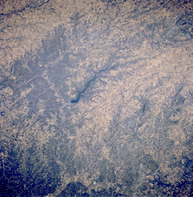 |
| STS073-707-00Q Brookville Lake, Indiana, U.S.A. October 1995 This northwest-looking, low-oblique photograph features Brookville Lake, which is fed and drained by the east fork of the Whitewater River. The small city of Brookville is barely discernible at the southern end of the lake. Gently rolling terrain with some small, forested hills and agricultural lands characterizes the area. Visible are the Ohio River (near bottom center) and a small portion of southwestern Ohio (lower right). |
| Images: | All Available Images Low-Resolution 181k |
|
| Mission: | STS073 |
|
| Roll - Frame: | 707 - Q |
|
| Geographical Name: | USA-INDIANA |
|
| Features: | BROOKVILLE LAKE,R.,AGR. |
|
| Center Lat x Lon: | 39.5N x 85W |
|
| Film Exposure: | N | N=Normal exposure, U=Under exposed, O=Over exposed, F=out of Focus |
| Percentage of Cloud Cover-CLDP: | 0 |
|
| Camera:: | HB |
|
| Camera Tilt: | LO | LO=Low Oblique, HO=High Oblique, NV=Near Vertical |
| Camera Focal Length: | 100 |
|
| Nadir to Photo Center Direction: | The direction from the nadir to the center point, N=North, S=South, E=East, W=West |
|
| Stereo?: | N | Y=Yes there is an adjacent picture of the same area, N=No there isn't |
| Orbit Number: | |
|
| Date: | 1995____ | YYYYMMDD |
| Time: | GMT HHMMSS |
|
| Nadir Lat: | N |
Latitude of suborbital point of spacecraft |
| Nadir Lon: | E |
Longitude of suborbital point of spacecraft |
| Sun Azimuth: | Clockwise angle in degrees from north to the sun measured at the nadir point |
|
| Space Craft Altitude: | nautical miles |
|
| Sun Elevation: | Angle in degrees between the horizon and the sun, measured at the nadir point |
|
| Land Views: | HILL |
|
| Water Views: | LAKE, RIVER |
|
| Atmosphere Views: | |
|
| Man Made Views: | AGRICULTURE |
|
| City Views: | |
|
Photo is not associated with any sequences | ||
| NASA Home Page |
JSC Home Page |
JSC Digital Image Collection |
Earth Science & Remote Sensing |
|
This service is provided by the International Space Station program and the JSC Earth Science & Remote Sensing Unit, ARES Division, Exploration Integration Science Directorate.

|