
Geographic Region: USA-WISCONSIN
Feature: GREEN B,MENOMINEE R, AGR
|
Geographic Region: USA-WISCONSIN Feature: GREEN B,MENOMINEE R, AGR |
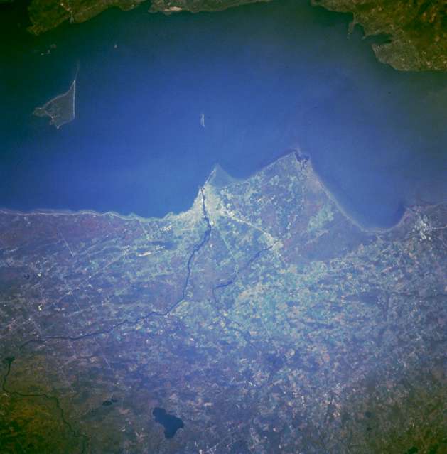 |
| STS068-237-044 Marinette and Menominee, Wisconsin and Michigan, U.S.A. October 1994 Apparent in this east-northeast, low-oblique photograph is the Menominee River, which separates Wisconsin and Michigan, empties into Green Bay (near center of the photograph), and serves as the boundary between Marinette, Wisconsin, on its southwest bank and Menominee, Michigan, on its northeast bank. Marinette's major industries are pulp, paper, and tourism; Menominee is a ferry port and a marketplace for a cheese producing area. In the 1800s, the city was a great shipping point for lumber and was known as the white pine capital of the world. Visible are Lake Noquebay (bottom center), Green Bay and adjacent Door Peninsula to the east, and Chambers Island within the bay. |
| Images: | All Available Images Low-Resolution 33k |
|
| Mission: | STS068 |
|
| Roll - Frame: | 237 - 44 |
|
| Geographical Name: | USA-WISCONSIN |
|
| Features: | GREEN B,MENOMINEE R, AGR |
|
| Center Lat x Lon: | 45.0N x 87.5W |
|
| Film Exposure: | N | N=Normal exposure, U=Under exposed, O=Over exposed, F=out of Focus |
| Percentage of Cloud Cover-CLDP: | 0 |
|
| Camera:: | HB |
|
| Camera Tilt: | 35 | LO=Low Oblique, HO=High Oblique, NV=Near Vertical |
| Camera Focal Length: | 250 |
|
| Nadir to Photo Center Direction: | W | The direction from the nadir to the center point, N=North, S=South, E=East, W=West |
| Stereo?: | Y | Y=Yes there is an adjacent picture of the same area, N=No there isn't |
| Orbit Number: | 102 |
|
| Date: | 19941006 | YYYYMMDD |
| Time: | 171207 | GMT HHMMSS |
| Nadir Lat: | 45.4N |
Latitude of suborbital point of spacecraft |
| Nadir Lon: | 86.2W |
Longitude of suborbital point of spacecraft |
| Sun Azimuth: | 173 | Clockwise angle in degrees from north to the sun measured at the nadir point |
| Space Craft Altitude: | 116 | nautical miles |
| Sun Elevation: | 39 | Angle in degrees between the horizon and the sun, measured at the nadir point |
| Land Views: | FOREST |
|
| Water Views: | BAY, RIVER |
|
| Atmosphere Views: | |
|
| Man Made Views: | URBAN AREA |
|
| City Views: | |
|
Photo is not associated with any sequences | ||
| NASA Home Page |
JSC Home Page |
JSC Digital Image Collection |
Earth Science & Remote Sensing |
|
This service is provided by the International Space Station program and the JSC Earth Science & Remote Sensing Unit, ARES Division, Exploration Integration Science Directorate.

|