
Geographic Region: USA-MICHIGAN
Feature: HOUGHTON & HIGGINS L,AGR
|
Geographic Region: USA-MICHIGAN Feature: HOUGHTON & HIGGINS L,AGR |
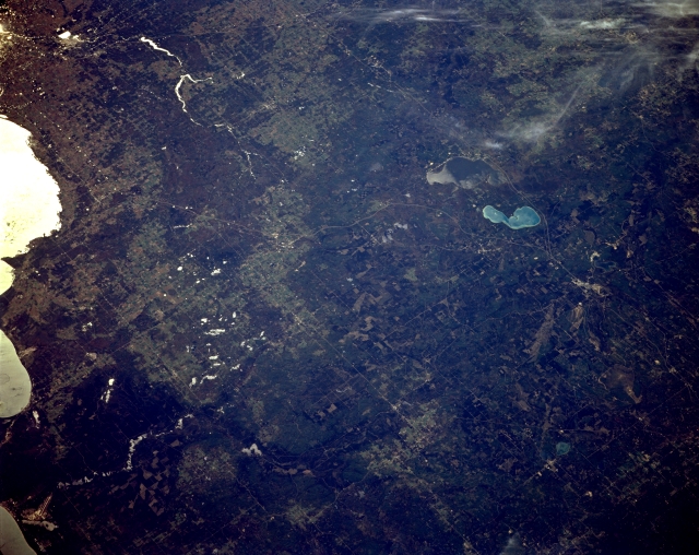 |
| STS068-164-125 West of Saginaw Bay, Michigan, U.S.A. October 1994 Featured in this southwest-looking, low-oblique photograph are the shoreline (in sunglint) of Saginaw Bay (left edge) and the forest and agricultural lands of eastern Michigan west of Saginaw Bay as far west as Houghton Lake and Higgins Lake (right and top of center, respectively). This popular tourist area has a glacial landscape with high concentrations of sand and moraines and a higher elevation than that of southern Michigan. Visible are the runways of Paul B. Wurtsmith Air Force Base and the Au Sable River (bottom left); Midland and two small reservoirs on the Tittabawassee River northwest of Midland (upper left); and West Twin Lake and the small city of Lewiston (barely discernible at bottom right). |
| Images: | All Available Images Low-Resolution 299k |
|
| Mission: | STS068 |
|
| Roll - Frame: | 164 - 125 |
|
| Geographical Name: | USA-MICHIGAN |
|
| Features: | HOUGHTON & HIGGINS L,AGR |
|
| Center Lat x Lon: | 44.5N x 84.5W |
|
| Film Exposure: | N | N=Normal exposure, U=Under exposed, O=Over exposed, F=out of Focus |
| Percentage of Cloud Cover-CLDP: | 5 |
|
| Camera:: | LH |
|
| Camera Tilt: | 48 | LO=Low Oblique, HO=High Oblique, NV=Near Vertical |
| Camera Focal Length: | 250 |
|
| Nadir to Photo Center Direction: | W | The direction from the nadir to the center point, N=North, S=South, E=East, W=West |
| Stereo?: | Y | Y=Yes there is an adjacent picture of the same area, N=No there isn't |
| Orbit Number: | 38 |
|
| Date: | 19941002 | YYYYMMDD |
| Time: | 183007 | GMT HHMMSS |
| Nadir Lat: | 45.4N |
Latitude of suborbital point of spacecraft |
| Nadir Lon: | 82.5W |
Longitude of suborbital point of spacecraft |
| Sun Azimuth: | 203 | Clockwise angle in degrees from north to the sun measured at the nadir point |
| Space Craft Altitude: | 118 | nautical miles |
| Sun Elevation: | 39 | Angle in degrees between the horizon and the sun, measured at the nadir point |
| Land Views: | FOREST |
|
| Water Views: | LAKE |
|
| Atmosphere Views: | |
|
| Man Made Views: | |
|
| City Views: | |
|
Photo is not associated with any sequences | ||
| NASA Home Page |
JSC Home Page |
JSC Digital Image Collection |
Earth Science & Remote Sensing |
|
This service is provided by the International Space Station program and the JSC Earth Science & Remote Sensing Unit, ARES Division, Exploration Integration Science Directorate.

|