
Geographic Region: USA-TEXAS
Feature: BRYAN,BRAZOS RIVER
|
Geographic Region: USA-TEXAS Feature: BRYAN,BRAZOS RIVER |
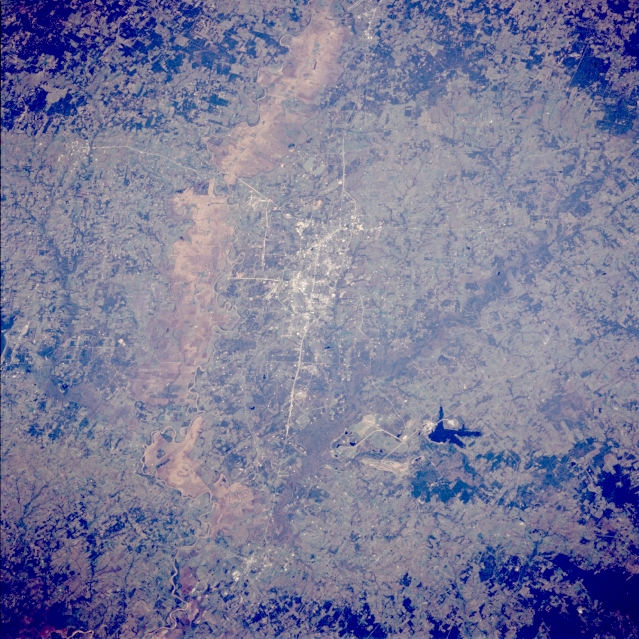 |
| STS066-088-073 Bryan and College Station, Texas, U.S.A. November 1994 Discernible in this photograph are some of the grid street patterns for College Station and Bryan, which are connected by Texas Highway 6. The tan swath of land west of these two towns is the floodplain of the Brazos River; the actual stream channel can be identified in only a few places (top and bottom of the photograph). The lighter colors show grass-covered plains and rolling hills; darker hardwood woodlands, found in stream bottoms or small valleys, are scattered throughout. Gibbons Creek is the small, irregular reservoir southeast of College Station. |
| Images: | All Available Images Low-Resolution 410k |
|
| Mission: | STS066 |
|
| Roll - Frame: | 88 - 73 |
|
| Geographical Name: | USA-TEXAS |
|
| Features: | BRYAN,BRAZOS RIVER |
|
| Center Lat x Lon: | 30.5N x 96.5W |
|
| Film Exposure: | N | N=Normal exposure, U=Under exposed, O=Over exposed, F=out of Focus |
| Percentage of Cloud Cover-CLDP: | 0 |
|
| Camera:: | HB |
|
| Camera Tilt: | 34 | LO=Low Oblique, HO=High Oblique, NV=Near Vertical |
| Camera Focal Length: | 250 |
|
| Nadir to Photo Center Direction: | W | The direction from the nadir to the center point, N=North, S=South, E=East, W=West |
| Stereo?: | N | Y=Yes there is an adjacent picture of the same area, N=No there isn't |
| Orbit Number: | 33 |
|
| Date: | 19941105 | YYYYMMDD |
| Time: | 172228 | GMT HHMMSS |
| Nadir Lat: | 30.2N |
Latitude of suborbital point of spacecraft |
| Nadir Lon: | 94.7W |
Longitude of suborbital point of spacecraft |
| Sun Azimuth: | 167 | Clockwise angle in degrees from north to the sun measured at the nadir point |
| Space Craft Altitude: | 163 | nautical miles |
| Sun Elevation: | 43 | Angle in degrees between the horizon and the sun, measured at the nadir point |
| Land Views: | RANGE |
|
| Water Views: | RIVER, RESERVOIR |
|
| Atmosphere Views: | |
|
| Man Made Views: | URBAN AREA, HIGHWAY, MINING |
|
| City Views: | BRYAN, COLLEGE STATION |
|
Photo is not associated with any sequences | ||
| NASA Home Page |
JSC Home Page |
JSC Digital Image Collection |
Earth Science & Remote Sensing |
|
This service is provided by the International Space Station program and the JSC Earth Science & Remote Sensing Unit, ARES Division, Exploration Integration Science Directorate.

|